MyTopo
Bessemer City North Carolina US Topo Map
Couldn't load pickup availability
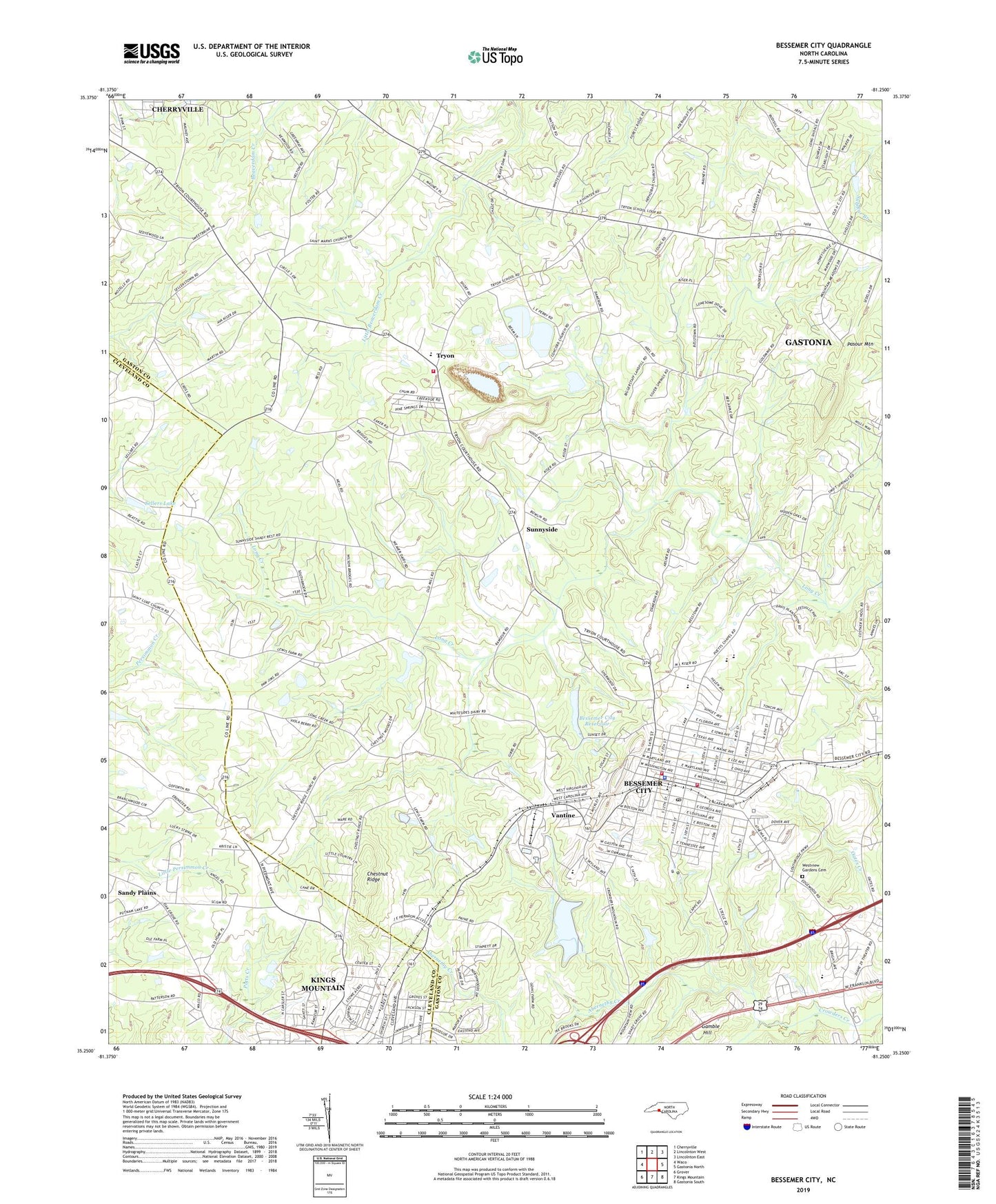
2022 topographic map quadrangle Bessemer City in the state of North Carolina. Scale: 1:24000. Based on the newly updated USGS 7.5' US Topo map series, this map is in the following counties: Gaston, Cleveland. The map contains contour data, water features, and other items you are used to seeing on USGS maps, but also has updated roads and other features. This is the next generation of topographic maps. Printed on high-quality waterproof paper with UV fade-resistant inks.
Quads adjacent to this one:
West: Waco
Northwest: Cherryville
North: Lincolnton West
Northeast: Lincolnton East
East: Gastonia North
Southeast: Gastonia South
South: Kings Mountain
Southwest: Grover
This map covers the same area as the classic USGS quad with code o35081c3.
Contains the following named places: Abernethy Creek, Bessember City Central Elementary School, Bessemer City, Bessemer City High School, Bessemer City Police Department, Bessemer City Post Office, Bessemer City Primary School, Bessemer City Quarry, Bessemer City Reservoir, Bessemer City Volunteer Fire Department, Bethel Associate Reformed Presbyterian Church, Bethel Church, Bingham Memorial Church, Chestnut Ridge, Chestnut Ridge Church, City of Bessemer City, Concord Church, Crowders Mountain Volunteer Fire and Rescue Station 2, Ebenezer Church, Faith Church, Gamble Hill, Gamble Hill Church, Grace United Methodist Church, Hephzibah Church, Holland Memorial Church, Lagoon A, Lagoon A Dam, Lagoon D, Lagoon D Dam, Lincoln Junior High School, Long Creek Church, Long Creek Dam, Martin Marietta Holding Lake, Martin Marietta Holding Lake Dam, Mount Pisgah Church, North Elementary School, Patterson Grove Church, Penley Chapel, Perry, Piedmont Church, Rhynes Airport, Sandy Plains, Sellers Lake, Sellers Lake Dam, Shady Grove Church, Storage Area Number Two, Storage Area Number Two Dam, Sunnyside, Sunnyside Church, Township of Cherryville, Trinity Church, Tryon, Tryon County Courthouse Historical Site, Tryon Elementary School, Tryonota Volunteer Fire Department, Vantine, Washington Park, West School, Westview Gardens Cemetery, WKMT-AM (Kings Mountain), ZIP Code: 28016