MyTopo
Marshville North Carolina US Topo Map
Couldn't load pickup availability
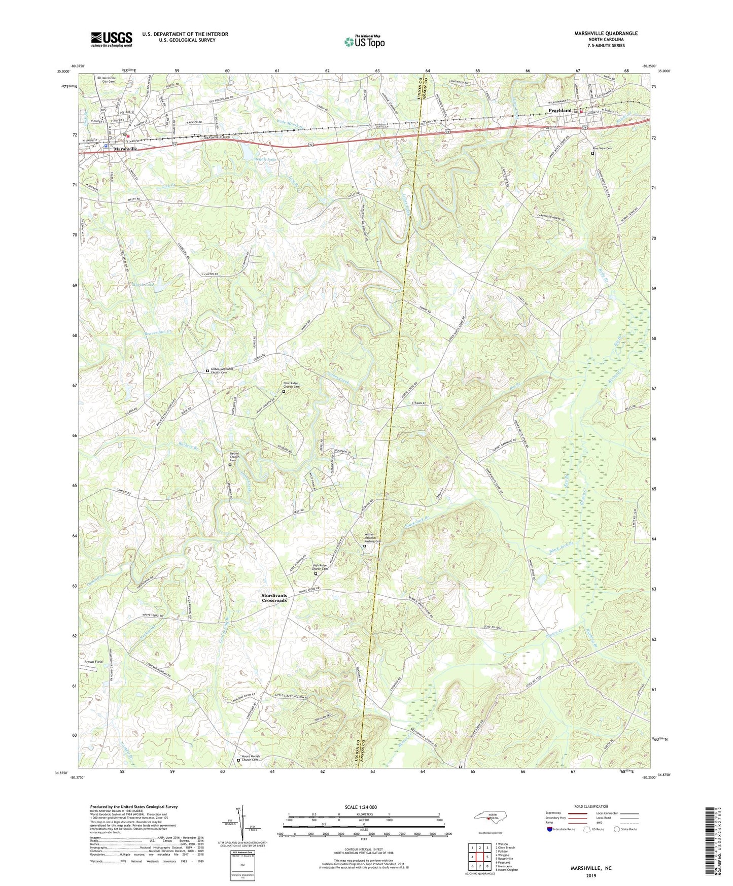
2022 topographic map quadrangle Marshville in the state of North Carolina. Scale: 1:24000. Based on the newly updated USGS 7.5' US Topo map series, this map is in the following counties: Union, Anson. The map contains contour data, water features, and other items you are used to seeing on USGS maps, but also has updated roads and other features. This is the next generation of topographic maps. Printed on high-quality waterproof paper with UV fade-resistant inks.
Quads adjacent to this one:
West: Wingate
Northwest: Watson
North: Olive Branch
Northeast: Polkton
East: Russellville
South: Hornsboro
Southwest: Pageland
This map covers the same area as the classic USGS quad with code o34080h3.
Contains the following named places: Barkers Branch, Beaver Lane Volunteer Rescue and Fire Department Station 8, Beaverdam Creek, Bethel Church, Bethel Church Cemetery, Big Branch, Black Jack Branch, Brown Field, Cool Spring Branch, Flint Ridge Church, Flint Ridge Church Cemetery, Gilboa Church, Gilboa Methodist Church Cemetery, High Ridge Church, High Ridge Church Cemetery, Key Branch, Lanes Creek Church, Lick Branch, Marsh Lake, Marsh Lake Dam, Marshville, Marshville City Cemetery, Marshville Police Department, Marshville Post Office, Meltonville Cemetery, Meltonville Church, Mount Carmel Church, Mount Moriah Church, Mount Moriah Church Cemetery, New Zion Church, Norkett Branch, Peachland, Peachland Fire District, Peachland Post Office, Pine View Cemetery, Rushing Branch, Stegall Lake, Stegall Lake Dam, Sturdivants Crossroads, Town of Marshville, Town of Peachland, Township of Marshville, White Store, Wide Mouth Branch, William Malachai Rushing Cemetery, ZIP Code: 28103