
MyTopo
Williamsburg North Carolina US Topo Map
Couldn't load pickup availability
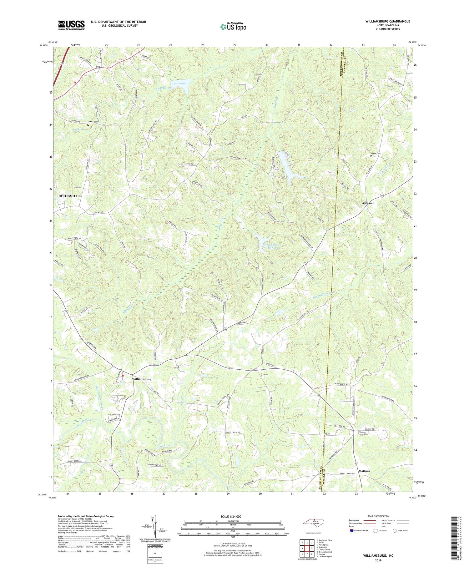
2019 topographic map quadrangle Williamsburg in the state of North Carolina. Scale: 1:24000. Based on the newly updated USGS 7.5' US Topo map series, this map is in the following counties: Rockingham, Caswell. The map contains contour data, water features, and other items you are used to seeing on USGS maps, but also has updated roads and other features. This is the next generation of topographic maps. Printed on high-quality waterproof paper with UV fade-resistant inks.
Quads adjacent to this one:
West: Reidsville
Northwest: Southeast Eden
North: Ruffin
Northeast: Park Spring
East: Cherry Grove
Southeast: Lake Burlington
South: Ossipee
Southwest: Browns Summit
Contains the following named places: Apple Cemetery, Ashland, Beaver Lodge Dam Number One, Beaver Lodge Lake Number One, Browns Arbor Church, Browns Chapel, Garrett Grove Church, Giles Creek, Grooms Chapel, High Rock Church, Hill View Acres, Hillview Church, Joyce Dam, Joyce Lake, Lake Wade, Lake Wade Dam, Lawsonville Road Church, Lenox Castle, Little Troublesome Creek, Lowes Church, Matkins, New Center Church, New Hope Church, Nu Life Church, Pleasant Grove Church, Pleasant View Church, Rockingham Lake, Rose Creek, Settle Cemetery, Stallings Lake, Stallings Lake Dam, Talleys Lake, Thompsonville Church, Township of Williamsburg, Williamsburg, Williamsburg Rescue Fire Station, Williamsburg School, Williamsburg Wildlife Club Lake Dam, Williamsburg Wildlife Lake, Yanceyville Road Volunteer Fire Department


