MyTopo
Lake Burlington North Carolina US Topo Map
Couldn't load pickup availability
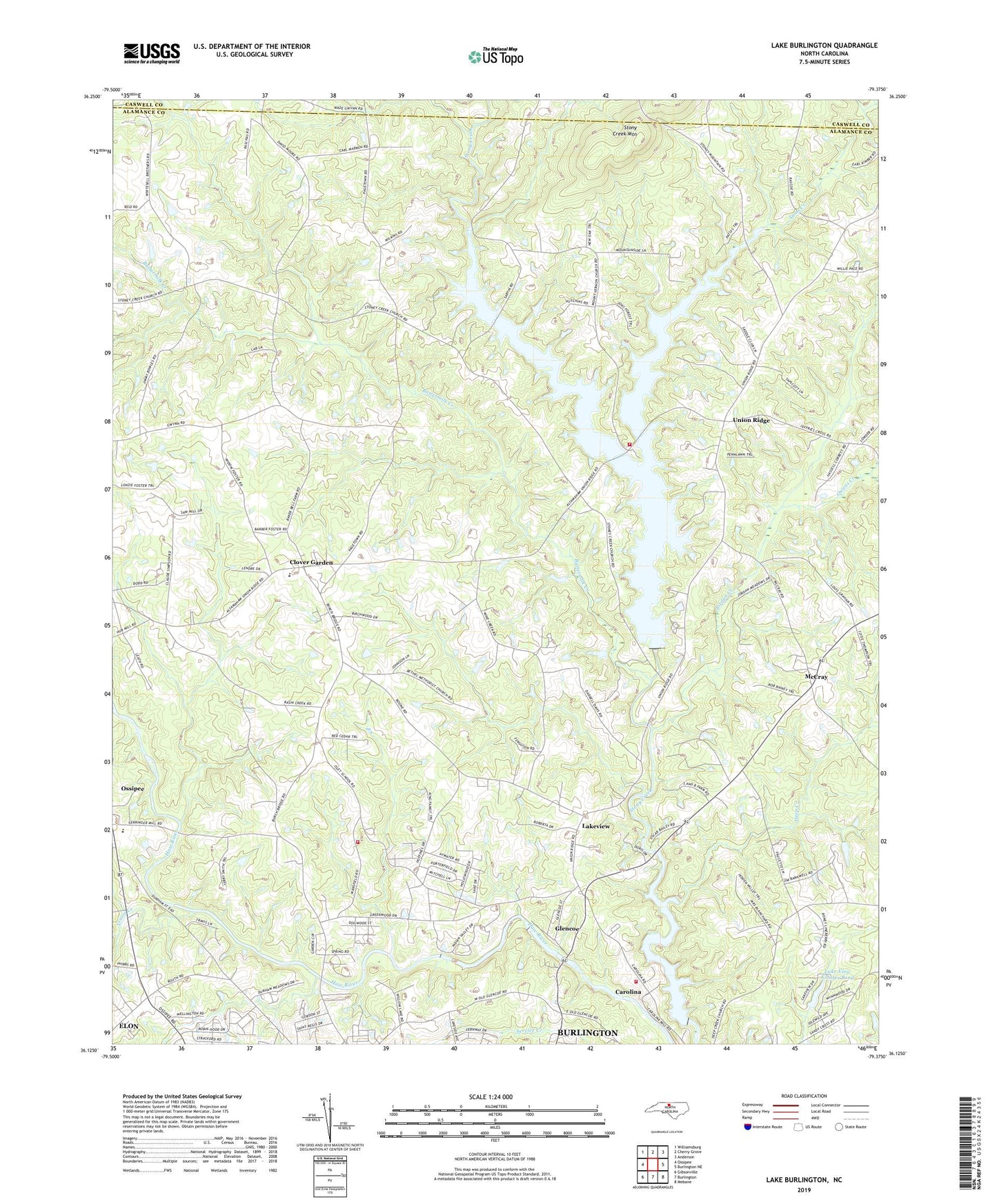
2022 topographic map quadrangle Lake Burlington in the state of North Carolina. Scale: 1:24000. Based on the newly updated USGS 7.5' US Topo map series, this map is in the following counties: Alamance, Caswell. The map contains contour data, water features, and other items you are used to seeing on USGS maps, but also has updated roads and other features. This is the next generation of topographic maps. Printed on high-quality waterproof paper with UV fade-resistant inks.
Quads adjacent to this one:
West: Ossipee
Northwest: Williamsburg
North: Cherry Grove
Northeast: Anderson
East: Burlington NE
Southeast: Mebane
South: Burlington
Southwest: Gibsonville
This map covers the same area as the classic USGS quad with code o36079b4.
Contains the following named places: Archs Grove Church, Bethel Church, Birchwood, British Acres, Bully Field Airport, Buttermilk Creek, Carolina, Clover Garden, Deep Creek, Faucette Township Volunteer Fire Department Station 17, Faucette Township Volunteer Fire Department Station 7, Glencoe, Glencoe Road Church, Green Acres, Hopedale Church, Indian Hills Country Club, Jordan Creek, Lake Burlington, Lake Burlington Sediment Pool, Lake Burlington Sediment Pool Number One Dam, Lake Burlington Sediment Pool Number Two, Lake Burlington Sediment Pool Number Two Dam, Lake Cammack, Lake Cammack Dam, Lake View Estates Pond, Lake View Estates Pond Dam, Lakeview, Lakeview Estates, McCray, Mount Vernon Church, North Central Alamance Fire Department, Old Stony Creek Dam, Owens Creek, Riverside Church, Saint Lukes Church, Saint Pauls Mission, Stony Creek Church, Stony Creek Mountain, Stony Creek Reservoir, Toms Creek, Township 4-Morton, Township 5-Faucette, Travis Creek, Union Ridge, Western High School, Zion Church, ZIP Codes: 27217, 27244