MyTopo
Ossipee North Carolina US Topo Map
Couldn't load pickup availability
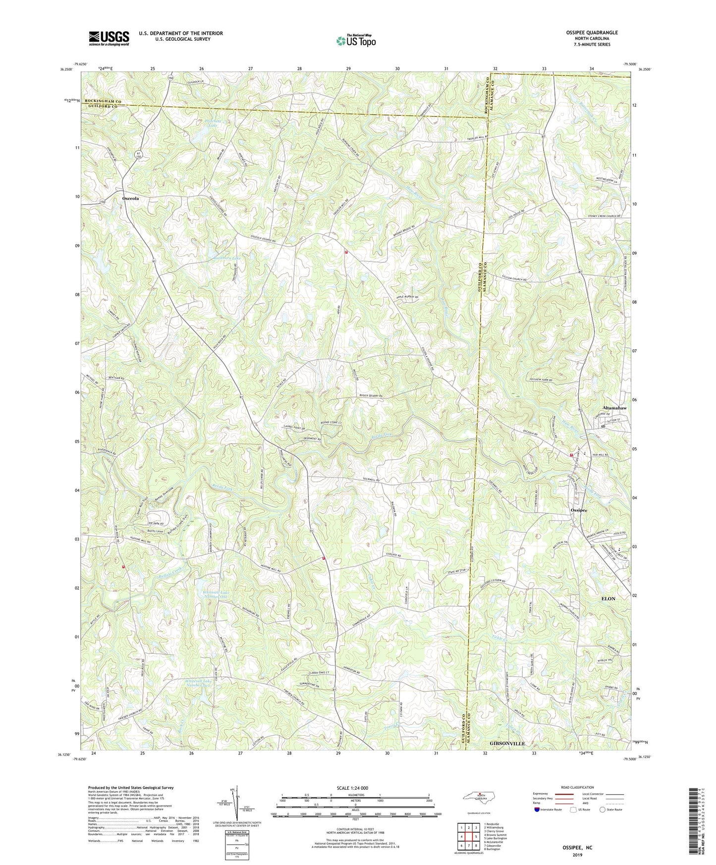
2022 topographic map quadrangle Ossipee in the state of North Carolina. Scale: 1:24000. Based on the newly updated USGS 7.5' US Topo map series, this map is in the following counties: Guilford, Alamance, Rockingham, Caswell. The map contains contour data, water features, and other items you are used to seeing on USGS maps, but also has updated roads and other features. This is the next generation of topographic maps. Printed on high-quality waterproof paper with UV fade-resistant inks.
Quads adjacent to this one:
West: Browns Summit
Northwest: Reidsville
North: Williamsburg
Northeast: Cherry Grove
East: Lake Burlington
Southeast: Burlington
South: Gibsonville
Southwest: McLeansville
This map covers the same area as the classic USGS quad with code o36079b5.
Contains the following named places: Altamahaw, Altamahaw - Ossipee Volunteer Fire Department, Altamahaw Census Designated Place, Altamahaw Post Office, Altamahaw-Ossipee Census Designated Place, Altamahaw-Ossipee School, Apples Chapel, Bera Church, Brown Wesleyan Church, Buckhorn Lake, Buckhorn Lake Dam, Buffalo Creek, Fairview Church, Fire District 28 Gibsonville Station 28, Freedom Church, Friedens Church, Gilliam Church, McLeansville Fire Department Station 27, Northeast Guilford Volunteer Fire Department Station 34, Osceola, Ossipee, Peace Church, Pritchett Lake, Pritchett Lake Dam, Reedy Fork, Riverside Dairy Farm, Shiloh Church, Tickle Creek, Town of Ossipee, Township of Washington, Whitesell Lake Lower Dam, Whitesell Lake Number One, Whitesell Lake Number Two, Whitesell Lake Upper Dam, ZIP Code: 27249