
MyTopo
Williston North Carolina US Topo Map
Couldn't load pickup availability
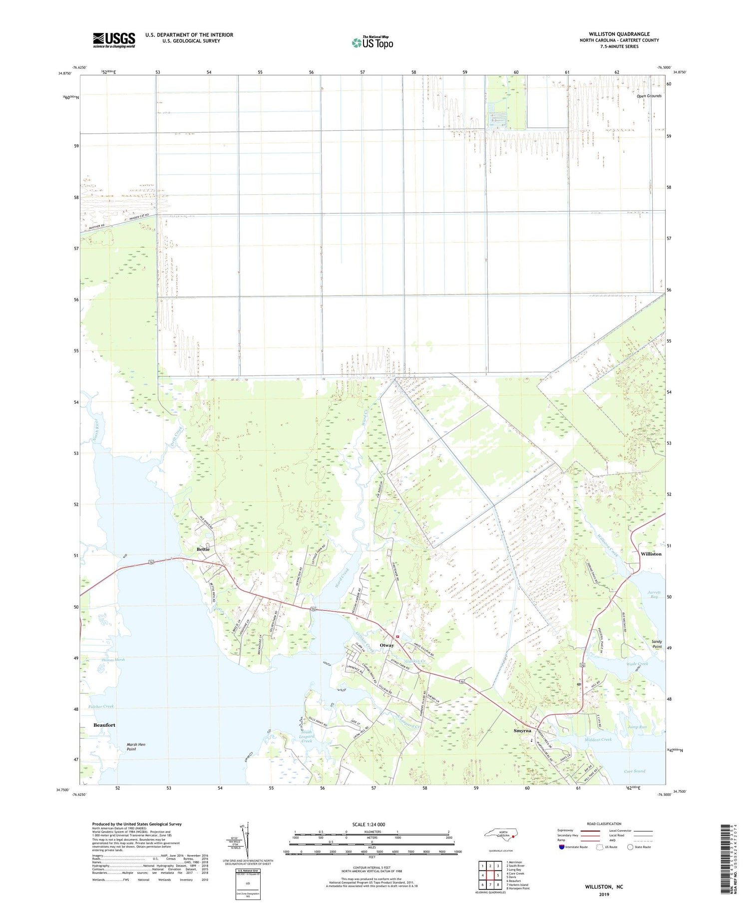
2019 topographic map quadrangle Williston in the state of North Carolina. Scale: 1:24000. Based on the newly updated USGS 7.5' US Topo map series, this map is in the following counties: Carteret. The map contains contour data, water features, and other items you are used to seeing on USGS maps, but also has updated roads and other features. This is the next generation of topographic maps. Printed on high-quality waterproof paper with UV fade-resistant inks.
Quads adjacent to this one:
West: Core Creek
Northwest: Merrimon
North: South River
Northeast: Long Bay
East: Davis
Southeast: Horsepen Point
South: Harkers Island
Southwest: Beaufort
Contains the following named places: Bettie, Bettie Church, Carteret County, Crabbing Creek, Deep Creek, Fulcher Creek, Gillikin Creek, Jump Run, Lynch Creek, Marsh Hen Point, Middens Creek, North Leopard Creek, Open Grounds, Otway, Otway Free Will Baptist Church, Otway Volunteer Fire and Rescue Department, River Road Estate Mobile Home Park, Smyrna, Smyrna Elementary School, Smyrna Post Office, South Leopard Creek, Thomas Creek, Thomas Marsh, Township of Straits, Wade Creek, Ward Creek, Williston, Williston Creek, Woodville Church, Yucca Village, ZIP Codes: 28579, 28589


