MyTopo
Merrimon North Carolina US Topo Map
Couldn't load pickup availability
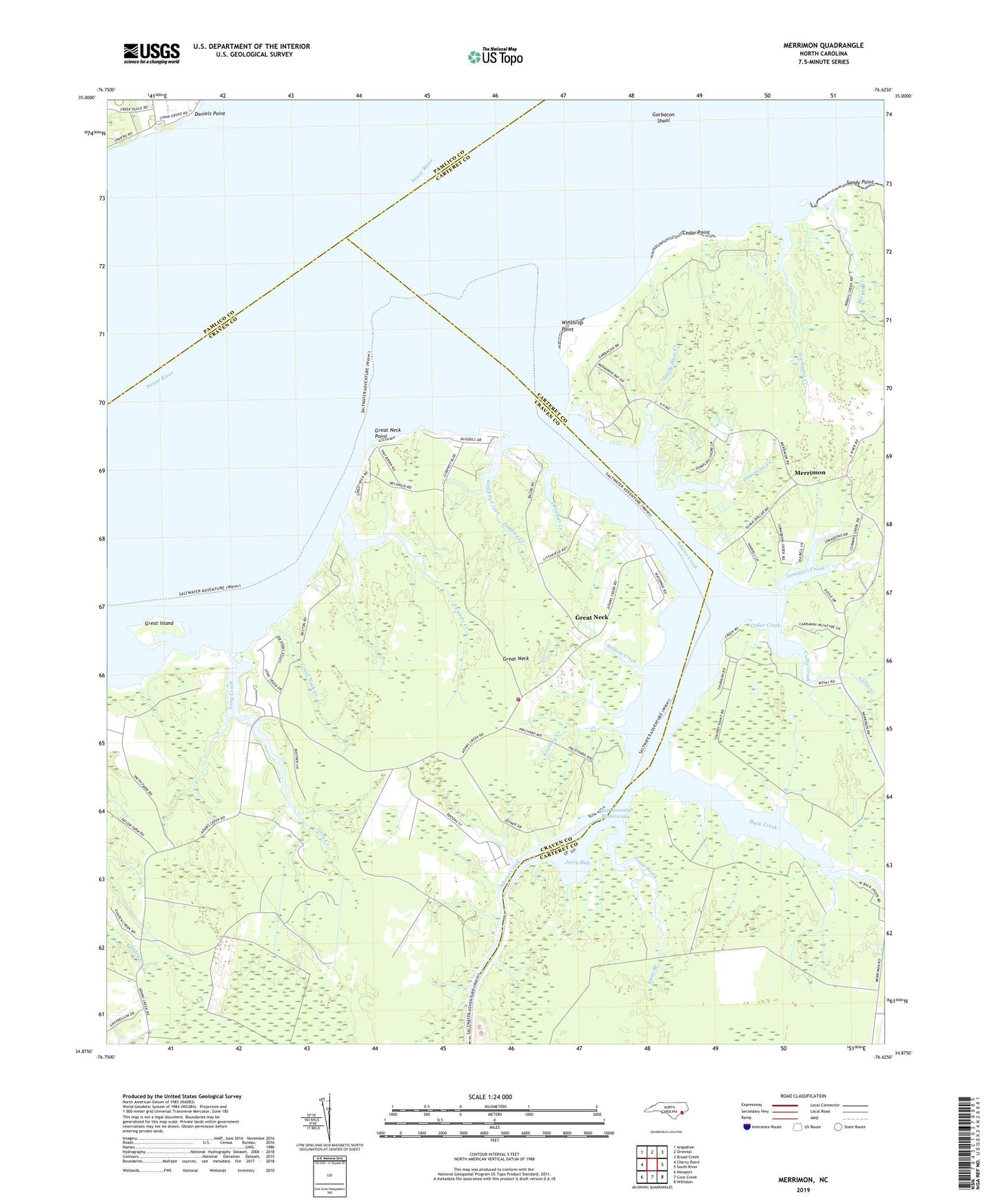
2022 topographic map quadrangle Merrimon in the state of North Carolina. Scale: 1:24000. Based on the newly updated USGS 7.5' US Topo map series, this map is in the following counties: Craven, Carteret, Pamlico. The map contains contour data, water features, and other items you are used to seeing on USGS maps, but also has updated roads and other features. This is the next generation of topographic maps. Printed on high-quality waterproof paper with UV fade-resistant inks.
Quads adjacent to this one:
West: Cherry Point
Northwest: Arapahoe
North: Oriental
Northeast: Broad Creek
East: South River
Southeast: Williston
South: Core Creek
Southwest: Newport
This map covers the same area as the classic USGS quad with code o34076h6.
Contains the following named places: Adams Creek, Adams Creek School, Antioch Church, Back Creek, Berrys Creek, Cedar Creek, Cedar Point, Courts Creek, Cullie Creek, Daniels Point, Delamar Creek, Dumpling Creek, Garbacon Creek, Garbacon Shoal, Godfrey Creek, Great Island, Great Neck, Great Neck Creek, Great Neck Point, Harlowe Volunteer Fire Department, Isaac Creek, Jerry Bay, Jonaquin Creek, Kearney Creek, Kellum Creek, Long Creek, Merrimon, Merrimon Church, Newasiac, Oak Grove Church, Reels Chapel, Saint Antioch Missionary Baptist Church, Sandy Huss Creek, Sandy Point, Winthrop Point, Zion Church