MyTopo
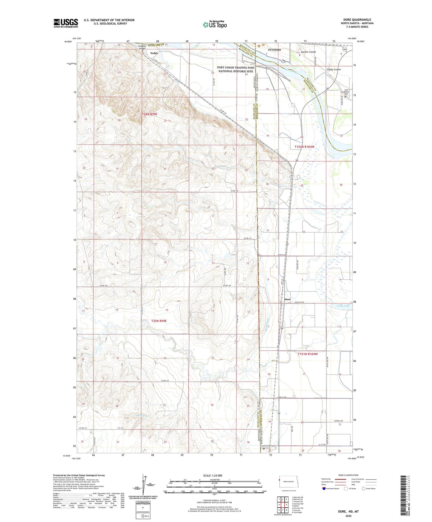
Dore North Dakota US Topo Map
Couldn't load pickup availability
2024 topographic map quadrangle Dore in the states of Montana, North Dakota. Scale: 1:24000. Based on the newly updated USGS 7.5' US Topo map series, this map is in the following counties: McKenzie, Richland, Williams, Roosevelt. The map contains contour data, water features, and other items you are used to seeing on USGS maps, but also has updated roads and other features. This is the next generation of topographic maps. Printed on high-quality waterproof paper with UV fade-resistant inks.
Quads adjacent to this one:
West: Fairview NW
Northwest: Bainville SW
North: Bainville SE
Northeast: Trenton SW
East: Buford
Southeast: Cartwright
South: Fairview
Southwest: Fairview SW
This map covers the same area as the classic USGS quad with code o47104h1.
Contains the following named places: 25N59E24CCDC01 Well, 26N59E11BADB01 Well, 26N59E22AD__01 Well, 26N59E22DBDD01 Well, 26N59E23ABCA01 Well, 26N59E23BBDA01 Well, 26N59E26CADC01 Well, Candee Dam, Dore, Fairview Cemetery, Figley Coulee, Flecher Reservoir Dam, Fort Buford, Fort Buford Cemetery, Fort Buford State Historic Site, Fort Union, Garden Coulee, Java Post Office, La Bonte Dam, Lars Borg Dam, Main Canal, Nohle, Nohly, Nohly Lake, Nohly Post Office, Nohly School, North Fork Fourmile Creek, Simon Spring, Township of Yellowstone