MyTopo
Tracy Mountain North Dakota US Topo Map
Couldn't load pickup availability
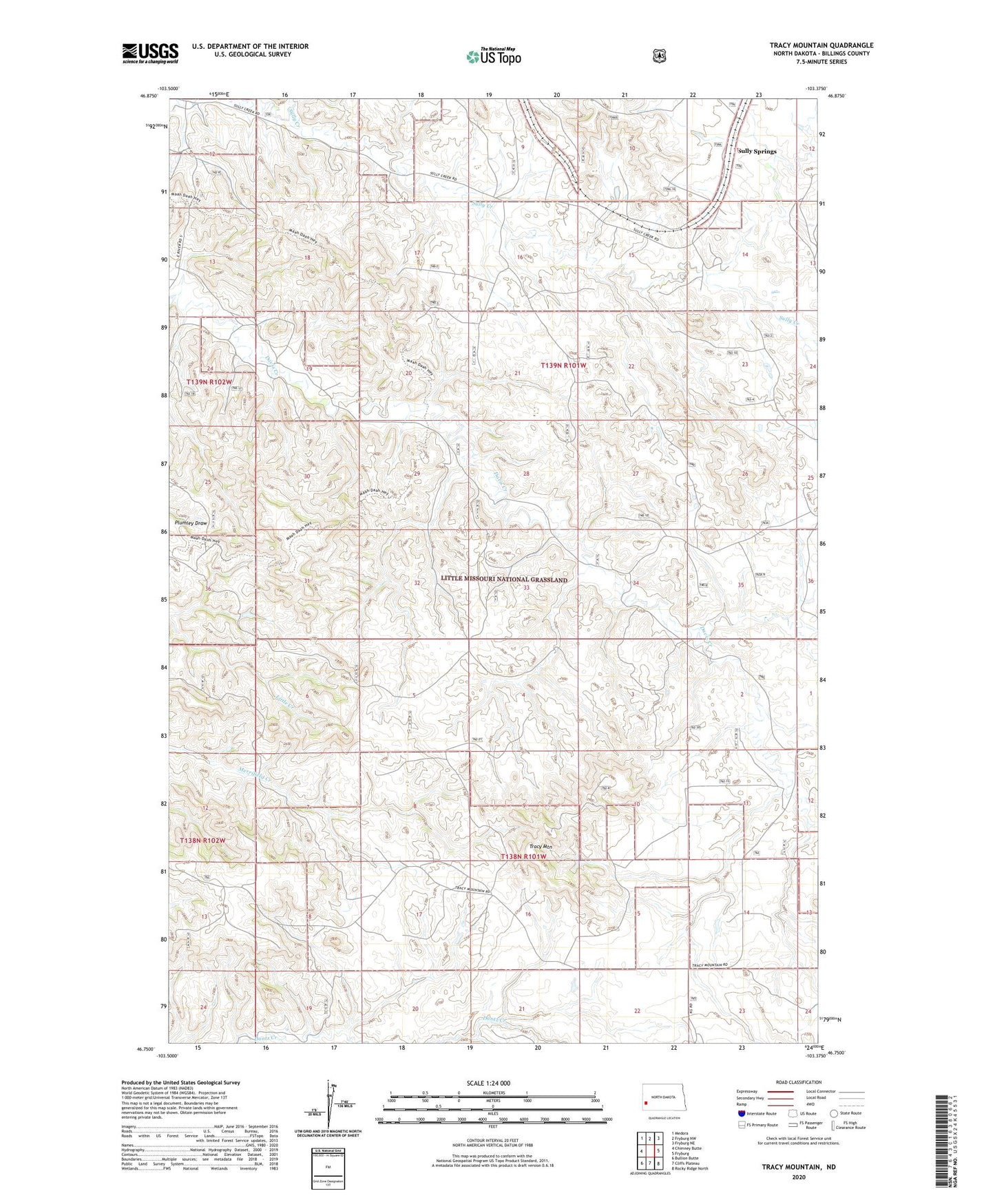
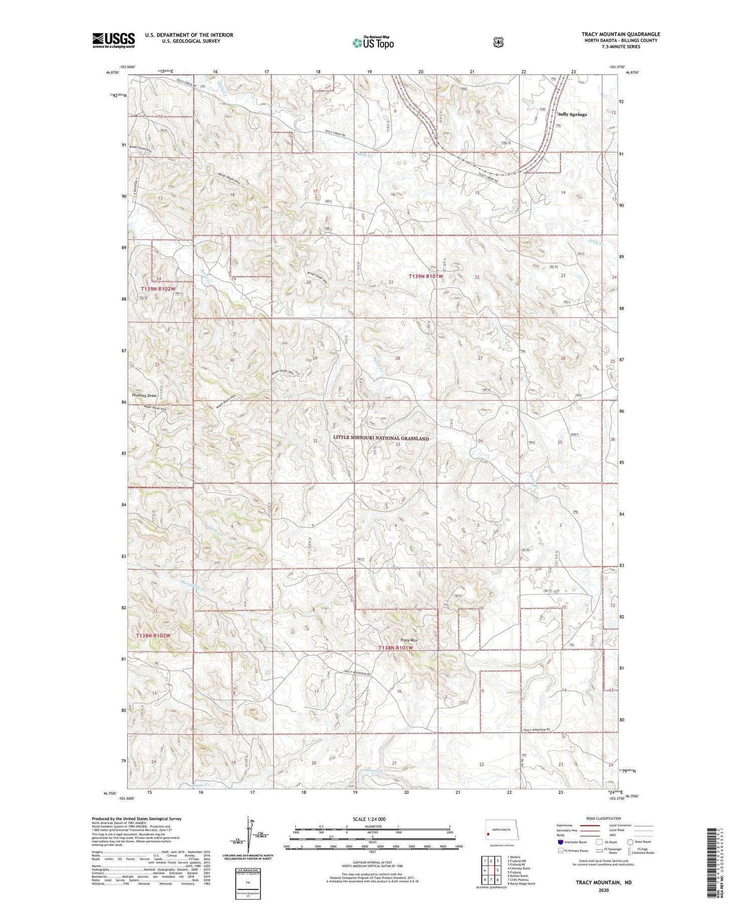
2020 topographic map quadrangle Tracy Mountain in the state of North Dakota. Scale: 1:24000. Based on the newly updated USGS 7.5' US Topo map series, this map is in the following counties: Billings. The map contains contour data, water features, and other items you are used to seeing on USGS maps, but also has updated roads and other features. This is the next generation of topographic maps. Printed on high-quality waterproof paper with UV fade-resistant inks.
Quads adjacent to this one:
West: Chimney Butte
Northwest: Medora
North: Fryburg NW
Northeast: Fryburg NE
East: Fryburg
Southeast: Rocky Ridge North
South: Cliffs Plateau
Southwest: Bullion Butte
Contains the following named places: Custer Initial Rock and Campsite, J O Connell Ranch, Porter Ranch, Ray Ranch, Scoria Oil Field, Sully Springs, Tracy Mountain, Unorganized Territory of South Billings