MyTopo
Antrim Ohio US Topo Map
Couldn't load pickup availability
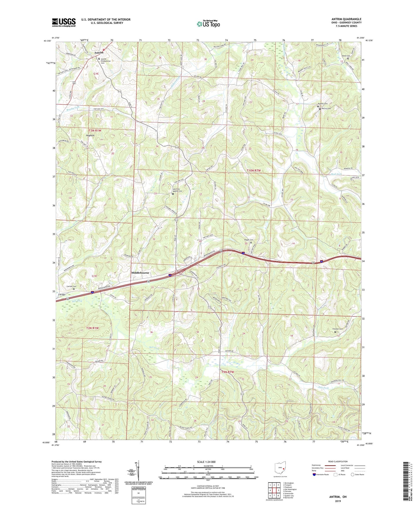
2019 topographic map quadrangle Antrim in the state of Ohio. Scale: 1:24000. Based on the newly updated USGS 7.5' US Topo map series, this map is in the following counties: Guernsey. The map contains contour data, water features, and other items you are used to seeing on USGS maps, but also has updated roads and other features. This is the next generation of topographic maps. Printed on high-quality waterproof paper with UV fade-resistant inks.
Quads adjacent to this one:
West: Old Washington
Northwest: Birmingham
North: Freeport
Northeast: Piedmont
East: Fairview
Southeast: Barnesville
South: Quaker City
Southwest: Senecaville
Contains the following named places: Antrim, Antrim Community Volunteer Fire Department, Antrim Mennonite Church, Antrim Post Office, Antrim Presbyterian Cemetery, Blooming Grove School, Bond Cemetery, Carlisle Cemetery, Clark School, Fletcher Cemetery, Fletcher Church, Greenwood School, Hogback, Kansas School, Leatherwood School, McCoy Cemetery, Middlebourne, Middlebourne Post Office, Oxford Township School, Pisgah Cemetery, Pisgah Church of Christ, Pleasant Hill School, Pleasant Valley School, Rosedale School, S Bridge, Salt Fork Baptist Cemetery, Salt Fork Baptist Church, Sand Hill School, School Number 12, School Number 8, Township of Oxford, WOUC-FM (Cambridge), WOUC-TV (Cambridge)