MyTopo
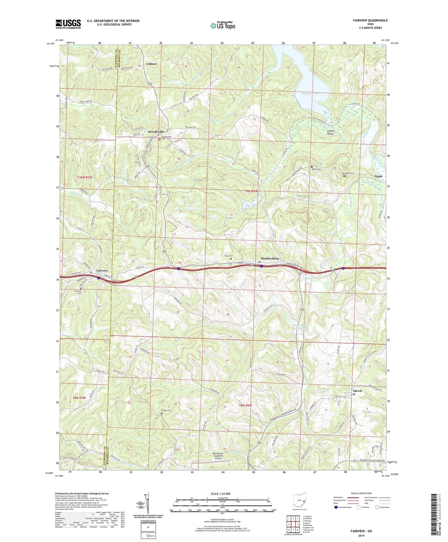
Fairview Ohio US Topo Map
Couldn't load pickup availability
2023 topographic map quadrangle Fairview in the state of Ohio. Scale: 1:24000. Based on the newly updated USGS 7.5' US Topo map series, this map is in the following counties: Belmont, Guernsey. The map contains contour data, water features, and other items you are used to seeing on USGS maps, but also has updated roads and other features. This is the next generation of topographic maps. Printed on high-quality waterproof paper with UV fade-resistant inks.
Quads adjacent to this one:
West: Antrim
Northwest: Freeport
North: Piedmont
Northeast: Flushing
East: Bethesda
Southeast: Hunter
South: Barnesville
Southwest: Quaker City
This map covers the same area as the classic USGS quad with code o40081a2.
Contains the following named places: Barnesville-Bradfield Airport, Bunfills Cemetery, Buttermilk Creek, Cabinet, Cabinet Post Office, Consolidation Coal Company Pond 0010-, Consolidation Coal Company Pond 0010-016 Dam, Egypt, Egypt Post Office, Fairview, Fairview Cemetery, Fairview Volunteer Fire Department, Gibson Cemetery, Hendrysburg, Hendrysburg Elementary School, Hendrysburg Post Office, Hope Cemetery, Lick Run, Old Egypt Cemetery, Olivett, Olivett Post Office, Robinson Run, Salem Cemetery, Salem Church, Sewellsville, Sewellsville Cemetery, Sewellsville Methodist Episcopal Church, Sewellsville Post Office, Sixteen Valley, Spencer Creek, State Route 800 Dam, State Route 800 Reservoir, Township of Kirkwood, Village of Fairview, ZIP Code: 43736