MyTopo
Brookville Ohio US Topo Map
Couldn't load pickup availability
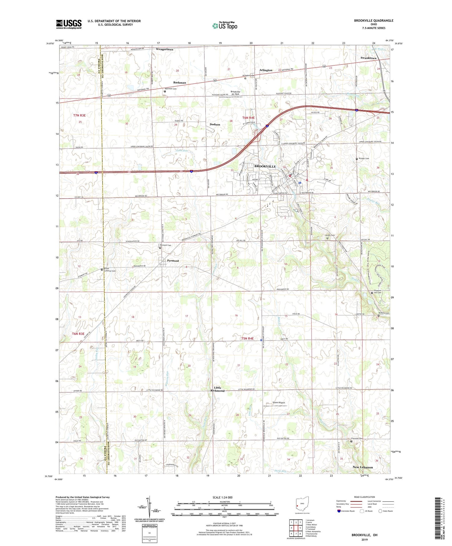
2023 topographic map quadrangle Brookville in the state of Ohio. Scale: 1:24000. Based on the newly updated USGS 7.5' US Topo map series, this map is in the following counties: Montgomery, Preble. The map contains contour data, water features, and other items you are used to seeing on USGS maps, but also has updated roads and other features. This is the next generation of topographic maps. Printed on high-quality waterproof paper with UV fade-resistant inks.
Quads adjacent to this one:
West: Lewisburg
Northwest: Arcanum
North: Laura
Northeast: West Milton
East: Trotwood
Southeast: Miamisburg
South: Farmersville
Southwest: West Alexandria
This map covers the same area as the classic USGS quad with code o39084g4.
Contains the following named places: Arlington, Arlington Cemetery, Bachman, Bachman Cemetery, Bachman Post Office, Brookside Plaza Shopping Center, Brookville, Brookville Church of the Brethren, Brookville Fire Department Station 1, Brookville Fire Department Station 2, Brookville High School, Brookville Middle School, Brookville Police Department, Brookville Post Office, Brookville Town Hall, City of Brookville, Community United Methodist Church, Dodson, Dodson Post Office, Eversole Cemetery, Eversole Church, First Baptist Church of Brookville, First Methodist Episcopal Church, Halbeisen Airport, Kreider Cemetery, Kreitzer Corner, Landis Cemetery, Lee Farms, Lick Run, Little Richmond, McNelly Cemetery, Melody 49 Twin Drive-In, Olivet United Brethren in Christ Church, Perry Township Police Department, Plainview Church, Pleasant Hill Cemetery, Providence Church, Pyrmont, Pyrmont Cemetery, Pyrmont Post Office, Pyrmont United Methodist Church, Schaney's Lair Airport, Shiloh Church, Shiloh Lutheran Cemetery, Stone Airport, Swanktown, Township of Perry, Trinity Lutheran Church, Wengerlawn, Wengerlawn Post Office, Westbrook Elementary School, WGTZ-FM (Eaton), Wolf Creek Church, Wysong Run, ZIP Code: 45309


