MyTopo
Bethesda Ohio US Topo Map
Couldn't load pickup availability
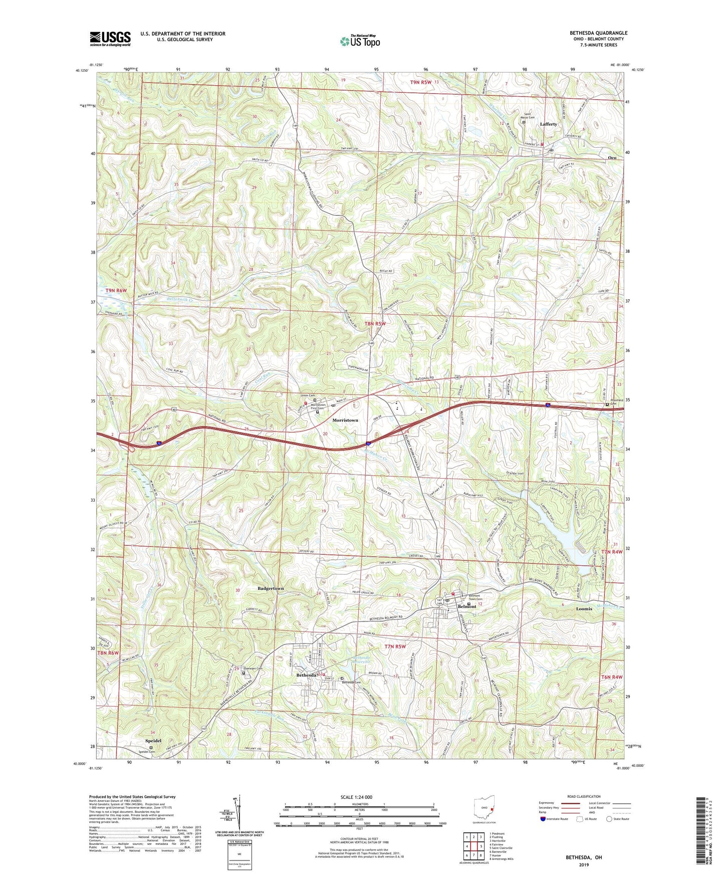
2023 topographic map quadrangle Bethesda in the state of Ohio. Scale: 1:24000. Based on the newly updated USGS 7.5' US Topo map series, this map is in the following counties: Belmont. The map contains contour data, water features, and other items you are used to seeing on USGS maps, but also has updated roads and other features. This is the next generation of topographic maps. Printed on high-quality waterproof paper with UV fade-resistant inks.
Quads adjacent to this one:
West: Fairview
Northwest: Piedmont
North: Flushing
Northeast: Harrisville
East: Saint Clairsville
Southeast: Armstrongs Mills
South: Hunter
Southwest: Barnesville
This map covers the same area as the classic USGS quad with code o40081a1.
Contains the following named places: Badgertown, Barkcamp Creek, Belmont, Belmont Elementary School, Belmont Historic District, Belmont Lake, Belmont Lake Dam, Belmont Lake State Reserve, Belmont Post Office, Belmont Town Cemetery, Belmont Volunteer Fire Department Station 17, Bethesda, Bethesda Cemetery, Bethesda Elementary School, Bethesda Fire and Rescue Station 18, Bethesda Post Office, Bethesda Reservoir, Bethesda Reservoir Dam, Coal Run, Ebenezer Cemetery, Epworth Park, Lafferty, Lafferty Census Designated Place, Lafferty Fire Station and Emergency Medical Services Station 27, Lafferty Post Office, Loomis, Mil-mar Trailer Court, Morristown, Morristown Elementary School, Morristown Fire Department Station 31, Morristown First Cemetery, Morristown Historic District, Morristown Post Office, Plainfield Cemetery, Saint Marys Cemetery, Speidel, Speidel Cemetery, Speidel Post Office, Township of Union, Union Cemetery, Union High School, Village of Belmont, Village of Bethesda, Village of Morristown, ZIP Codes: 43759, 43951