MyTopo
Ayersville Ohio US Topo Map
Couldn't load pickup availability
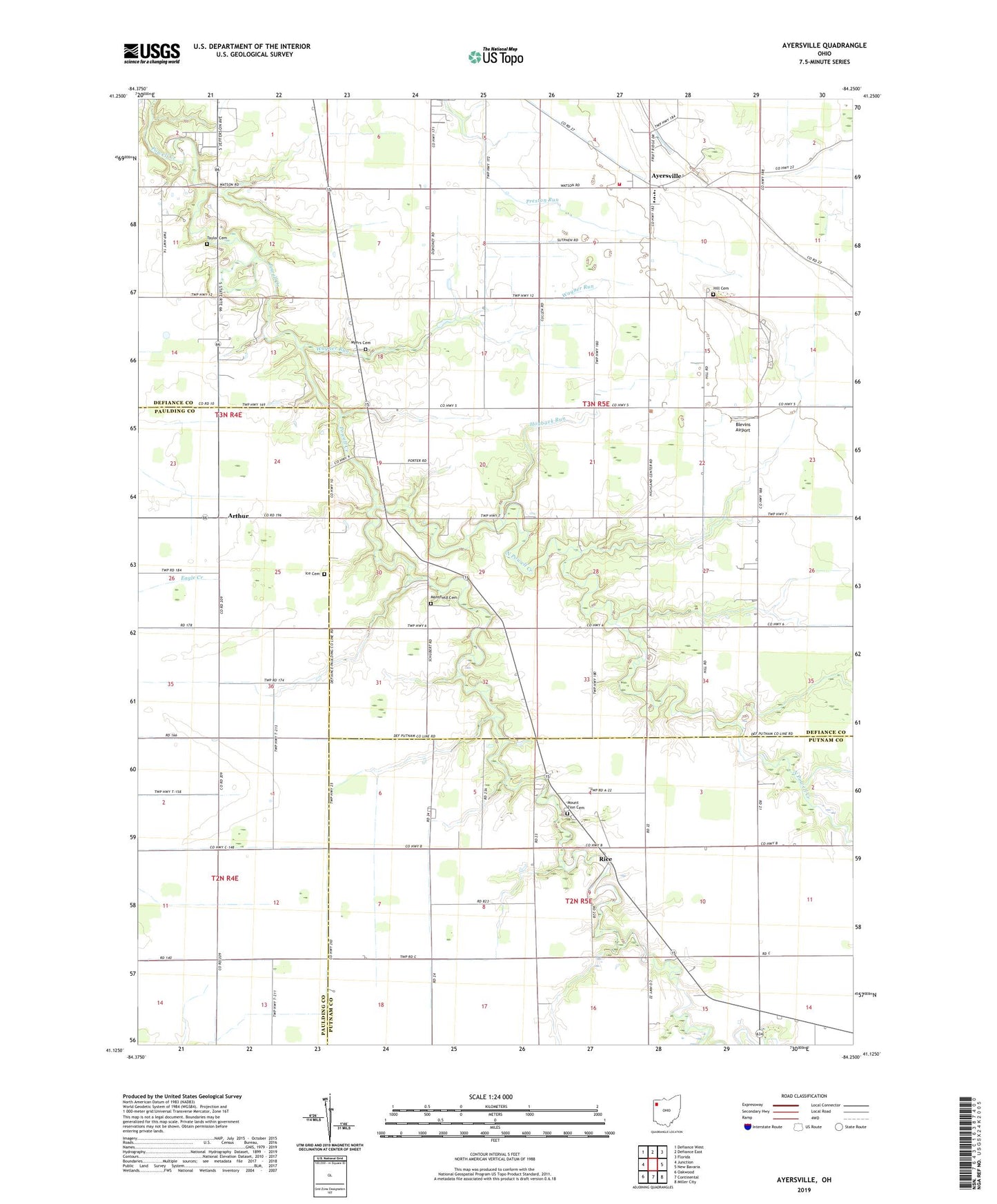
2023 topographic map quadrangle Ayersville in the state of Ohio. Scale: 1:24000. Based on the newly updated USGS 7.5' US Topo map series, this map is in the following counties: Defiance, Putnam, Paulding. The map contains contour data, water features, and other items you are used to seeing on USGS maps, but also has updated roads and other features. This is the next generation of topographic maps. Printed on high-quality waterproof paper with UV fade-resistant inks.
Quads adjacent to this one:
West: Junction
Northwest: Defiance West
North: Defiance East
Northeast: Florida
East: New Bavaria
Southeast: Miller City
South: Continental
Southwest: Oakwood
This map covers the same area as the classic USGS quad with code o41084b3.
Contains the following named places: Andrews Farms, Arthur, Arthur Post Office, Ayersville, Ayersville Elementary School, Ayersville High School, Ayersville Post Office, Ayersville United Methodist Church, Bauer Landing Strip, Beulah Church, Blevins Airport, Countryside Estates, Don Mar Farms, Evangelical Church, Highland Church, Highland Township Volunteer Fire Department Station 100, Hill Cemetery, Hogback Run, Ice Cemetery, Mansfield Cemetery, Mount Zion Cemetery, Mount Zion Church, Myers Cemetery, North Powell Creek, Rice, Rice Post Office, South Powell Creek, Southerton, Steffel Ditch, Taylor Cemetery, Township of Highland, Trimed Emergency Medical Services, Wagner Run