MyTopo
New Bavaria Ohio US Topo Map
Couldn't load pickup availability
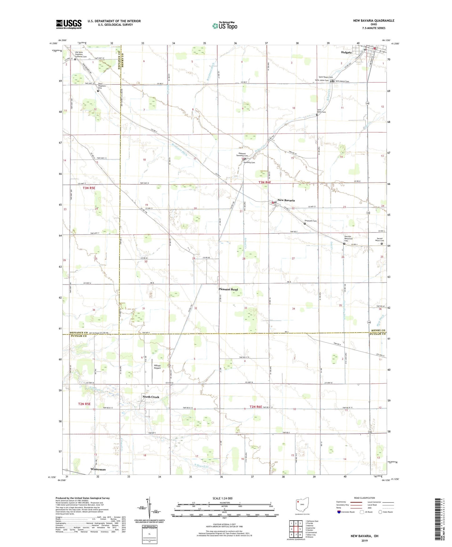
2023 topographic map quadrangle New Bavaria in the state of Ohio. Scale: 1:24000. Based on the newly updated USGS 7.5' US Topo map series, this map is in the following counties: Henry, Putnam, Defiance. The map contains contour data, water features, and other items you are used to seeing on USGS maps, but also has updated roads and other features. This is the next generation of topographic maps. Printed on high-quality waterproof paper with UV fade-resistant inks.
Quads adjacent to this one:
West: Ayersville
Northwest: Defiance East
North: Florida
Northeast: Malinta
East: Hamler
Southeast: Ottawa
South: Miller City
Southwest: Continental
This map covers the same area as the classic USGS quad with code o41084b2.
Contains the following named places: Emanuels Cemetery, Emmanuels United Church of Christ, German Reformed Cemetery, Henry County South Joint Ambulance District Holgate Emergency Medical Services, Hiltner Airport, Holgate, Holgate High School, Holgate Volunteer Fire Department, Maple Grove Dairy, New Bavaria, New Bavaria - Pleasant Township Fire Department, New Bavaria Post Office, North Creek, North Creek Post Office, Old Saint Stephens Lutheran Cemetery, Pleasant Bend, Pleasant Bend Methodist Church, Pleasant Grove Church, Pleasant Township Cemetery, Pleasant Township Cemetery 1, Pleasantbend Post Office, Sacred Heart Catholic Church, Sacred Heart Cemetery, Sacred Heart School, Saint Johns Cemetery, Saint Marys Cemetery, Saint Peters Cemetery, Saint Stephens Cemetery, Saint Stephens Church, Township of Pleasant, Village of Holgate, Village of New Bavaria, Wezbra Dairy, ZIP Codes: 43527, 43548