MyTopo
Blakeslee Ohio US Topo Map
Couldn't load pickup availability
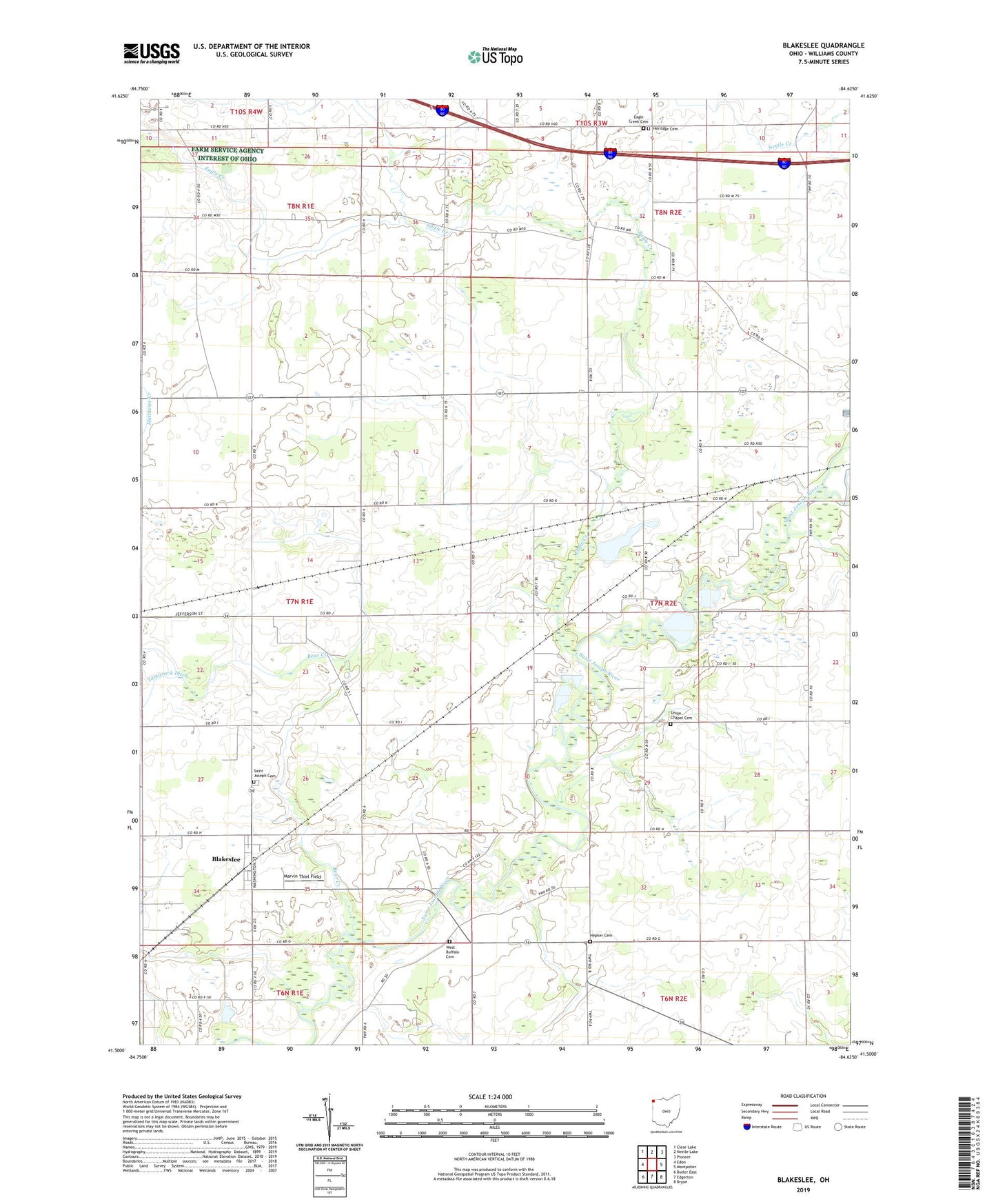
2023 topographic map quadrangle Blakeslee in the state of Ohio. Scale: 1:24000. Based on the newly updated USGS 7.5' US Topo map series, this map is in the following counties: Williams. The map contains contour data, water features, and other items you are used to seeing on USGS maps, but also has updated roads and other features. This is the next generation of topographic maps. Printed on high-quality waterproof paper with UV fade-resistant inks.
Quads adjacent to this one:
West: Edon
Northwest: Clear Lake
North: Nettle Lake
Northeast: Pioneer
East: Montpelier
Southeast: Bryan
South: Edgerton
Southwest: Butler East
This map covers the same area as the classic USGS quad with code o41084e6.
Contains the following named places: Bear Creek, Bethlehem Christian Union Church, Blakeslee, Blakeslee Post Office, Bratton School, Browns Recreation Lake, Browns Recreation Lake Dam, Creek Farms, Eagle Creek, Eagle Creek Cemetery, Farm Service Agency Interest of Ohio, Fetter School, Hepker Cemetery, Heritage Cemetery, Marvin Thiel Field, Mount Olive Church, North Branch Eagle Creek, Saint Joseph Catholic Church, Saint Joseph Cemetery, Saint Joseph School, School Number 1, School Number 10, School Number 11, School Number 12, School Number 3, School Number 4, School Number 5, School Number 6, School Number 7, School Number 8, School Number 9, Township of Florence, Township of Superior, Union Chapel Cemetery, Union Corners, Village of Blakeslee, West Buffalo, West Buffalo Cemetery, West Woodly Addition, ZIP Codes: 43505, 43543