MyTopo
Butler East Indiana US Topo Map
Couldn't load pickup availability
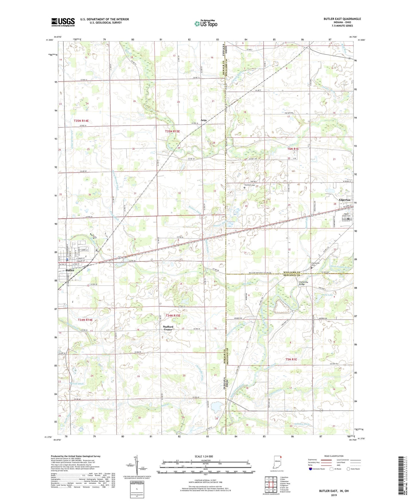
2022 topographic map quadrangle Butler East in the states of Indiana, Ohio. Scale: 1:24000. Based on the newly updated USGS 7.5' US Topo map series, this map is in the following counties: DeKalb, Williams, Defiance. The map contains contour data, water features, and other items you are used to seeing on USGS maps, but also has updated roads and other features. This is the next generation of topographic maps. Printed on high-quality waterproof paper with UV fade-resistant inks.
Quads adjacent to this one:
West: Butler West
Northwest: Hamilton
North: Edon
Northeast: Blakeslee
East: Edgerton
Southeast: Mark Center
South: Hicksville
Southwest: Saint Joe
Contains the following named places: Amaden Ditch, Artic, Ayford Ditch, Bethel Church, Big Run, Big Run Church, Bratton Ditch, Bratton School, Buck Creek, Butler, Butler Elementary School, Butler Police Department, Butler Post Office, Chridtoffel Ditch, Church of Christ, City of Butler, Clarksville, Clarksville Bridge, Clarksville Cemetery, Clarksville School, Cornell Ditch, Eastside Junior-Senior High School, Farnham Cemetery, Foulks Ditch, Goebel Farms, Greens Ditch, John Smith Ditch, Kline Field Airport, Koder School, Ladd Lake, Maple Grove Cemetery, Mary Metcalf Ditch, Miller Park, Peter Grube Ditch, Praul Ditch, Russell Run, School Number 6, Smith Ditch, Stafford Center, Streeter Ditch, Township of Stafford, Township of Troy, Walters Ditch, West Milford School, Wilson School, Ziegler Ditch