MyTopo
Edon Ohio US Topo Map
Couldn't load pickup availability
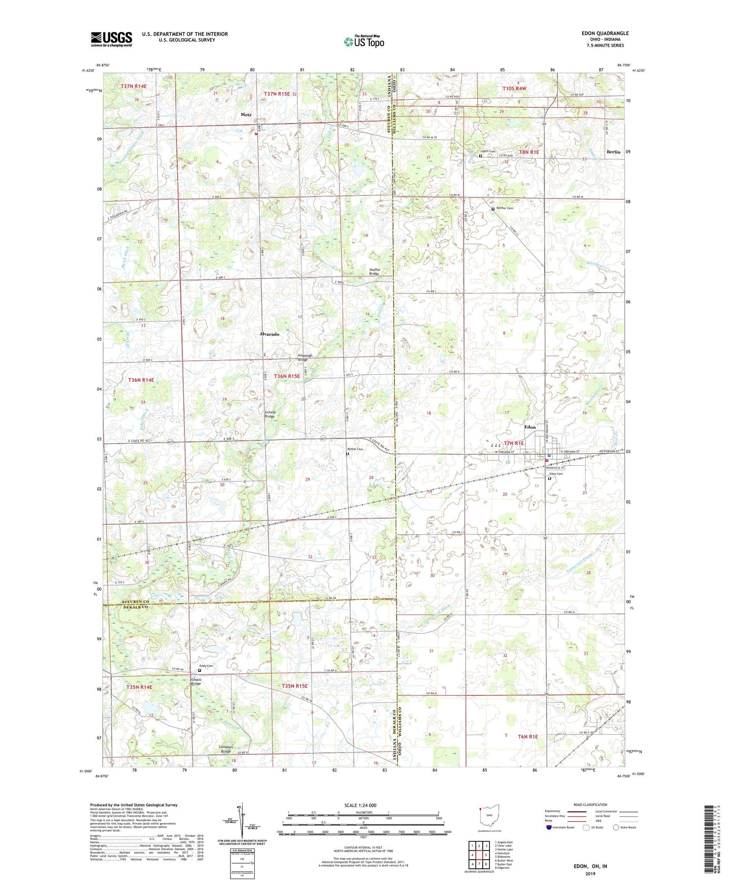
2023 topographic map quadrangle Edon in the states of Indiana, Ohio. Scale: 1:24000. Based on the newly updated USGS 7.5' US Topo map series, this map is in the following counties: Williams, Steuben, DeKalb. The map contains contour data, water features, and other items you are used to seeing on USGS maps, but also has updated roads and other features. This is the next generation of topographic maps. Printed on high-quality waterproof paper with UV fade-resistant inks.
Quads adjacent to this one:
West: Hamilton
Northwest: Angola East
North: Clear Lake
Northeast: Nettle Lake
East: Blakeslee
Southeast: Edgerton
South: Butler East
Southwest: Butler West
This map covers the same area as the classic USGS quad with code o41084e7.
Contains the following named places: Alvarado, Anspaugh Bridge, Berlin, Bethel Cemetery, Boisher Cemetery, Burdick Lake, Campbell Bridge, Doty School, Eddy Cemetery, Edon, Edon Cemetery, Edon Community Park, Edon High School, Edon Home Court, Edon Post Office, Edon United Methodist Church, Edon Village Police Department, Enfield Bridge, Florence Township Fire Department, Gaskill Bridge, Gimblet Hill School, Hiram Sweet Ditch, Lash School, Ligett Cemetery, Matthews Creek, Metz, Metz Volunteer Fire Department, Mount Pleasant Church, Saint Peters Lutheran Church, School Number 4, School Number 5, Shaffer Bridge, Tamarack Ditch, Tamarack School, Township of Richland, Village of Edon, Williams County Emergency Medical Services Medic 4, Woodwind Hollow Golf Course, Zion Church, ZIP Code: 43518