MyTopo
Chillicothe West Ohio US Topo Map
Couldn't load pickup availability
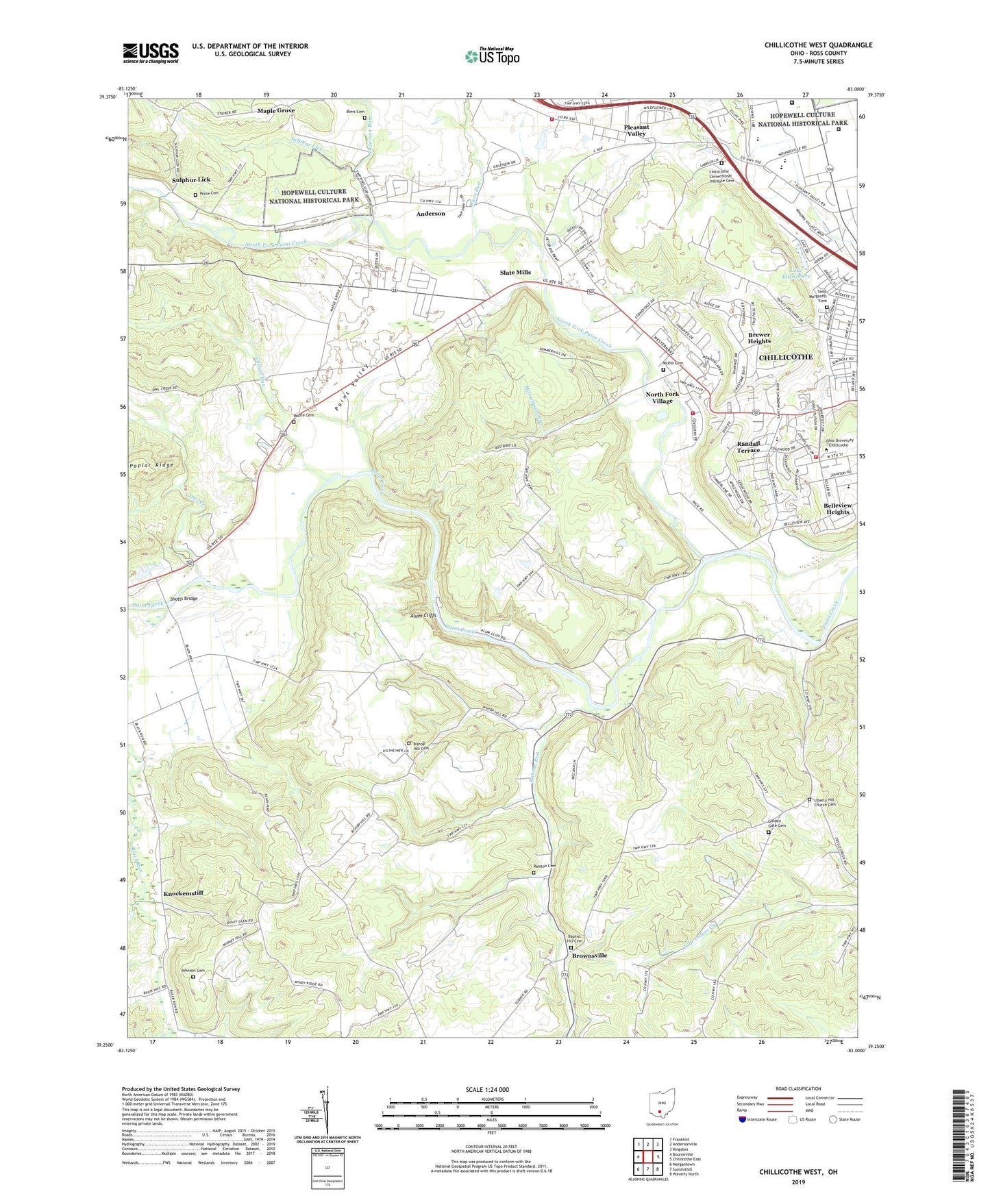
2023 topographic map quadrangle Chillicothe West in the state of Ohio. Scale: 1:24000. Based on the newly updated USGS 7.5' US Topo map series, this map is in the following counties: Ross. The map contains contour data, water features, and other items you are used to seeing on USGS maps, but also has updated roads and other features. This is the next generation of topographic maps. Printed on high-quality waterproof paper with UV fade-resistant inks.
Quads adjacent to this one:
West: Bourneville
Northwest: Frankfort
North: Andersonville
Northeast: Kingston
East: Chillicothe East
Southeast: Waverly North
South: Summithill
Southwest: Morgantown
This map covers the same area as the classic USGS quad with code o39083c1.
Contains the following named places: Adena State Memorial, Allen Elementary School, Alum Cliffs, Anderson, Anderson Post Office, Anderson Run, Baptist Hill Cemetery, Baptist Hill Church, Belleview Heights, Bethel Chapel, Beulah Chapel, Biers Cemetery, Biers Run, Bishop Flaget Middle School, Bishop Hill Cemetery, Bishop Hill Church, Bishop Hill School, Brewer Heights, Brownsville, Camp Sherman, Cattail Run, Cattail School, Chillicothe Correctional Institute Cemetery, Chillicothe Correctional Institution, Chillicothe Country Club, Chillicothe Federal Reformatory, Chillicothe Fire Department Station 4, Cinema 6, Ebenezer Church, Ebush, Ebush Post Office, Golden Gate Cemetery, Greenbrier School, Happy Valley Church, Henness School, Hirsch Fruit Farm, Johnson Cemetery, Knockemstiff, Lake Ellensmere, Liberty Hill Church, Liberty Hill Church Cemetery, Maple Grove, McDill Cemetery, Moore Cemetery, Newingburg, Newingburg Post Office, North Fork Church, North Fork Paint Creek, North Fork Village, North Fork Village Census Designated Place, Ohio University Chillicothe Branch, Owl Creek, Paint Valley, Paint Valley School, Pickaway Plains Health Pro Ambulance Service, Pleasant Valley, Poke Hollow School, Poole Cemetery, Ralston Cemetery, Ralston Run, Ralston Run School, Randall Terrace, Ross Correctional Institution, Ross County, Rube School, Saint Margarets Cemetery, Scioto Township Fire Department Station 2, Shady Glen Church of Christ in Christian Union, Shotts Bridge, Slate Mills, Slate Mills Post Office, Story Place Post Office, Sulphur Lick, Sulphur Lick Post Office, Sulphur Lick School, Union Township Fire Department Station 1, Union-Scioto High School, Union-Scioto Intermediate School, Union-Scioto Primary School, Westside Church Of The Nazarene