MyTopo
Andersonville Ohio US Topo Map
Couldn't load pickup availability
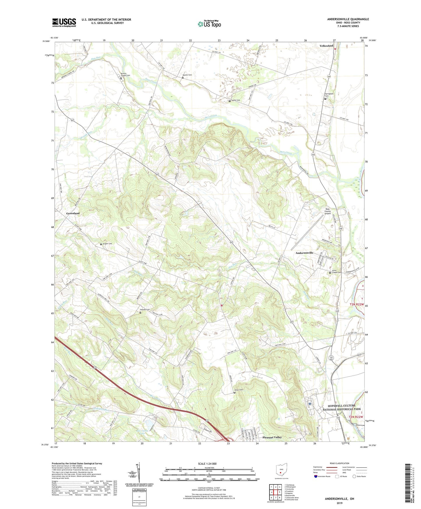
2023 topographic map quadrangle Andersonville in the state of Ohio. Scale: 1:24000. Based on the newly updated USGS 7.5' US Topo map series, this map is in the following counties: Ross. The map contains contour data, water features, and other items you are used to seeing on USGS maps, but also has updated roads and other features. This is the next generation of topographic maps. Printed on high-quality waterproof paper with UV fade-resistant inks.
Quads adjacent to this one:
West: Frankfort
Northwest: Clarksburg
North: Williamsport
Northeast: Circleville
East: Kingston
Southeast: Chillicothe East
South: Chillicothe West
Southwest: Bourneville
This map covers the same area as the classic USGS quad with code o39083d1.
Contains the following named places: Albright School, Andersonville, Andersonville Census Designated Place, Andersonville Post Office, Bowdle Cemetery, Bowill School, Briggs School, Browns Chapel, Browns Chapel Cemetery, Brownstown, Carey, Chillicothe Veterans Affairs Medical Center, Deer Creek, Draper Cemetery, Dry Run, Dry Run Chapel, Dry Run School, Dunlap School, Forest Hill School, Greenland, Greenland Post Office, Hay Run, Mad Run, Metzger School, Minear Cemetery, Mona School, Noble Cemetery, Pleasant Valley Church, Pleasant Valley School, Pleasant Valley Wildlife Area, Ross County Airport, Rouse School, Rustic Acres Lake, Rustic Acres Lake Dam, Shiloh Church, Shiloh School, Spring Bank Church, Springbank Cemetery, Springbank School, Stall Run, Sun Valley Lake, Sun Valley Lake Dam, Tootle School, Township of Union, Triplett Farm, Union Cemetery, Union Chapel, Union Chapel Cemetery, Union Township Fire Department Station 2, Union Township Fire Department Station 3, View, View Post Office, Waugh Run