MyTopo
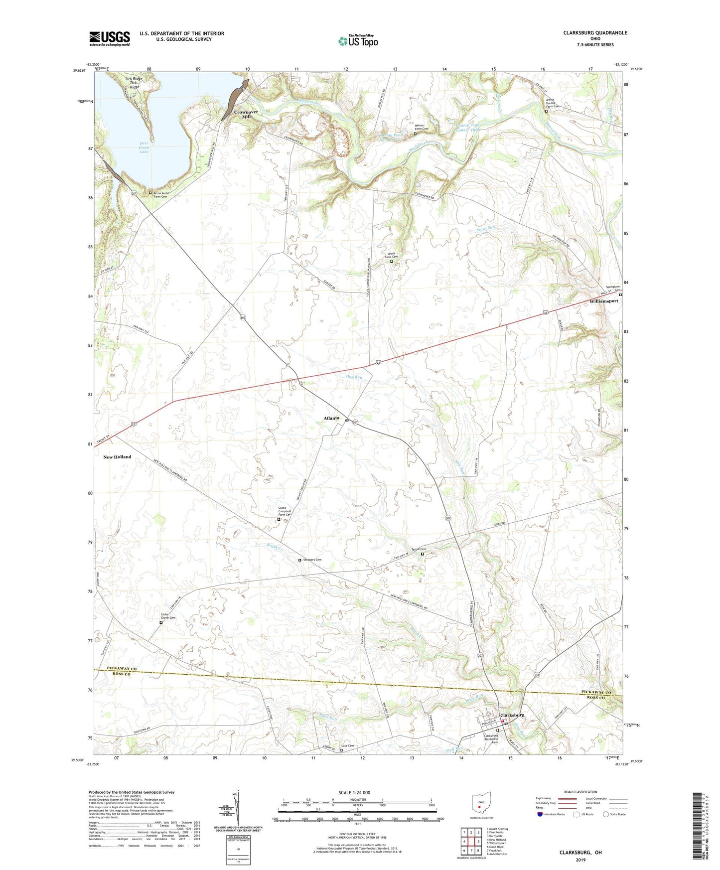
Clarksburg Ohio US Topo Map
Couldn't load pickup availability
2019 topographic map quadrangle Clarksburg in the state of Ohio. Scale: 1:24000. Based on the newly updated USGS 7.5' US Topo map series, this map is in the following counties: Pickaway, Ross. The map contains contour data, water features, and other items you are used to seeing on USGS maps, but also has updated roads and other features. This is the next generation of topographic maps. Printed on high-quality waterproof paper with UV fade-resistant inks.
Quads adjacent to this one:
West: New Holland
Northwest: Mount Sterling
North: Five Points
Northeast: Darbyville
East: Williamsport
Southeast: Andersonville
South: Frankfort
Southwest: Good Hope
Contains the following named places: Angles Farm, Arnold School, Arron Kellar Farm Cemetery, Arthur Dunlap Farm Cemetery, Atlanta, Atlanta Post Office, Bottom Line Farms, Brush Creek, Buskirk Creek, Cedar Grove Cemetery, Cedar Grove School, Clarksburg, Clarksburg Elementary School, Clarksburg Methodist Cemetery, Clarksburg Post Office, Clearview Farms, Crossroads Farms, Crownover Mill, Deer Creek Lake, Deercreek Dam, Deercreek Farms, Deerfield Township Volunteer Fire and Rescue, Dry Run, Dublin Hill School, Dunlap Lake, Dunlap Lake Dam, Dunlap Pond Dam Number Three, Dunlap Pond Dam Number Two, Dunlap Pond Number Three, Dunlap Pond Number Two, Dunlap School, Georges Run, Grant Campbell Farm Cemetery, Hammond Farms, Hay Run School, Hinton Farm Cemetery, Homestead Acres, Kozy Corners, Lewis Farm Cemetery, Locust Grove School, Lutz Cemetery, M A D Farms, Maple Dell School, McCoy Farm, Mouser School, Pleasant Grove School, Plum Run, Plummer School, Remy Farms, Roberts Farms, School Number 1, Springlawn Cemetery, State Run, Tanquary Cemetery, Tarbill Cemetery, Township of Perry, Vernon Farms, Victor Farms, Village of Clarksburg