MyTopo
Continental Ohio US Topo Map
Couldn't load pickup availability
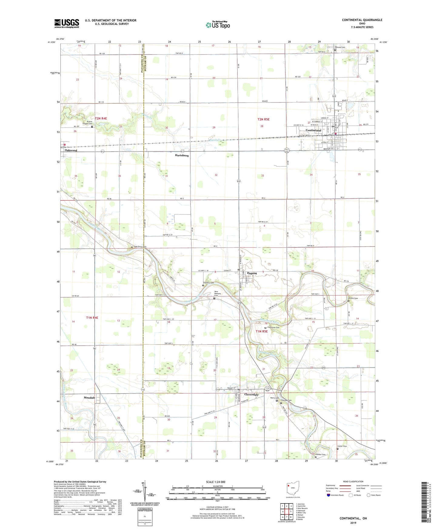
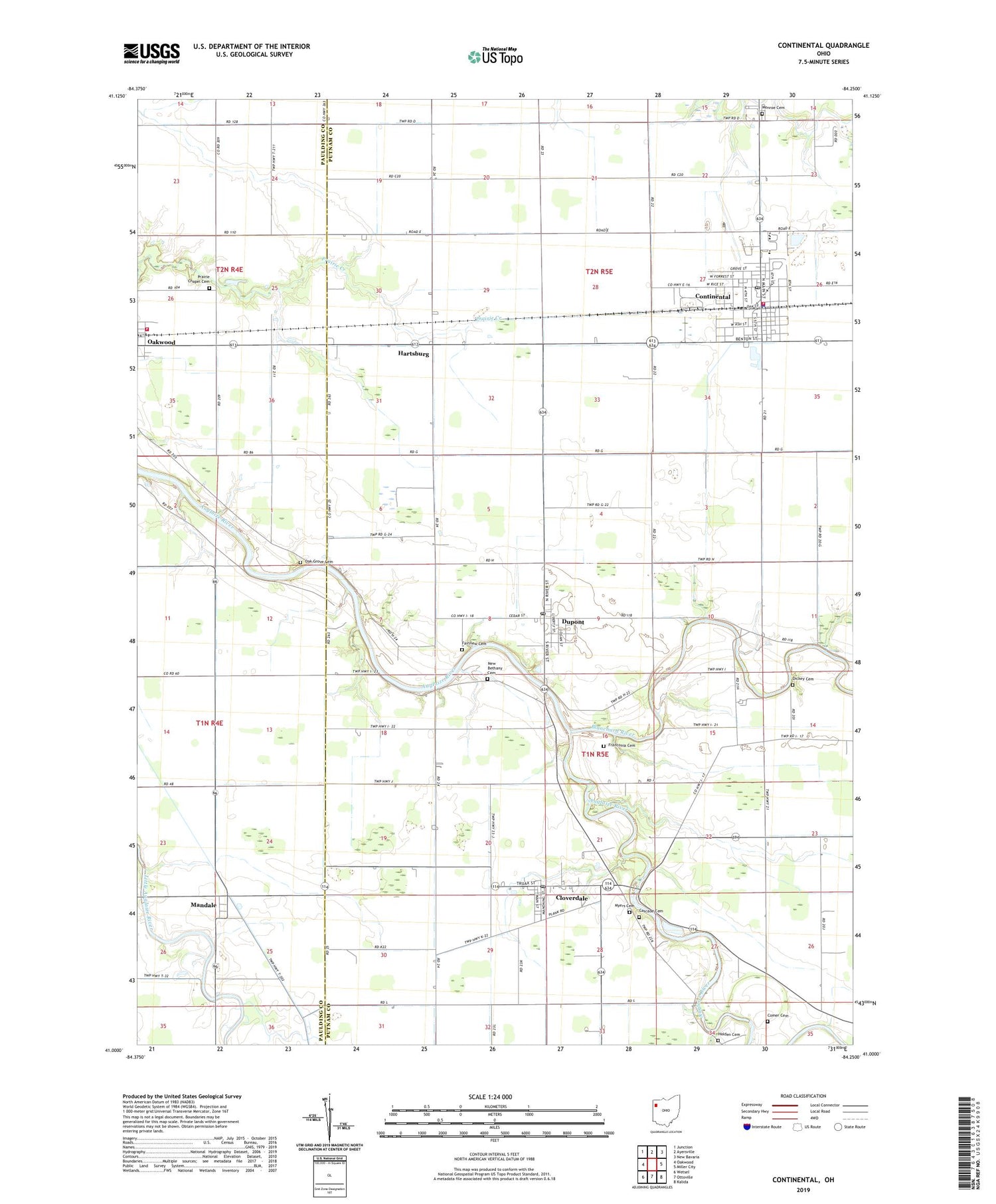
2019 topographic map quadrangle Continental in the state of Ohio. Scale: 1:24000. Based on the newly updated USGS 7.5' US Topo map series, this map is in the following counties: Putnam, Paulding. The map contains contour data, water features, and other items you are used to seeing on USGS maps, but also has updated roads and other features. This is the next generation of topographic maps. Printed on high-quality waterproof paper with UV fade-resistant inks.
Quads adjacent to this one:
West: Oakwood
Northwest: Junction
North: Ayersville
Northeast: New Bavaria
East: Miller City
Southeast: Kalida
South: Ottoville
Southwest: Wetsel
Contains the following named places: Blanchard River, Cascade, Cascade Cemetery, Cascade Post Office, Casoade Park, Cloverdale, Cloverdale Post Office, Comer Cemetery, Continental, Continental Fire Department, Continental High School, Continental Police Department, Continental Post Office, Dickey Cemetery, Dupont, Dupont Post Office, East Mandale, Etties-Burg, Fairview Cemetery, Franconia, Franconia Cemetery, Franconia Post Office, Hamer, Hartsburg, Hartsburg Post Office, Hartsburg United Methodist Church, Holden Cemetery, Huntstown, Huntstown Post Office, Lapp Ditch, Mandale, Mandale Church of Christ in Christian Union, Mandale Post Office, Mobile Manor, Monroe Cemetery, Myers Cemetery, New Bethany Cemetery, Oak Grove Cemetery, Oakwood Volunteer Fire and Rescue Department, Pear Meadows Farm, Prairie Chapel, Prairie Chapel Cemetery, South Mount Zion Church, Township of Monroe, Township of Perry, Van Ham Dairy, Village of Cloverdale, Village of Continental, Village of Dupont, Village of Oakwood, ZIP Code: 45831