MyTopo
Frankfort Ohio US Topo Map
Couldn't load pickup availability
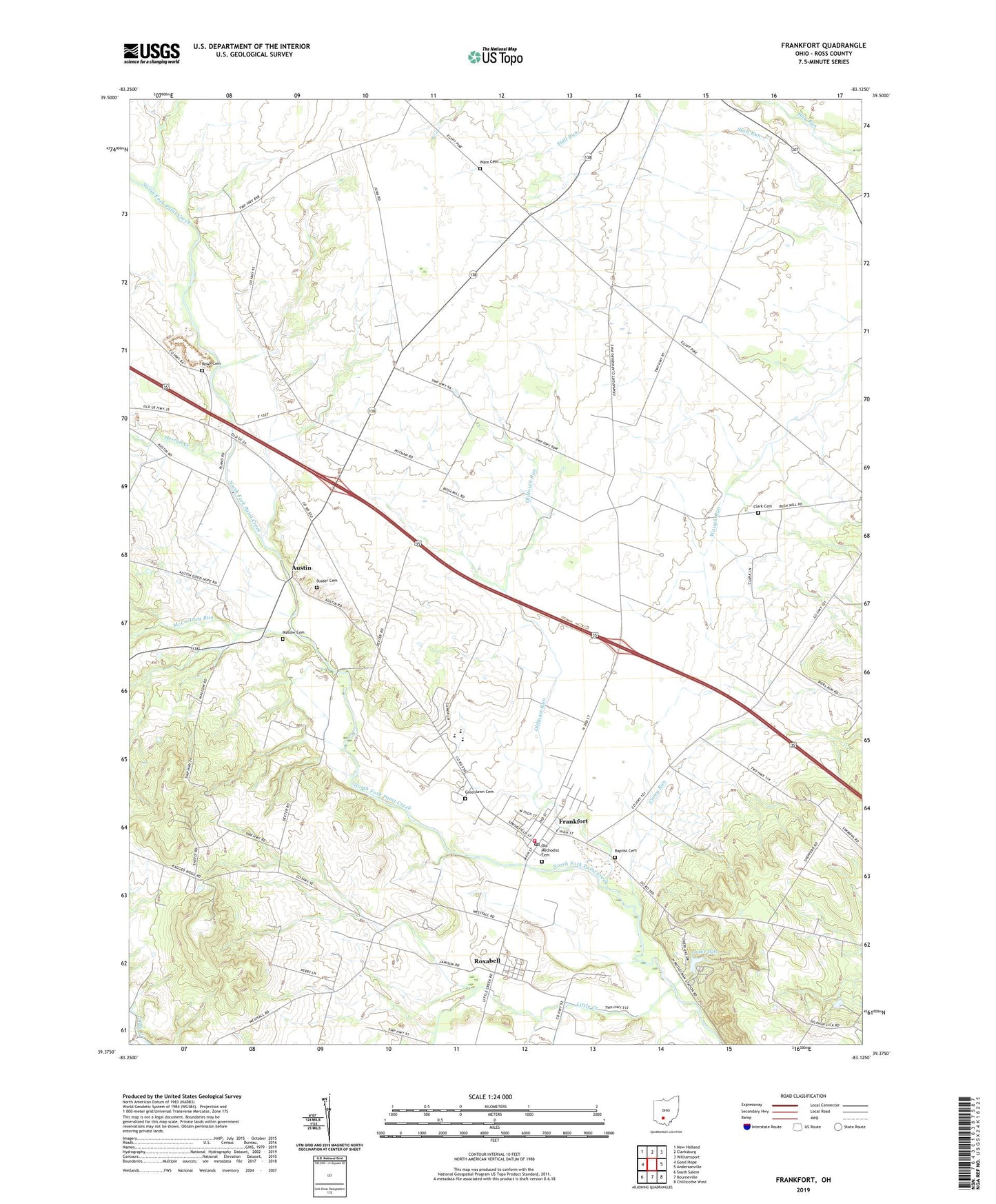
2019 topographic map quadrangle Frankfort in the state of Ohio. Scale: 1:24000. Based on the newly updated USGS 7.5' US Topo map series, this map is in the following counties: Ross. The map contains contour data, water features, and other items you are used to seeing on USGS maps, but also has updated roads and other features. This is the next generation of topographic maps. Printed on high-quality waterproof paper with UV fade-resistant inks.
Quads adjacent to this one:
West: Good Hope
Northwest: New Holland
North: Clarksburg
Northeast: Williamsport
East: Andersonville
Southeast: Chillicothe West
South: Bourneville
Southwest: South Salem
Contains the following named places: Adena High School, Austin, Austin Chapel, Austin Post Office, Baptist Cemetery, Bethel School, Bowdle Farms, Clark Cemetery, Cline School, Concord Township Emergency Squad, Concord Township Fire Department, Corey Run, Dewey Creek, Dry Run, Egypt Church, Estel Chapel, Estell School, Fisher School, Fountain School, Frankfort, Frankfort Elementary School, Frankfort Post Office, Grassland Dairy, Greenland School, Greenlawn Cemetery, Herrod Creek, Lake Hill, Lake Hill Campground, Lake Hill Dam, Leffingwell School, Little Creek, Mallow Cemetery, Mallow School, McCortney Run, New Bethel Church, Noble School, Old Methodist Cemetery, Oldtown Run, Putnam Dairy Farm, Rowe Cemetery, Roxabell, Roxabell Post Office, Sanford School, Stader Cemetery, Township of Concord, Township of Deerfield, Village of Frankfort, Ware Cemetery, Wind Dreamer Farms, ZIP Codes: 43115, 45628