MyTopo
Fremont West Ohio US Topo Map
Couldn't load pickup availability
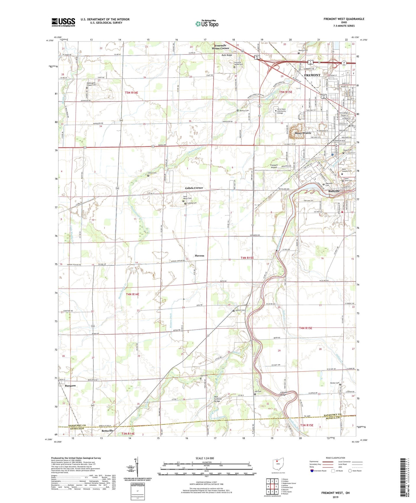
2023 topographic map quadrangle Fremont West in the state of Ohio. Scale: 1:24000. Based on the newly updated USGS 7.5' US Topo map series, this map is in the following counties: Sandusky, Seneca. The map contains contour data, water features, and other items you are used to seeing on USGS maps, but also has updated roads and other features. This is the next generation of topographic maps. Printed on high-quality waterproof paper with UV fade-resistant inks.
Quads adjacent to this one:
West: Helena
Northwest: Elmore
North: Lindsey
Northeast: Wightmans Grove
East: Fremont East
Southeast: Watson
South: Tiffin North
Southwest: Bascom
This map covers the same area as the classic USGS quad with code o41083c2.
Contains the following named places: Anderson Field, Ballville, Ballville Census Designated Place, Ballville Township House, Ballville Township Volunteer Fire Department, Birchard Park, Bowlus Cemetery, Burgoon Post Office, Church of Christ Apostolic Faith, Church of the Nazarene, Decker Cemetery, East Branch Wolf Creek, Faith Church, First Baptist Church of Fremont, Fourmile House Cemetery, Fourmile House Corner, Fremont Airport, Fremont Baptist Church, Fremont Fire Department Central Station, Gabels Corner, Gillmor Airport, Gilmore Bridge, Golden Gate Estates, Grace Brethren Chapel, Halters Cemetery, Havens, Havens Post Office, Hayes Cemetery, Highland Jersey Farms, Hill Cemetery, Hite Cemetery, Indian Creek, Lakota East Elementary School, Ludwig Cemetery, Lutz Elementary School, Memorial Hospital Heliport, Memorial United Methodist Church, Mill Mobile Home Park, Mount Pleasant Baptist Church, Mull Covered Bridge, Oakwood Cemetery, Ohio State Highway Patrol - Fremont Patrol Post, Otis Elementary School, Our Lady of the Pines School, Portage Trail Park, Potter Village Shopping Center, ProMedica Memorial Hospital, Ruhl Ridge, Rutherford B Hayes Presidential Center Library, Saint Anns Cemetery, Saint Casimir Catholic Church, Saint Casimir School, Saint Josephs Cemetery, Saint Marys Cemetery, Sandusky County, Sandusky Scenic River State Access Area, Shawl Cemetery, Spiegel Grove State Park, Stony Prairie, Stony Prairie Census Designated Place, Sycamore Hills Golf Course, Terra Community College, Township of Ballville, Township of Jackson, Vanguard Vocational and Technical Center, Washington Chapel, Washington Chapel Cemetery, Winters Ditch, Winters Station, Wolf Creek, Wolf Creek Park, Word of Faith Fellowship Church, Young's Colonial Acres, ZIP Code: 43407