MyTopo
Lindsey Ohio US Topo Map
Couldn't load pickup availability
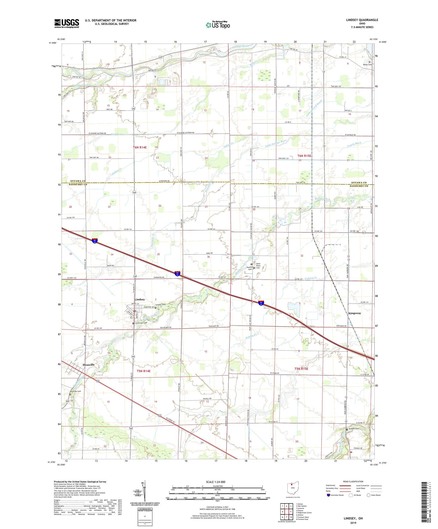
2023 topographic map quadrangle Lindsey in the state of Ohio. Scale: 1:24000. Based on the newly updated USGS 7.5' US Topo map series, this map is in the following counties: Sandusky, Ottawa. The map contains contour data, water features, and other items you are used to seeing on USGS maps, but also has updated roads and other features. This is the next generation of topographic maps. Printed on high-quality waterproof paper with UV fade-resistant inks.
Quads adjacent to this one:
West: Elmore
Northwest: Genoa
North: Oak Harbor
Northeast: Lacarne
East: Wightmans Grove
Southeast: Fremont East
South: Fremont West
Southwest: Helena
This map covers the same area as the classic USGS quad with code o41083d2.
Contains the following named places: Bethel United Brethren Church, Binkley Cemetery, Hessville, Hessville Cemetery, Hessville Census Designated Place, Hessville Post Office, Hineline Cemetery, Indian Creek, Kingsway, Kingsway Post Office, Lindsey, Lindsey Cemetery, Lindsey Post Office, Lindsey Volunteer Fire Department, Ninemile Creek, Overmyer Cemetery, Roose Cemetery, Saint Pauls Cemetery, Saint Pauls Church, Sandusky Township Fire Department and Emergency Medical Services, Sugar Creek, Township of Salem, Township of Sandusky, Township of Washington, Trinity United Methodist Church, Village of Lindsey, Washington Township School, ZIP Code: 43442