MyTopo
Gavers Ohio US Topo Map
Couldn't load pickup availability
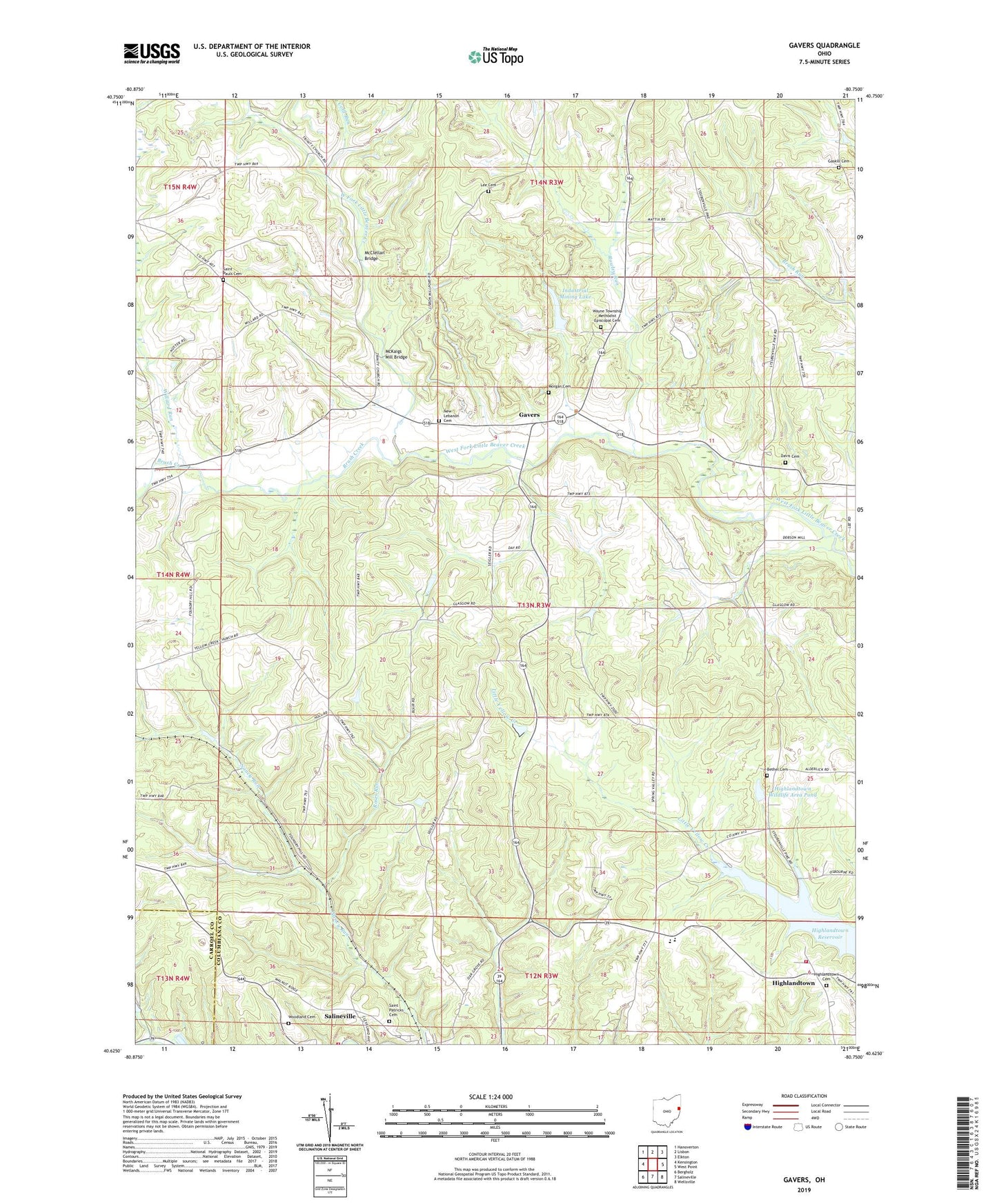
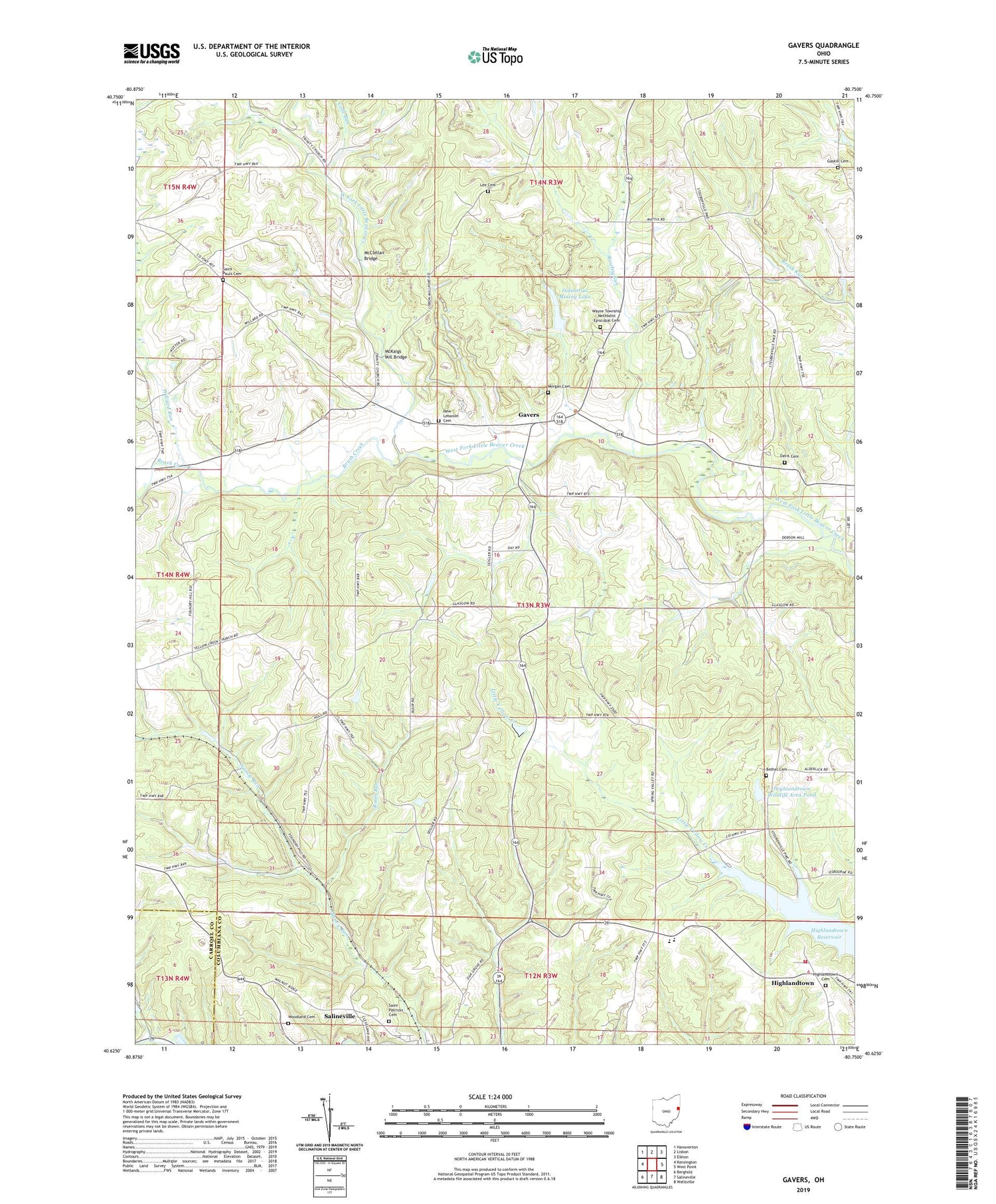
2019 topographic map quadrangle Gavers in the state of Ohio. Scale: 1:24000. Based on the newly updated USGS 7.5' US Topo map series, this map is in the following counties: Columbiana, Carroll. The map contains contour data, water features, and other items you are used to seeing on USGS maps, but also has updated roads and other features. This is the next generation of topographic maps. Printed on high-quality waterproof paper with UV fade-resistant inks.
Quads adjacent to this one:
West: Kensington
Northwest: Hanoverton
North: Lisbon
Northeast: Elkton
East: West Point
Southeast: Wellsville
South: Salineville
Southwest: Bergholz
Contains the following named places: Bethel Cemetery, Bethel Presbyterian Church, Brush Creek, Cold Run, Davis Cemetery, Gaskill Cemetery, Gavers, Gavers Post Office, Highlandtown, Highlandtown Cemetery, Highlandtown Elementary School, Highlandtown Reservoir, Highlandtown Volunteer Fire Department, Highlandtown Wildlife Area, Highlandtown Wildlife Area Pond, Industrial Mining Lake, Industrial Mining Lake Dam, Lee Cemetery, McClellan Bridge, McKaigs Mill Bridge, Morgan Cemetery, New Lebanon Cemetery, New Lebanon United Presbyterian Church, Roses Run, Rowley Run, Saint Patricks Cemetery, Saint Pauls Cemetery, Salineville Volunteer Fire Department, Sandy-Beaver Canal Tunnel, Southern High School, Township of Washington, Township of Wayne, Wayne School, Wayne Township Methodist Episcopal Cemetery, Williard Run, Woodland Cemetery, ZIP Codes: 43945, 44432