MyTopo
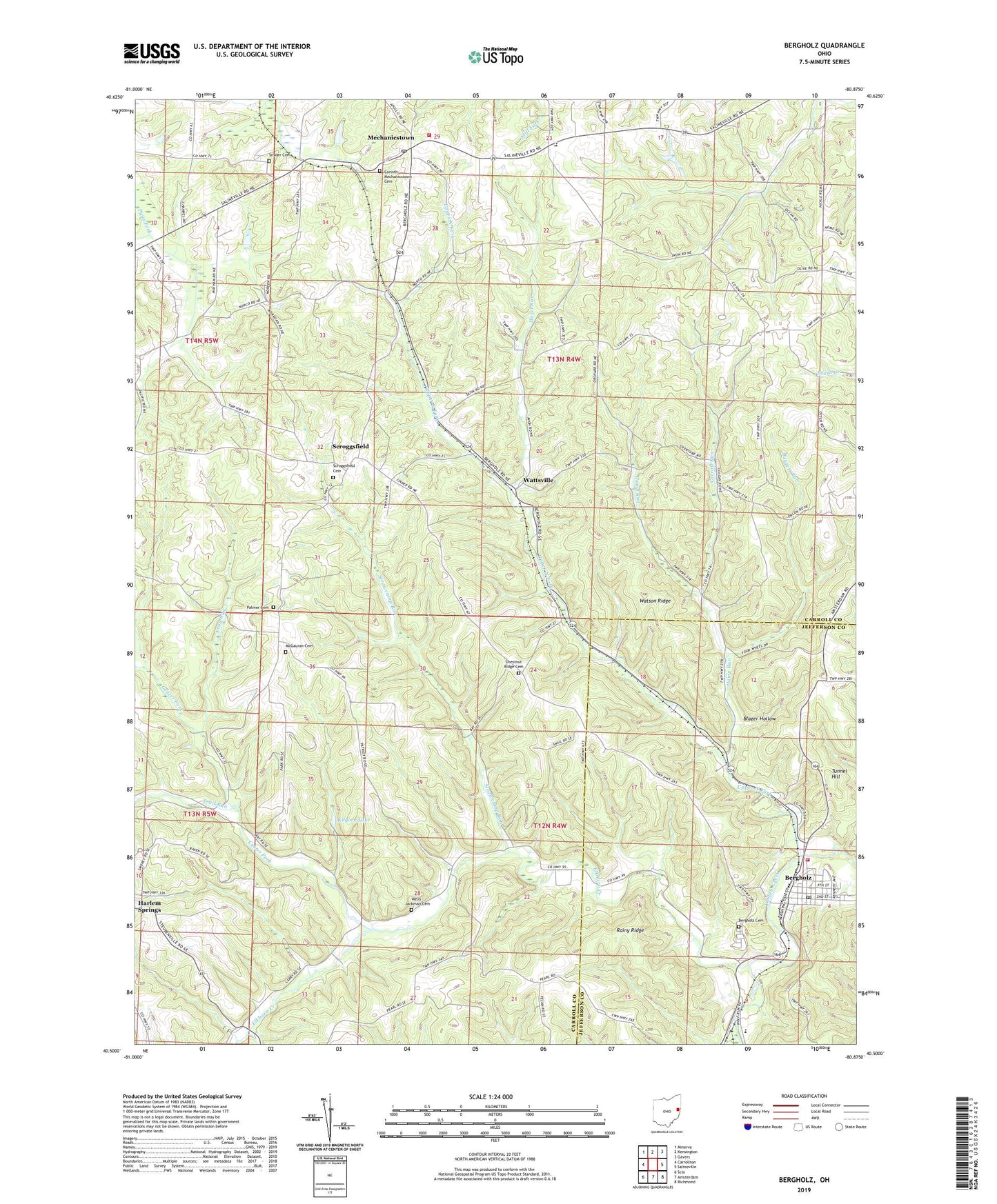
Bergholz Ohio US Topo Map
Couldn't load pickup availability
2023 topographic map quadrangle Bergholz in the state of Ohio. Scale: 1:24000. Based on the newly updated USGS 7.5' US Topo map series, this map is in the following counties: Carroll, Jefferson. The map contains contour data, water features, and other items you are used to seeing on USGS maps, but also has updated roads and other features. This is the next generation of topographic maps. Printed on high-quality waterproof paper with UV fade-resistant inks.
Quads adjacent to this one:
West: Carrollton
Northwest: Minerva
North: Kensington
Northeast: Gavers
East: Salineville
Southeast: Richmond
South: Amsterdam
Southwest: Scio
This map covers the same area as the classic USGS quad with code o40080e8.
Contains the following named places: Bergholz, Bergholz Cemetery, Bergholz Post Office, Bergholz Squad, Bergholz Volunteer Fire Company, Blazer Hollow, Burgett Run, Carroll Run, Center Fork, Chestnut Ridge Cemetery, Chestnut Ridge Church, Corinth - Mechanicstown Cemetery, Elkhorn Creek, Fox Township Volunteer Fire Department, Frog Run, Hazel Run, Hump Run, Kilgore Lake, McClain Field, McGauran Cemetery, Mechanicstown, Mechanicstown Post Office, Palmer Cemetery, Rainy Ridge, Scroggsfield, Scroggsfield Cemetery, Scroggsfield Church, Scroggsfield Post Office, Snyder Cemetery, Springfield High School, Strawcamp Run, Township of Fox, Township of Lee, Trail Run, Tunnel Hill, Upper North Fork, Village of Bergholz, Watson Ridge, Wattsville, Wattsville Post Office, Wells - Jackman Cemetery, Willis Elementary School