MyTopo
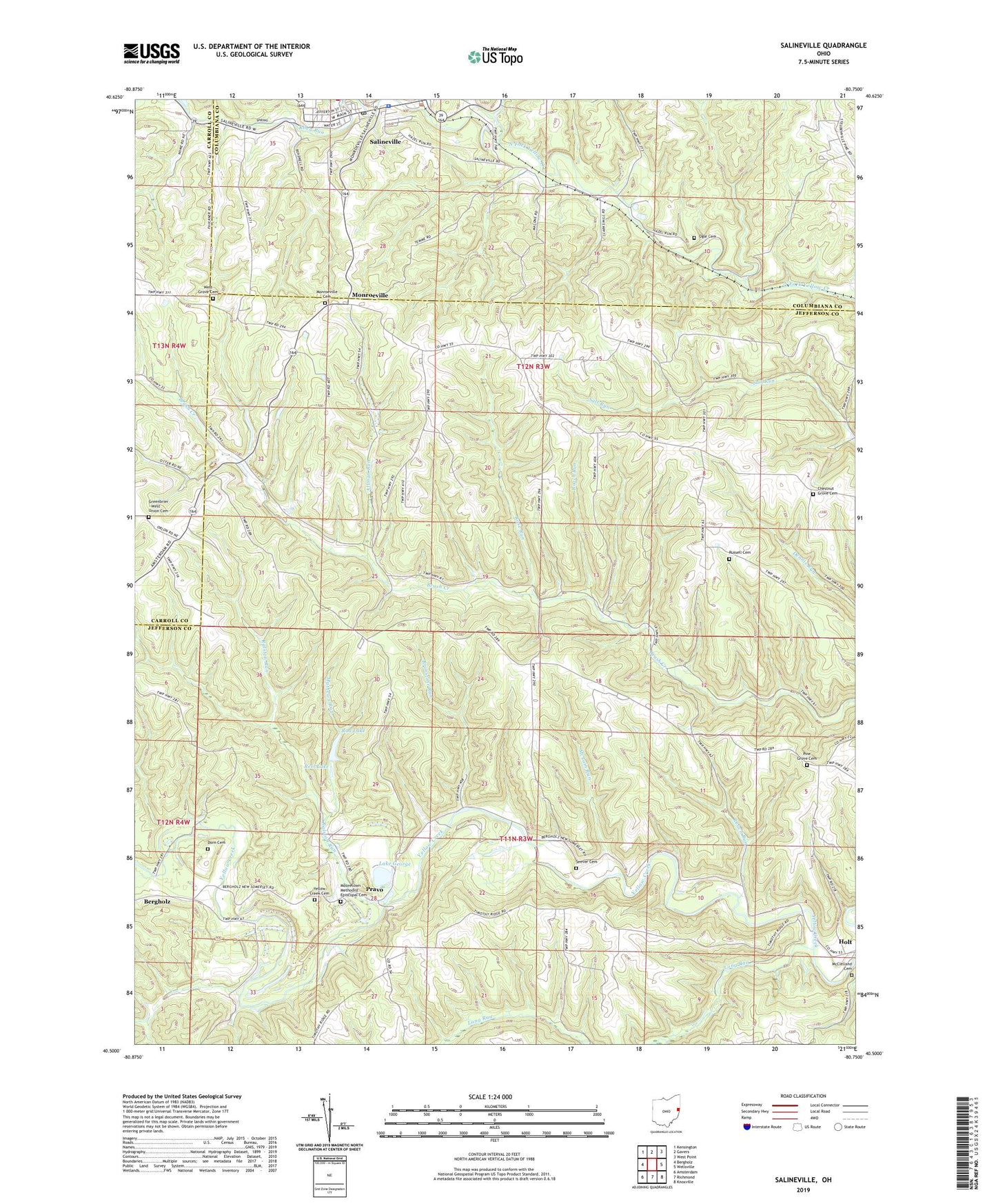
Salineville Ohio US Topo Map
Couldn't load pickup availability
2023 topographic map quadrangle Salineville in the state of Ohio. Scale: 1:24000. Based on the newly updated USGS 7.5' US Topo map series, this map is in the following counties: Jefferson, Columbiana, Carroll. The map contains contour data, water features, and other items you are used to seeing on USGS maps, but also has updated roads and other features. This is the next generation of topographic maps. Printed on high-quality waterproof paper with UV fade-resistant inks.
Quads adjacent to this one:
West: Bergholz
Northwest: Kensington
North: Gavers
Northeast: West Point
East: Wellsville
Southeast: Knoxville
South: Richmond
Southwest: Amsterdam
This map covers the same area as the classic USGS quad with code o40080e7.
Contains the following named places: Allman Run, Brimstone Run, Brush Creek Wildlife Area, Chestnut Grove Cemetery, Chestnut Grove Church, Diamond Valley, Dorn Cemetery, Dry Run, East Salineville, Granny Bour, Grants Hill Church, Greenbrier - West Union Cemetery, Haysville, Holt, Holt Post Office, Lake George, Long Run, Mathews Run, McClelland Cemetery, McLain Run, Monroeville, Monroeville Cemetery, Mooretown Methodist Episcopal Cemetery, Nancy Run, Ogle Cemetery, Pine Grove Cemetery, Pine Grove Methodist Church, Pine Hill, Pinehill Post Office, Pravo, Pravo Post Office, Ralston Run, Reel Lake, Riley Run, Roach Run, Rod Lake, Rod Lake Dam, Rose Run, Russell Cemetery, Saint Patricks Church, Salineville, Salineville Police Department, Salineville Post Office, Salineville United Methodist Church, Seever Cemetery, Southern Middle School, Township of Brush Creek, Township of Ross, Village of Salineville, West Grove Cemetery, West Union Church, Yellow Creek Cemetery, ZIP Codes: 43908, 43930, 43932