MyTopo
Lagrange Ohio US Topo Map
Couldn't load pickup availability
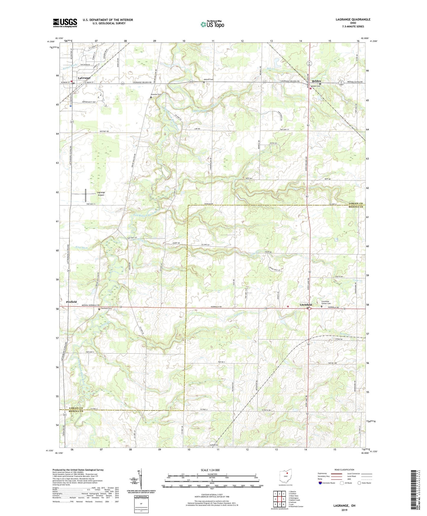
2019 topographic map quadrangle Lagrange in the state of Ohio. Scale: 1:24000. Based on the newly updated USGS 7.5' US Topo map series, this map is in the following counties: Lorain, Medina. The map contains contour data, water features, and other items you are used to seeing on USGS maps, but also has updated roads and other features. This is the next generation of topographic maps. Printed on high-quality waterproof paper with UV fade-resistant inks.
Quads adjacent to this one:
West: Wellington
Northwest: Oberlin
North: Grafton
Northeast: West View
East: Mallet Creek
Southeast: Westfield Center
South: Lodi
Southwest: Sullivan
Contains the following named places: Aldrich Cemetery, Belden, Belden Cemetery, Belden Post Office, Blue Barn Farms, Center Creek, Conrad Farms, Crow Creek, Eppley Pond, Eppley Pond Dam, Grafton Township Fire Department, Grafton Township Hall, Harris Corn Field Airport, Keystone High School, Keystone Middle School, Knowles Cemetery, Kruggel Airport, Kruggel Farms, Lagrange, Lagrange Airport, Lagrange Fire and Rescue, Lagrange Police Department, LaGrange Post Office, Lagrange Township Hall, Litchfield, Litchfield Center Cemetery, Litchfield Elementary School, Litchfield Fire Department, Litchfield Post Office, Penfield, Penfield Cemetery, Penfield Community Church, Penfield Community Park, Penfield Elementary School, Penfield Post Office, Penfield Township Hall, Preston Oil Field, Risley, Salt Creek, Township of Grafton, Township of Lagrange, Township of Litchfield, Township of Penfield, Village of LaGrange, ZIP Code: 44253