MyTopo
Mallet Creek Ohio US Topo Map
Couldn't load pickup availability
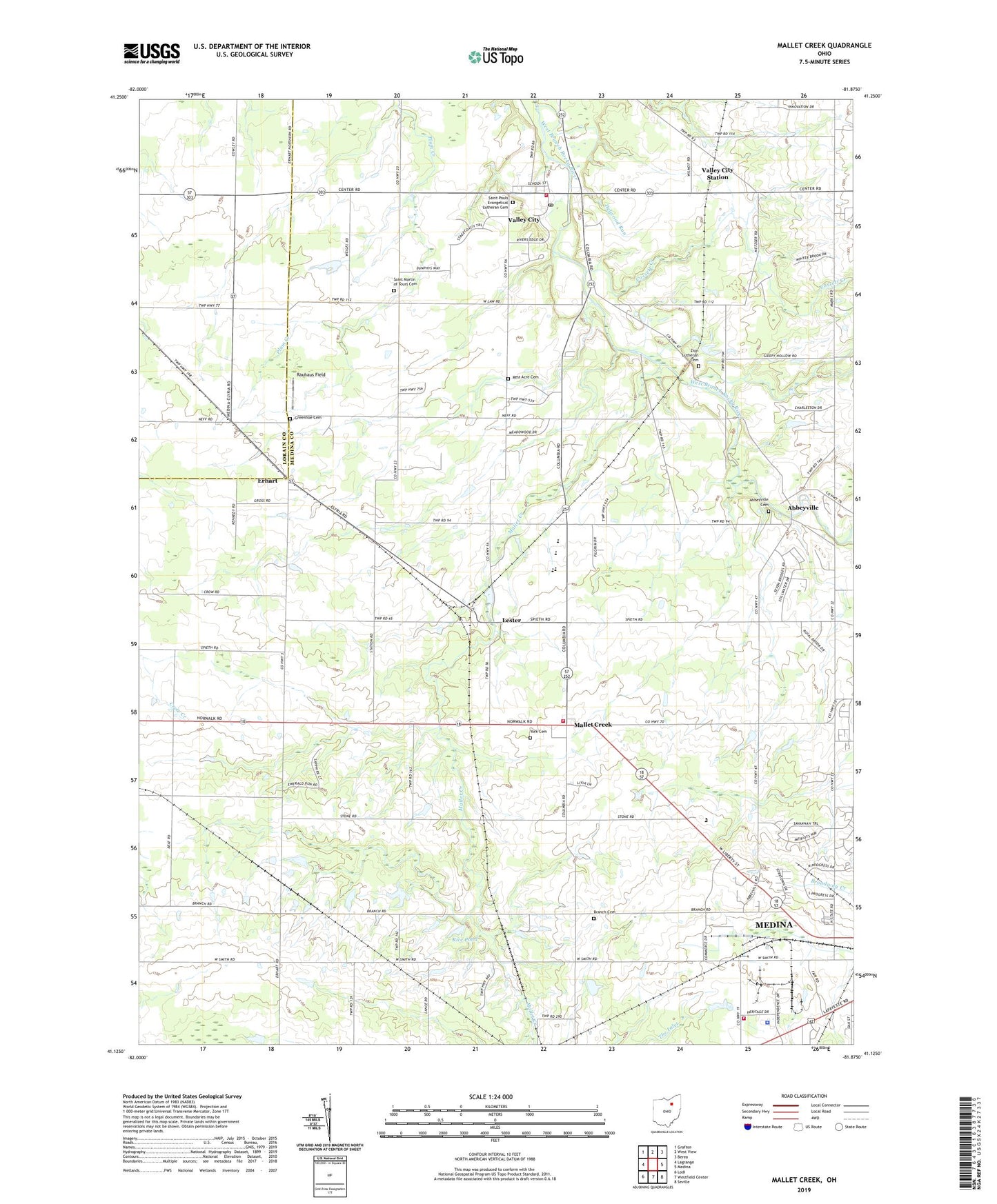
2023 topographic map quadrangle Mallet Creek in the state of Ohio. Scale: 1:24000. Based on the newly updated USGS 7.5' US Topo map series, this map is in the following counties: Medina, Lorain. The map contains contour data, water features, and other items you are used to seeing on USGS maps, but also has updated roads and other features. This is the next generation of topographic maps. Printed on high-quality waterproof paper with UV fade-resistant inks.
Quads adjacent to this one:
West: Lagrange
Northwest: Grafton
North: West View
Northeast: Berea
East: Medina
Southeast: Seville
South: Westfield Center
Southwest: Lodi
This map covers the same area as the classic USGS quad with code o41081b8.
Contains the following named places: Abbeyville, Abbeyville Cemetery, Abbeyville Post Office, Anderson Landscaping and Tree Farm, Boy Scout Camp, Branch Cemetery, Buckeye Elementary School, Buckeye High School, Chamberlain, Cossett Creek, Davis Tree Farm and Nursery, Delwood Run, Erhart, Erhart Post Office, Erhart Volunteer Fire and Rescue, Franks Corner, Graham's Landing Airport, Greenhoe Cemetery, Hill Haven Farm and Greenhouse, Lester, Lester Post Office, Liverpool Elementary School, Mallet Creek, Mallett Creek Post Office, Medina County Fairgrounds, Medina County Jail, Medina County Sheriff's Office, Medina Fire Department - Station 2, Pliny, Pliny Post Office, Rauhaus Field, Rest Acre Cemetery, Rice Pond, Rice Pond Dam, Saint Martin of Tours Cemetery, Saint Martin of Tours Church, Saint Pauls Church, Saint Pauls Evangelical Lutheran Cemetery, Township of Liverpool, Township of York, Trinity Horse Farm, Valley City, Valley City Census Designated Place, Valley City Fire Department, Valley City Post Office, Valley City Station, York Cemetery, York Elementary School, York United Methodist Church, Zion Lutheran Cemetery, Zion Lutheran Church, ZIP Code: 44280