MyTopo
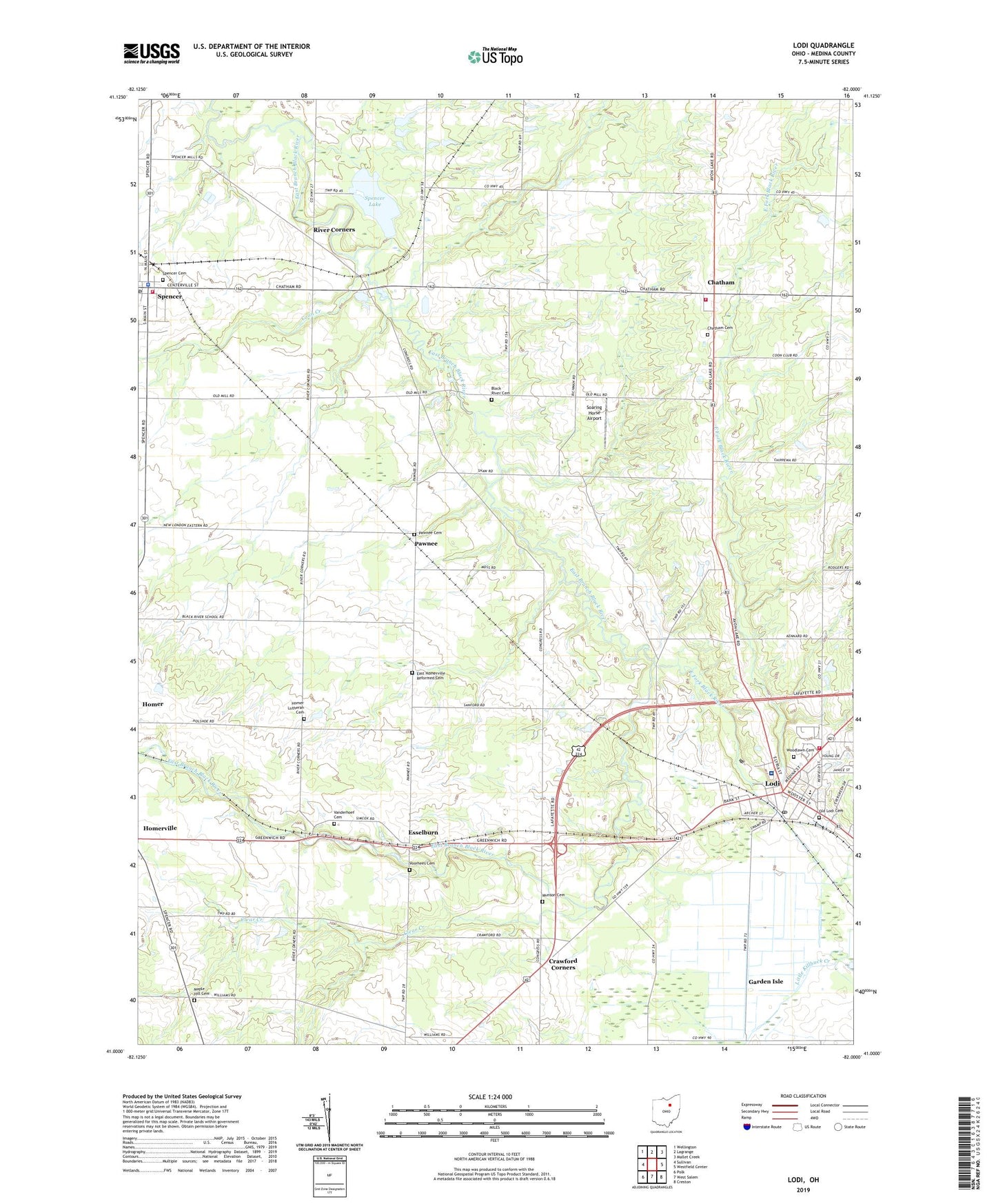
Lodi Ohio US Topo Map
Couldn't load pickup availability
2019 topographic map quadrangle Lodi in the state of Ohio. Scale: 1:24000. Based on the newly updated USGS 7.5' US Topo map series, this map is in the following counties: Medina. The map contains contour data, water features, and other items you are used to seeing on USGS maps, but also has updated roads and other features. This is the next generation of topographic maps. Printed on high-quality waterproof paper with UV fade-resistant inks.
Quads adjacent to this one:
West: Sullivan
Northwest: Wellington
North: Lagrange
Northeast: Mallet Creek
East: Westfield Center
Southeast: Creston
South: West Salem
Southwest: Polk
Contains the following named places: A J Vegatable Farm, Aungst Hog Farm, Bayridge Farm, Black River Cemetery, Black River Church of the Brethren, Chatham, Chatham Cemetery, Chatham Elementary School, Chatham Post Office, Chatham Township Fire Department, Clear Creek, Coon Creek, Crawford Corners, East Fork Black River, East Homerville Church, East Homerville Reformed Cemetery, Edsel W Campbell Mobile Home Park, Esselburn, Evergreen Estates, First Congregational Church, Four Square Church, Garden Isle, Geisingers Corners, Harrisville Swamp, Hidden Hollow County Park, Homer Lutheran Cemetery, Knollbrook Golf Course, Leatha House County Park, Lodi, Lodi Branch Medina County District Library, Lodi Community Hospital, Lodi Community Hospital Heliport, Lodi Elementary School, Lodi Fire Department, Lodi Post Office, Lodi United Methodist Church, Maple Hill Cemetery, Munson Cemetery, Old Lodi Cemetery, Pawnee, Pawnee Cemetery, Pawnee Post Office, Pine Villas, Richman Farms, River Corners, Scenic Ridge Farm, Sherwood Forrest Camp Grounds Pond, Sherwood Forrest Camp Grounds Pond Dam, Soaring Horse Airport, Spencer, Spencer Cemetery, Spencer Community Fire District, Spencer Lake, Spencer Lake Dam, Spencer Lake State Wildlife Area, Spencer Police Department, Spencer Post Office, Sunset Mobile Home Park, Township of Chatham, Township of Harrisville, Township of Spencer, Turning Point Farm, Vanderhoef Cemetery, Village of Lodi, Village of Spencer, Voorhees Cemetery, West Fork East Branch Black River, Wilderness Ridge Farm, Woodlawn Cemetery, Zion Church, ZIP Codes: 44235, 44254, 44275