MyTopo
Malinta Ohio US Topo Map
Couldn't load pickup availability
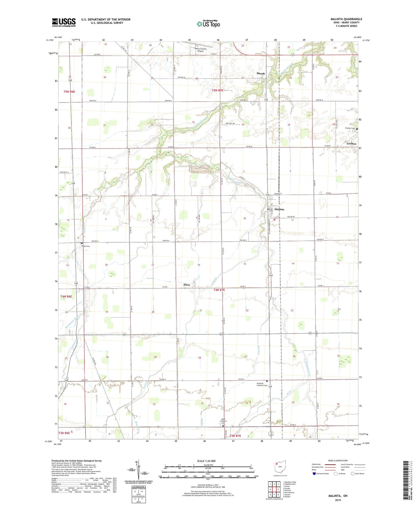
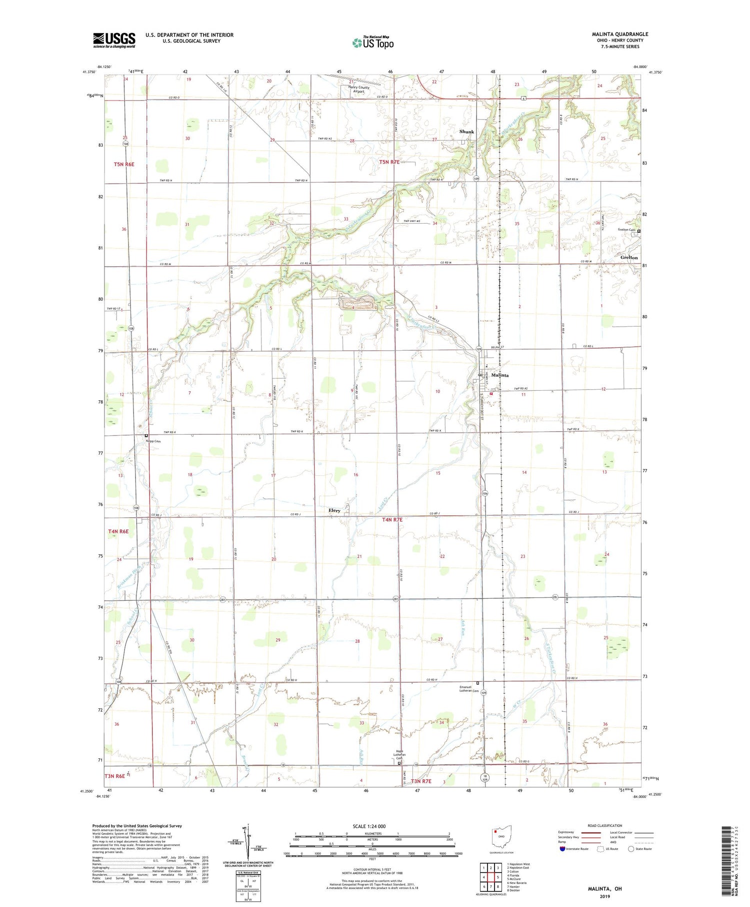
2019 topographic map quadrangle Malinta in the state of Ohio. Scale: 1:24000. Based on the newly updated USGS 7.5' US Topo map series, this map is in the following counties: Henry. The map contains contour data, water features, and other items you are used to seeing on USGS maps, but also has updated roads and other features. This is the next generation of topographic maps. Printed on high-quality waterproof paper with UV fade-resistant inks.
Quads adjacent to this one:
West: Florida
Northwest: Napoleon West
North: Napoleon East
Northeast: Colton
East: McClure
Southeast: Deshler
South: Hamler
Southwest: New Bavaria
Contains the following named places: Arps School, Ash Run, Bickford School, Brush College, Brush Creek, Deigle School, Dunbar School, Elery, Elery Post Office, Elery School, Emanuel Lutheran Cemetery, Grelton Cemetery, Grelton Methodist Church, Henry County, Henry County Airport, Henry County South Joint Ambulance District Malinta Emergency Medical Services, Hope Lutheran Cemetery, Hope Lutheran Church, Huber School, Immanuel Church, Knipp Cemetery, Kratz School, Lost Creek, Malinta, Malinta - Monroe Township Fire Department, Malinta Post Office, Malinta-Grelton Elementary School, Saint John Church, Saint Paul Church, School Creek, Shunk, Shunk Post Office, Struble School, Township of Harrison, Township of Monroe, Village of Malinta, West Creek, ZIP Code: 43535