MyTopo
Morgantown Ohio US Topo Map
Couldn't load pickup availability
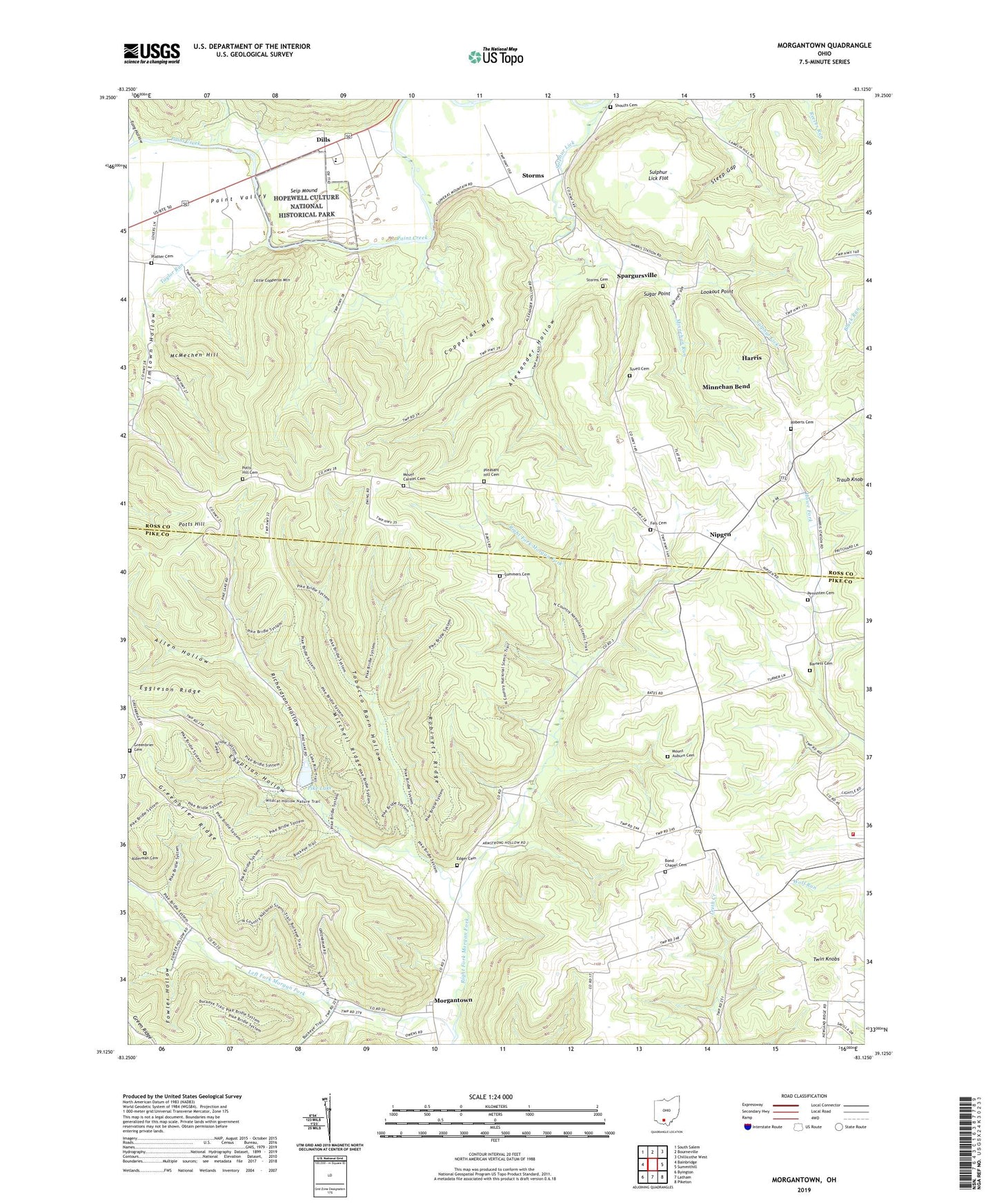
2019 topographic map quadrangle Morgantown in the state of Ohio. Scale: 1:24000. Based on the newly updated USGS 7.5' US Topo map series, this map is in the following counties: Ross, Pike. The map contains contour data, water features, and other items you are used to seeing on USGS maps, but also has updated roads and other features. This is the next generation of topographic maps. Printed on high-quality waterproof paper with UV fade-resistant inks.
Quads adjacent to this one:
West: Bainbridge
Northwest: South Salem
North: Bourneville
Northeast: Chillicothe West
East: Summithill
Southeast: Piketon
South: Latham
Southwest: Byington
Contains the following named places: Alderman Cemetery, Alexander Hollow, Allen Hollow, Barnett Cemetery, Barnett School, Bond Chapel, Bond Chapel Cemetery, Buchanan School, Christian Union Church Lake, Christian Union Church Lake Dam, Coder School, Copperas Mountain, Dills, Edger Cemetery, Eggleson Ridge, Egyptian Hollow, Fels Cemetery, Fowler Hollow, Garlands Ford, Greenbrier Cemetery, Greenbrier School, Harris, Jimtown Hollow, Left Fork Morgan Fork, Little Copperas Mountain, Lookout Point, McMechen Hill, Minnehan Bend, Minnehan Run, Mitchell Ridge, Morgan Fork Chapel, Morgantown, Morgantown Post Office, Mount Auburn Cemetery, Mount Carmel Cemetery, Mount Holy Church, Mount Victory School, Nipgen, Nipgen Post Office, Paint Valley High School, Pebble Township Volunteer Fire Department, Pennisten Cemetery, Pike Lake, Pike Lake Dam, Platter Cemetery, Pleasant Grove, Pleasant Hill Cemetery, Ponslar School, Potts Hill, Potts Hill Cemetery, Potts Hill School, Ralston School, Red School, Richardson Hollow, Right Fork Morgan Fork, Roberts Cemetery, Robinett Ridge, Ross-Pike County Tabernacle, Seip Mound, Seip Mound State Memorial, Shoults Cemetery, Spargursville, Spargursville Post Office, Steep Gap, Storms, Storms Cemetery, Storms Church, Storms Post Office, Sugar Point, Sulphur Lick Flat, Sulphur Lick School, Summers Cemetery, Taylor Run, Tobacco Barn Hollow, Tong Hollow, Township of Benton, Tuvell Cemetery, Twin Knobs, Wiper Memorial Church