MyTopo
Port William Ohio US Topo Map
Couldn't load pickup availability
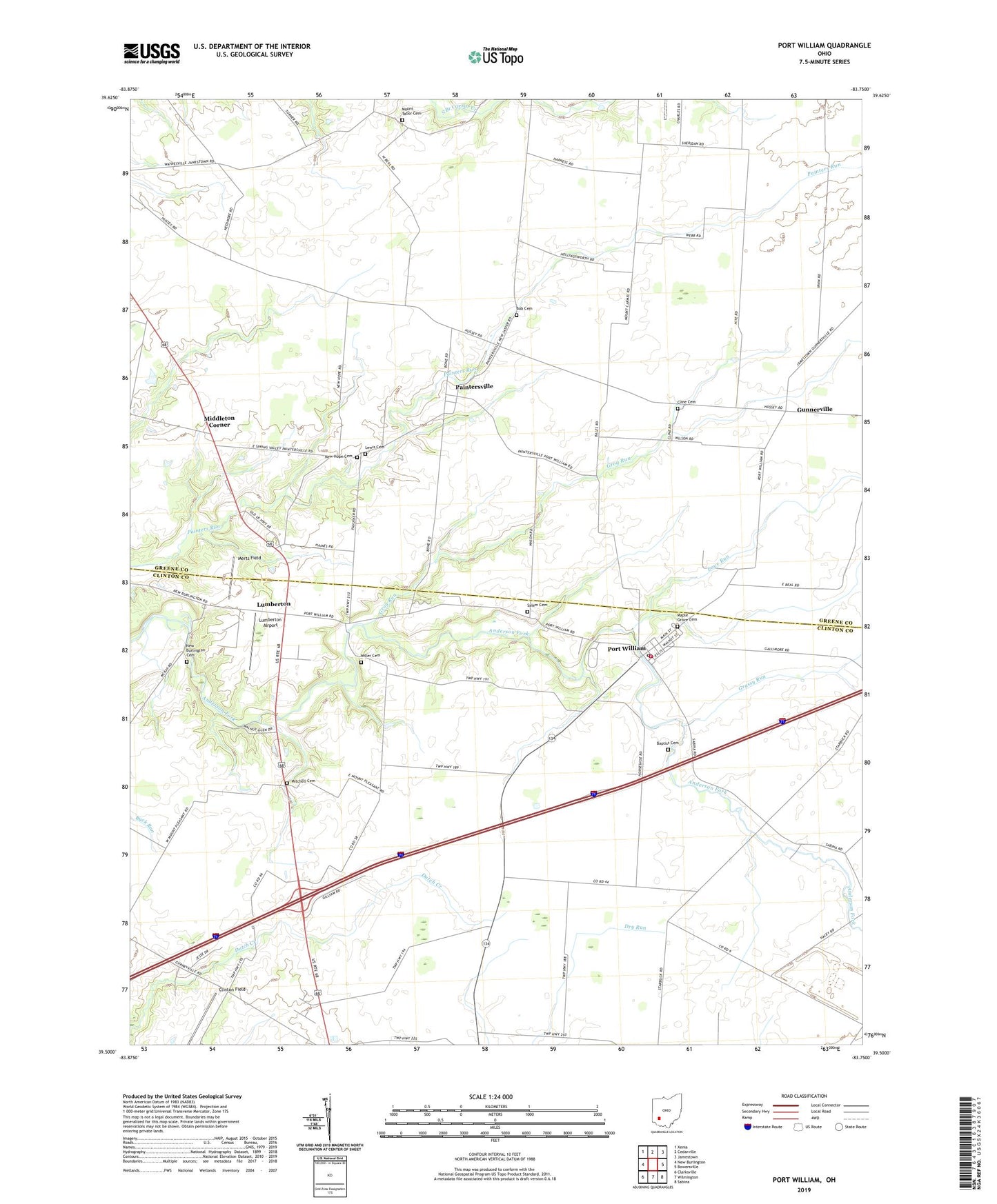
2019 topographic map quadrangle Port William in the state of Ohio. Scale: 1:24000. Based on the newly updated USGS 7.5' US Topo map series, this map is in the following counties: Greene, Clinton. The map contains contour data, water features, and other items you are used to seeing on USGS maps, but also has updated roads and other features. This is the next generation of topographic maps. Printed on high-quality waterproof paper with UV fade-resistant inks.
Quads adjacent to this one:
West: New Burlington
Northwest: Xenia
North: Cedarville
Northeast: Jamestown
East: Bowersville
Southeast: Sabina
South: Wilmington
Southwest: Clarksville
Contains the following named places: Antram School, Bab Cemetery, Baptist Cemetery, Caesar Creek High School, Cline Cemetery, Clinton Field, Eleazar School, Ervin School, Grassy Run, Grog Run, Guest Brothers Farm, Gunnerville, Lewis Cemetery, Liberty Township Heliport, Love Run, Lumberton, Lumberton Airport, Lumberton Post Office, Lumberton United Methodist Church, Maple Grove Cemetery, Merts Field, Middleton Corner, Miller Cemetery, Mitchell Cemetery, Morrisville Post Office, Mount Carmel School, Mount Pleasant, Mount Pleasant School, Mount Tabor Cemetery, Mount Tabor Church, Mount Tabor School, Needmore School, New Burlington Cemetery, New Hope Cemetery, Newhope School, Ogles, Paintersville, Paintersville Post Office, Pleasant View School, Port William, Port William Fire Department, Port William Post Office, Port William United Methodist Church, Salem - Devoe Cemetery, Township of Caesarscreek, Township of Liberty, Village of Port William, ZIP Code: 45164