MyTopo
Ringgold Ohio US Topo Map
Couldn't load pickup availability
Also explore the Ringgold Forest Service Topo of this same quad for updated USFS data
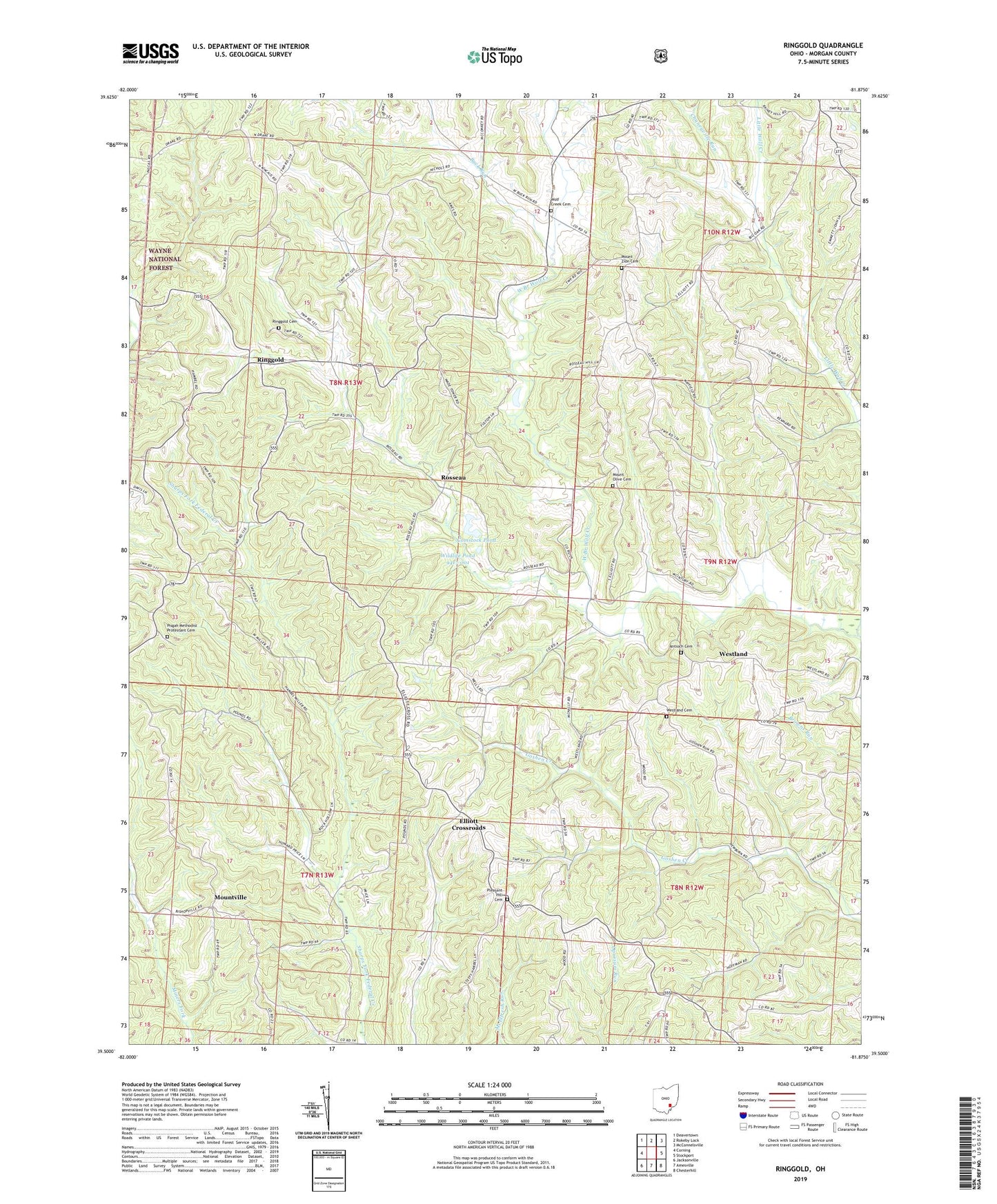
2023 topographic map quadrangle Ringgold in the state of Ohio. Scale: 1:24000. Based on the newly updated USGS 7.5' US Topo map series, this map is in the following counties: Morgan. The map contains contour data, water features, and other items you are used to seeing on USGS maps, but also has updated roads and other features. This is the next generation of topographic maps. Printed on high-quality waterproof paper with UV fade-resistant inks.
Quads adjacent to this one:
West: Corning
Northwest: Deavertown
North: Rokeby Lock
Northeast: McConnelsville
East: Stockport
Southeast: Chesterhill
South: Amesville
Southwest: Jacksonville
This map covers the same area as the classic USGS quad with code o39081e8.
Contains the following named places: Antioch Cemetery, Antioch Church, Armstrong School, Buck Run, Chaneyville, Chaneyville Run, Cheneyville Post Office, Comstock Pond, Comstock Pond Dam, Elliott Crossroads, Elliott Post Office, Fairview Park, Goshen School, Hickory Ridge School, Hopkins School, Little Wolf Creek, Maple Grove School, Moody, Mount Olive Cemetery, Mount Olive Church, Mount Zion Cemetery, Mountville, Mountville Post Office, Pisgah Methodist Protestant Cemetery, Pisgah United Methodist Church, Pleasant Hill Cemetery, Pleasant Hill Church, Pleasant Hill School, Ringgold, Ringgold Cemetery, Ringgold Free Methodist Church, Ringgold School, Rock Hollow School, Rosseau, Rosseau Post Office, Shilling, Shilling Post Office, Township of Homer, Township of Union, Union-Homer Elementary School, West Liberty School, Westland, Westland Cemetery, Westland Post Office, White Pigeon School, Whitewash School, Wildlife Pond 9417-001, Wildlife Pond Dam 9417-001, Wolf Creek Cemetery, Wolf Creek Church of Christ, Wolf Creek Wildlife Area