MyTopo
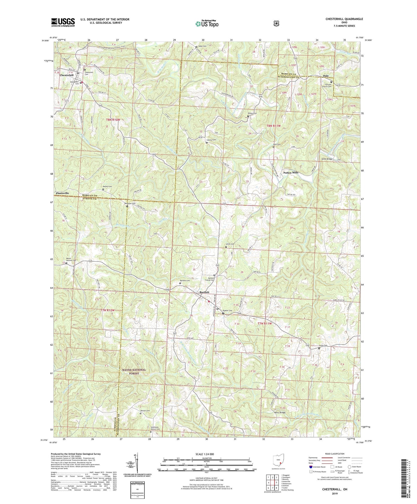
Chesterhill Ohio US Topo Map
Couldn't load pickup availability
Also explore the Chesterhill Forest Service Topo of this same quad for updated USFS data
2023 topographic map quadrangle Chesterhill in the state of Ohio. Scale: 1:24000. Based on the newly updated USGS 7.5' US Topo map series, this map is in the following counties: Washington, Morgan, Athens. The map contains contour data, water features, and other items you are used to seeing on USGS maps, but also has updated roads and other features. This is the next generation of topographic maps. Printed on high-quality waterproof paper with UV fade-resistant inks.
Quads adjacent to this one:
West: Amesville
Northwest: Ringgold
North: Stockport
Northeast: Beverly
East: Watertown
Southeast: Little Hocking
South: Cutler
Southwest: Stewart
This map covers the same area as the classic USGS quad with code o39081d7.
Contains the following named places: Aldridge Run, Bartlett, Bartlett Cemetery, Bartlett Elementary School, Bartlett Friends Cemetery, Bartlett Post Office, Bethel Cemetery, Bethel Methodist Church, Bethel Ridge Apostolic Tabernacle, Brill Run, Buckeye Run, Burt Cemetery, Chesterhill, Chesterhill Cemetery, Chesterhill Church of the Nazarene, Chesterhill Post Office, Chesterhill United Methodist Church, Chesterhill Volunteer Fire Department, Coal Run, Cody Cemetery, Dale, Downtown Chesterhill Historic District, Epworth Church, Fairview Church, Fairview Church Cemetery, Henry Bridge, Laurel Run, Liberty Cemetery, Liberty Church, Marion Elementary School, Mile Run, Mission Cemetery, Mount Herman Cemetery, Mount Hermon Church, North Branch Coal Run, Old Quaker Cemetery, Patten Mills, Quaker Cemetery, Shinn Bridge, Shrader Run, Smith Cemetery, Southland Mission, Southland Mission Cemetery, Tabor Cemetery, Tabor Church of Christ, Township of Wesley, Union Cemetery, Village of Chesterhill, Walnut Run, Wesley Township Fire Department, Wesleyan Cemetery, Wesleyan Church, Wilson Cemetery, ZIP Code: 45724