MyTopo
Stockdale Ohio US Topo Map
Couldn't load pickup availability
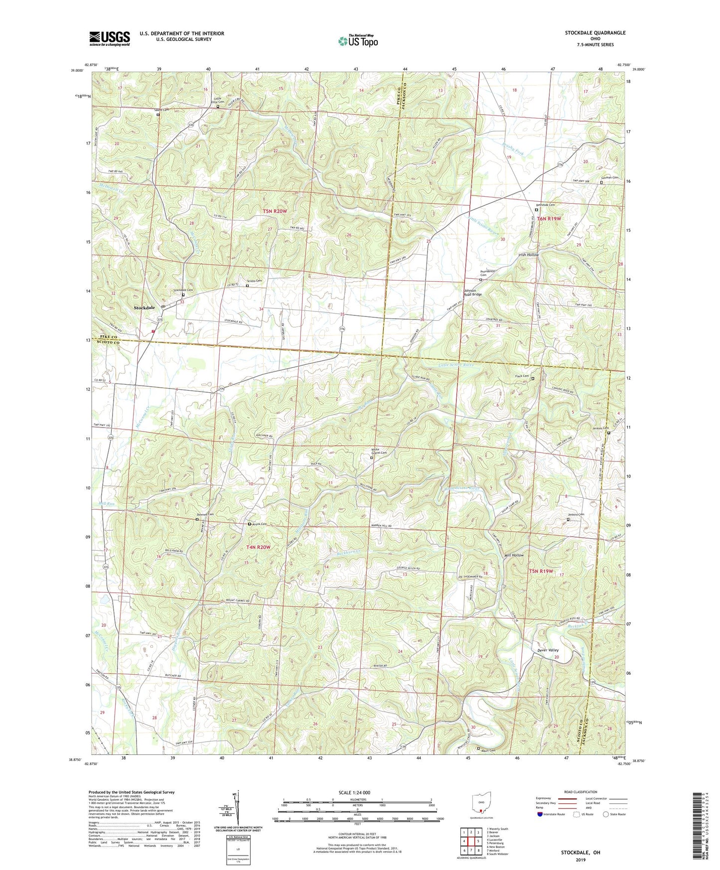
2023 topographic map quadrangle Stockdale in the state of Ohio. Scale: 1:24000. Based on the newly updated USGS 7.5' US Topo map series, this map is in the following counties: Scioto, Pike, Jackson. The map contains contour data, water features, and other items you are used to seeing on USGS maps, but also has updated roads and other features. This is the next generation of topographic maps. Printed on high-quality waterproof paper with UV fade-resistant inks.
Quads adjacent to this one:
West: Lucasville
Northwest: Waverly South
North: Beaver
Northeast: Jackson
East: Petersburg
Southeast: South Webster
South: Minford
Southwest: New Boston
This map covers the same area as the classic USGS quad with code o38082h7.
Contains the following named places: Bethesda Cemetery, Bethesda Chapel Freewill Baptist Church, Brown Farm, Brushy Fork, Buckhorn Creek, Bucklick Creek, Cordle Dairy, Dever Valley, Dewey School, Downey Cemetery, Dry Run, Flack Cemetery, German Cemetery, Glade Run, Glade School, Hamilton Church, Holland Fork, Irish Hollow, Jenkins Cemetery, Johnson Road Bridge, Kronk Cemetery, Little Ettie Baptist Church, Little Ettie Cemetery, Madison Missionary Church, Madison School, Massie, Massie Post Office, Mault Cemetery, McConnel Creek, McDowell Creek, Mill Hollow, Millstone Run, Mount Carmel Church, Mount Carmel School, Perry Addition, Pools Corners, Providence Cemetery, Providence Church, Salem Cemetery, Salem Church, Salem School, Scioto Cemetery, Stockdale, Stockdale Cemetery, Stockdale Census Designated Place, Stockdale Church, Stockdale Elementary School, Stockdale Post Office, Stockdale Volunteer Fire Department, Sugarcamp Creek, Township of Madison, Township of Marion, White Gravel Cemetery, White Gravel Church, White Gravel School, ZIP Code: 45653