MyTopo
Weston Ohio US Topo Map
Couldn't load pickup availability
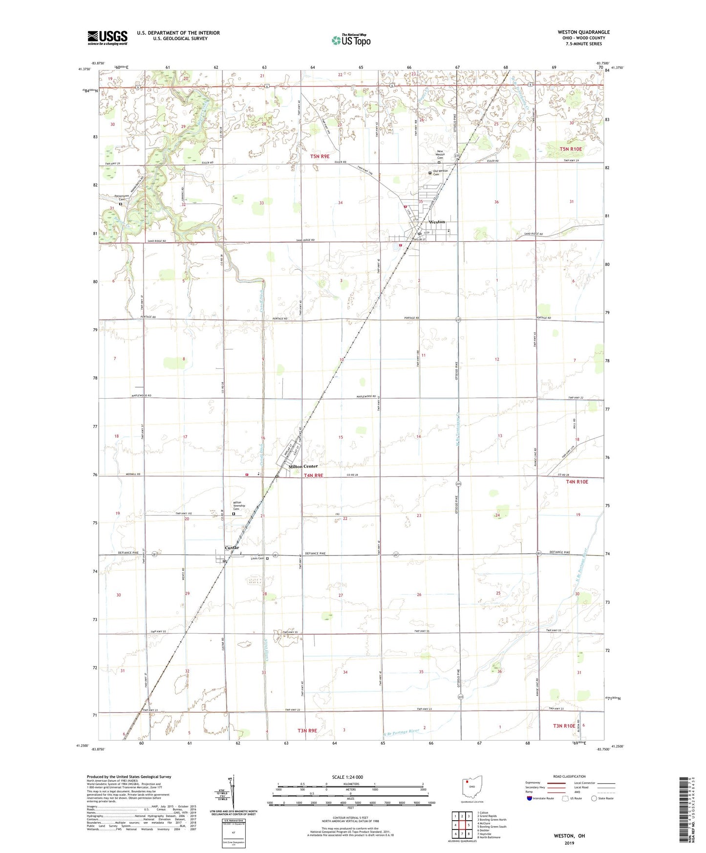
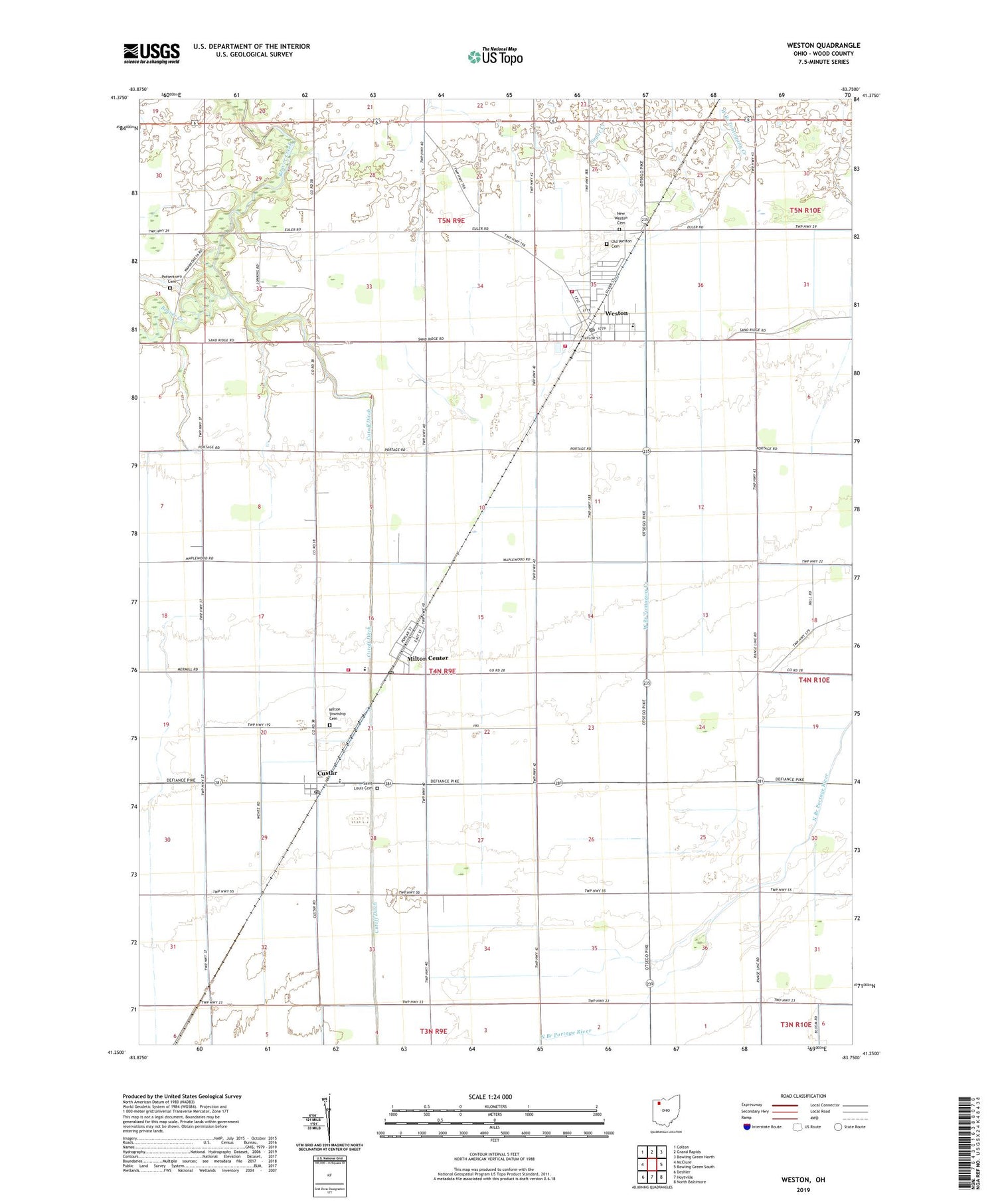
2019 topographic map quadrangle Weston in the state of Ohio. Scale: 1:24000. Based on the newly updated USGS 7.5' US Topo map series, this map is in the following counties: Wood. The map contains contour data, water features, and other items you are used to seeing on USGS maps, but also has updated roads and other features. This is the next generation of topographic maps. Printed on high-quality waterproof paper with UV fade-resistant inks.
Quads adjacent to this one:
West: McClure
Northwest: Colton
North: Grand Rapids
Northeast: Bowling Green North
East: Bowling Green South
Southeast: North Baltimore
South: Hoytville
Southwest: Deshler
Contains the following named places: Antioch Church, Baldwin Woods Preserve, Custar, Custar Post Office, Cutoff Ditch, Grace Evangelical Lutheran Church, Haney, Lawndale Mobile Home Plaza, Manders Dairy, Milton Center, Milton Center Post Office, Milton Elementary School, Milton Township Cemetery, Milton Township Fire District, New Weston Cemetery, Old Weston Cemetery, Pottertown Cemetery, Saint Louis Cemetery, Saint Louis Elementary School, Sonlight Christian Assembly of God Church, Township of Milton, Township of Weston, Village of Custar, Village of Milton Center, Village of Weston, Weston, Weston Church of Christ, Weston Elementary School, Weston Emergency Medical Services, Weston Fire Department, Weston Post Office, Weston Public Library, Weston Sewage Treatment Plant, Weston Trailer Court, Weston United Methodist Church, Weston Water Treatment Plant, ZIP Codes: 43511, 43541, 43569