MyTopo
Wright City Oklahoma US Topo Map
Couldn't load pickup availability
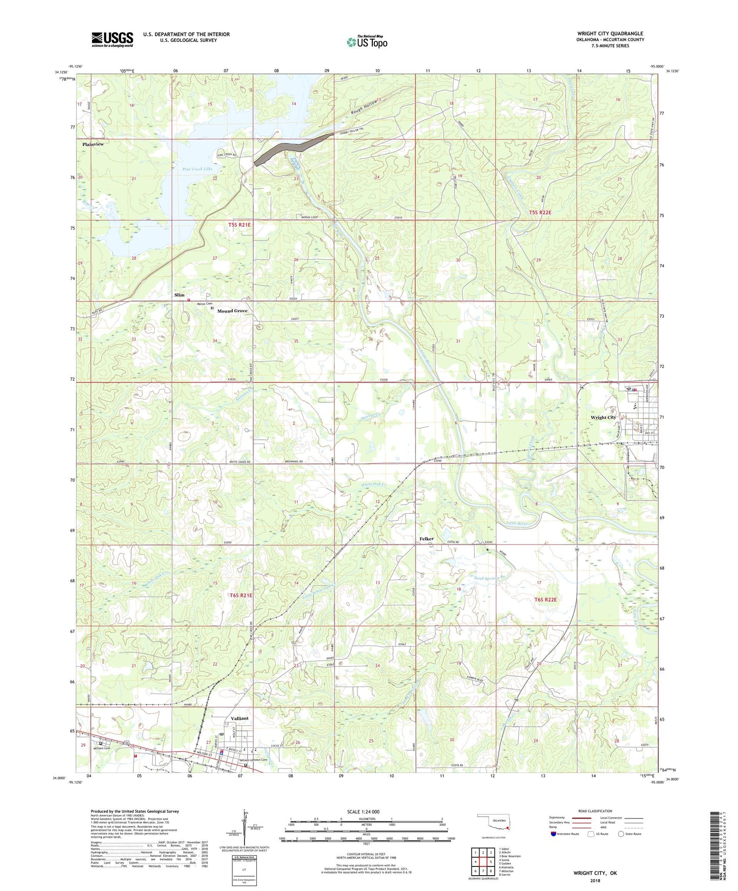
2022 topographic map quadrangle Wright City in the state of Oklahoma. Scale: 1:24000. Based on the newly updated USGS 7.5' US Topo map series, this map is in the following counties: McCurtain. The map contains contour data, water features, and other items you are used to seeing on USGS maps, but also has updated roads and other features. This is the next generation of topographic maps. Printed on high-quality waterproof paper with UV fade-resistant inks.
Quads adjacent to this one:
West: Swink
Northwest: Sobol
North: Alikchi
Northeast: Bear Mountain
East: Golden
Southeast: Garvin
South: Millerton
Southwest: Kiomatia
This map covers the same area as the classic USGS quad with code o34095a1.
Contains the following named places: Cypress Creek, Doaksville, Felker, First Assembly of God Church, First Baptist Church, J. Leland Burkett Ministries Church, Little White Oak Creek, Moran Cemetery, Mound Grove, Pine Creek, Pine Creek Dam, Pine Creek Lake, Pine Creek Volunteer Fire Department, Plainview, Rock Creek, Rough Hollow, Sand Springs Branch, Slim, Stevens Creek, Town of Valliant, Town of Wright City, United Methodist Church, Valliant, Valliant Cemetery, Valliant Church of God, Valliant Division, Valliant Elementary School, Valliant Fire Department, Valliant High School, Valliant Middle School, Valliant Police Department, Valliant Post Office, Valliant Uptown Cemetery, Weyerhauser Paper Company Fire Department, White Oak Creek, White Sands Church, Wright City, Wright City Elementary School, Wright City High School, Wright City Junior High School, Wright City Police Department, Wright City Post Office, Wright City Volunteer Fire Department, ZIP Code: 74764