MyTopo
Swink Oklahoma US Topo Map
Couldn't load pickup availability
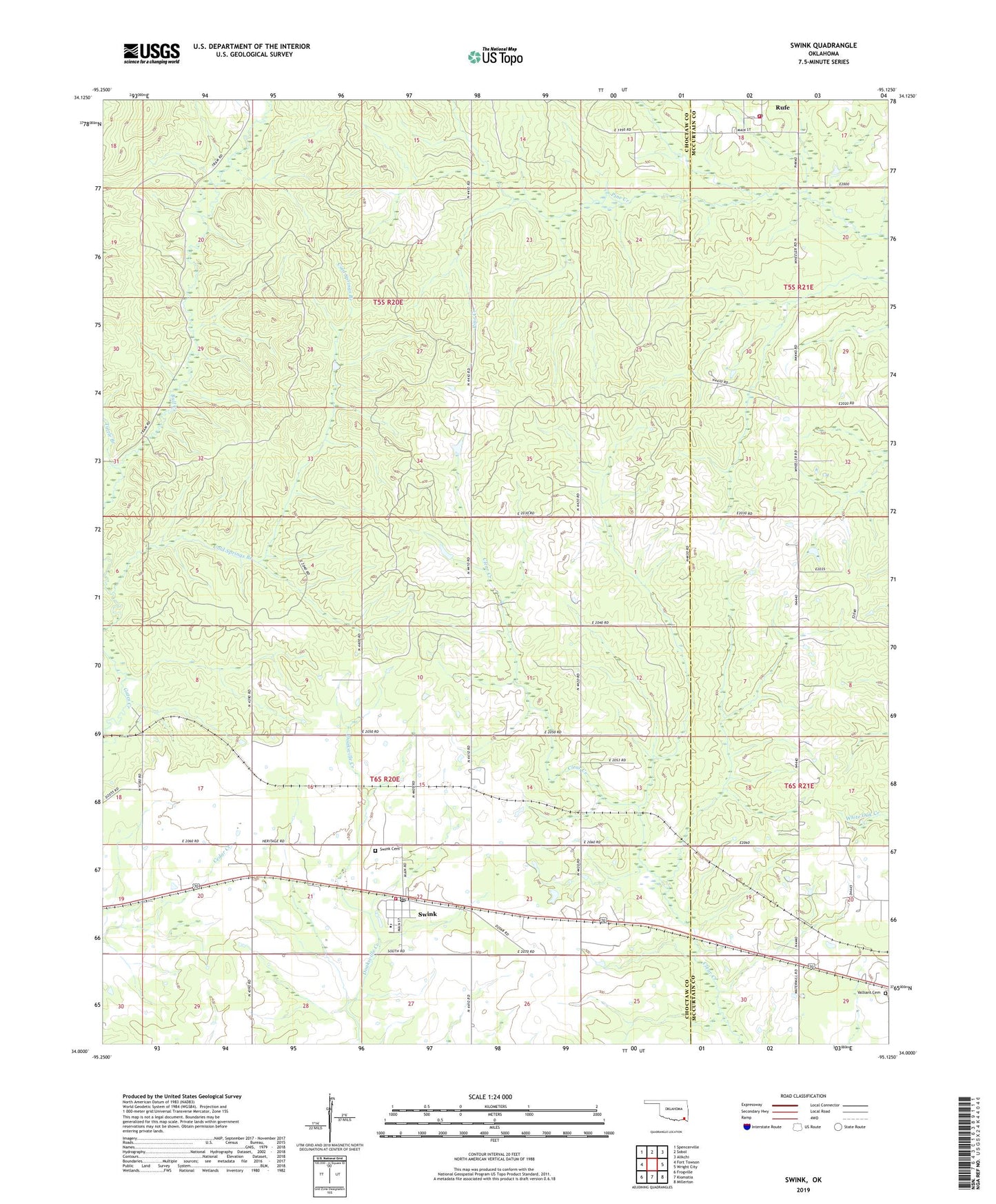
2022 topographic map quadrangle Swink in the state of Oklahoma. Scale: 1:24000. Based on the newly updated USGS 7.5' US Topo map series, this map is in the following counties: Choctaw, McCurtain. The map contains contour data, water features, and other items you are used to seeing on USGS maps, but also has updated roads and other features. This is the next generation of topographic maps. Printed on high-quality waterproof paper with UV fade-resistant inks.
Quads adjacent to this one:
West: Fort Towson
Northwest: Spencerville
North: Sobol
Northeast: Alikchi
East: Wright City
Southeast: Millerton
South: Kiomatia
Southwest: Frogville
This map covers the same area as the classic USGS quad with code o34095a2.
Contains the following named places: Cold Springs Branch, Elliott School, Rufe, Rufe Post Office, Rufe Volunteer Fire Department, Swink, Swink Cemetery, Swink Census Designated Place, Swink Elementary School, Swink Post Office, Swink Volunteer Fire Department, Town of Swink, Tuttle Branch, Valliant Cemetery, ZIP Codes: 74735, 74761