MyTopo
Martha Oklahoma US Topo Map
Couldn't load pickup availability
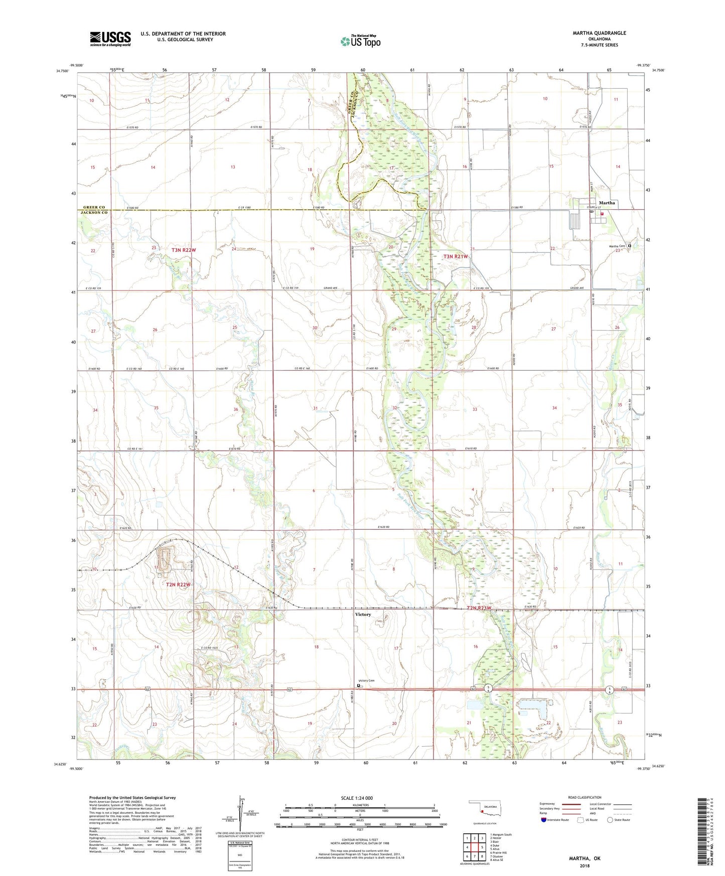
2022 topographic map quadrangle Martha in the state of Oklahoma. Scale: 1:24000. Based on the newly updated USGS 7.5' US Topo map series, this map is in the following counties: Jackson, Greer. The map contains contour data, water features, and other items you are used to seeing on USGS maps, but also has updated roads and other features. This is the next generation of topographic maps. Printed on high-quality waterproof paper with UV fade-resistant inks.
Quads adjacent to this one:
West: Duke
Northwest: Mangum South
North: Hester
Northeast: Blair
East: Altus
Southeast: Altus SE
South: Olustee
Southwest: Prairie Hill
This map covers the same area as the classic USGS quad with code o34099f4.
Contains the following named places: Horse Branch, Martha, Martha Cemetery, Martha Post Office, Martha Volunteer Fire Department, Mountain View Church, Town of Martha, Victory, Victory Cemetery, ZIP Code: 73556