MyTopo
Anadarko West Oklahoma US Topo Map
Couldn't load pickup availability
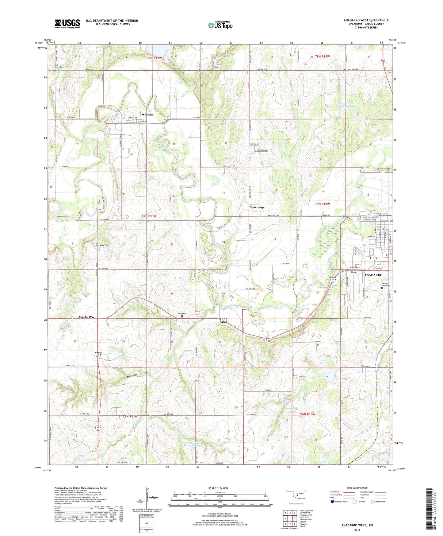
2018 topographic map quadrangle Anadarko West in the state of Oklahoma. Scale: 1:24000. Based on the newly updated USGS 7.5' US Topo map series, this map is in the following counties: Caddo. The map contains contour data, water features, and other items you are used to seeing on USGS maps, but also has updated roads and other features. This is the next generation of topographic maps. Printed on high-quality waterproof paper with UV fade-resistant inks.
Quads adjacent to this one:
West: Fort Cobb
Northwest: Fort Cobb Dam
North: Gracemont
Northeast: Anadarko NW
East: Anadarko East
Southeast: Cyril
South: Apache
Southwest: Boone
Contains the following named places: Anadarko High School, Anadarko Middle School, Anadarko Municipal Airport, Apache Wye, Cedar Canyon, Deep Creek, First Baptist Church, First United Methodist Church, Fort Cobb Laterals Site 10 Dam, Fort Cobb Laterals Site 10 Reservoir, Fort Cobb Laterals Site 11 Dam, Fort Cobb Laterals Site 11 Reservoir, Fort Cobb Laterals Site 12 Dam, Fort Cobb Laterals Site 13 Dam, Fort Cobb Laterals Site 13 Reservoir, Fort Cobb Laterals Site 9 Dam, Fort Cobb Laterals Site 9 Reservoir, Hog Creek, Holiness Camp, Kiowa-Comanche-Apache-Fort Sill Apache/Caddo-Wichita-Delaware Joint-Use Oklahoma Tribal Statistical Area, KRPT-AM (Anadarko), Leaper Creek, Lost Creek, Memory Lane Cemetery, Mission Elementary School, Nazarene Camp, Randlett Park, Red Stone Cemetery, Red Stone Church, Rest Haven Cemetery, Rogers Lake, Saint Patricks Church, Soldier Creek, Southwestern Power Station Number 3 Dam, Southwestern Power Station Reservoir, Squaretop, Sugar Creek Site L-44 Dam, Sugar Creek Site L-44 Reservoir, Sugar Creek Site L45 Dam, Sugar Creek Site L45 Reservoir, Sugar Creek Site L46 Dam, Sugar Creek Site L46 Reservoir, Sunset Elementary School, Tonkawa Creek Site 2 Dam, Tonkawa Creek Site 8 Dam, Tonkawa Creek Site 8 Reservoir, Township of West McKinley, Ware Cemetery, Ware Chapel, Washita, Washita Census Designated Place