MyTopo
Ardmore East Oklahoma US Topo Map
Couldn't load pickup availability
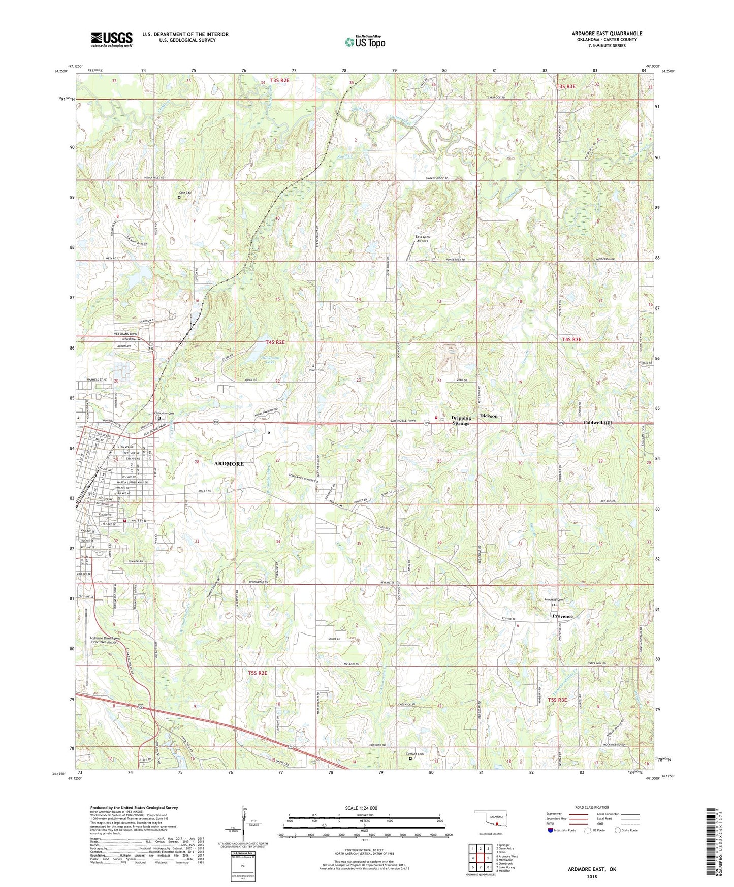
2018 topographic map quadrangle Ardmore East in the state of Oklahoma. Scale: 1:24000. Based on the newly updated USGS 7.5' US Topo map series, this map is in the following counties: Carter. The map contains contour data, water features, and other items you are used to seeing on USGS maps, but also has updated roads and other features. This is the next generation of topographic maps. Printed on high-quality waterproof paper with UV fade-resistant inks.
Quads adjacent to this one:
West: Ardmore West
Northwest: Springer
North: Gene Autry
Northeast: Nebo
East: Mannsville
Southeast: McMillan
South: Lake Murray
Southwest: Overbrook
Contains the following named places: Ardmore Downtown Executive Airport, Ardmore Fire Department Station 2, Bass Aero Airport, Caldwell Hill, Carter 1 Dam, Carter 1 Reservoir, Chickasaw Lake, Chickasaw Lake Dam, Church of Christ Northeast, Clearview Cemetery, Cole Cemetery, Concord Cemetery, Concord Church, Deadman Branch, Dickson Volunteer Fire Department Station 2, Douglas School, Dripping Springs, Fraley Park, Lake Murray State Park, Mckown Lake, Mckown Lake Dam, Metropolitan AME Church, Moore Pond, Moore Pond Dam, Niblack Chapel, Northeast Baptist Church, Provence, Provence Cemetery, Provence Church, Pruitt Cemetery, Roberts Airport, Sand Branch, Sand Creek, Southern Oklahoma Technology Center, Springdale Church, Springdale School, Township of Wilson, Trinity Baptist Church, Victory Temple Church of God, Washington School, West Anadarche Creek, Whittington Park, Will Rogers Elementary School, ZIP Code: 73401