MyTopo
Nebo Oklahoma US Topo Map
Couldn't load pickup availability
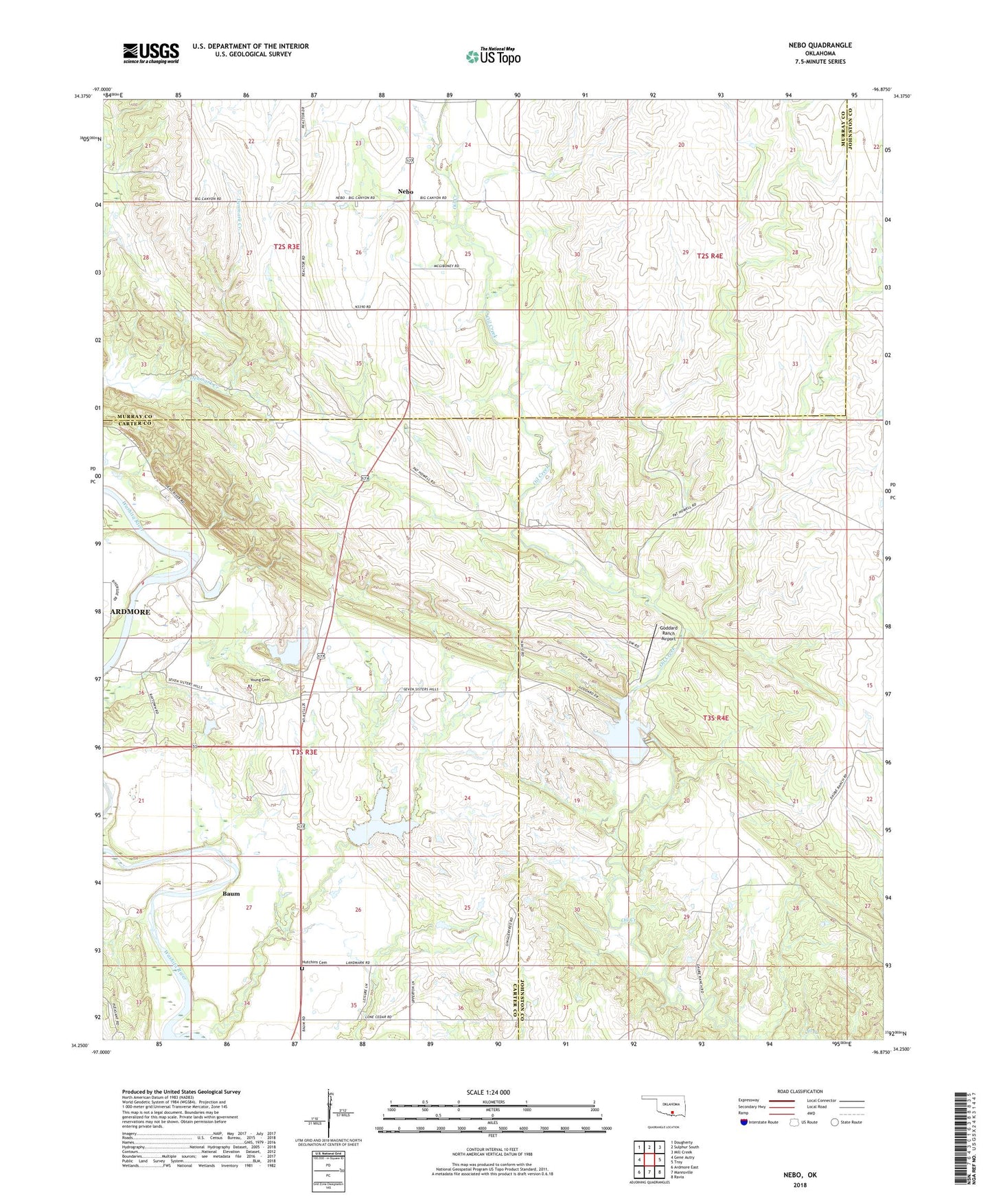
2022 topographic map quadrangle Nebo in the state of Oklahoma. Scale: 1:24000. Based on the newly updated USGS 7.5' US Topo map series, this map is in the following counties: Carter, Johnston, Murray. The map contains contour data, water features, and other items you are used to seeing on USGS maps, but also has updated roads and other features. This is the next generation of topographic maps. Printed on high-quality waterproof paper with UV fade-resistant inks.
Quads adjacent to this one:
West: Gene Autry
Northwest: Dougherty
North: Sulphur South
Northeast: Mill Creek
East: Troy
Southeast: Ravia
South: Mannsville
Southwest: Ardmore East
This map covers the same area as the classic USGS quad with code o34096c8.
Contains the following named places: Baum, Goddard Ranch 2 Dam, Goddard Ranch 2 Reservoir, Goddard Ranch Airport, Goddard Ranch I Dam, Goddard Ranch I Reservoir, Hutchins Cemetery, Nebo, Nebo School, Oknoname 069002 Dam, Oknoname 069002 Reservoir, Township of Ratliff, Young Cemetery