MyTopo
McMillan Oklahoma US Topo Map
Couldn't load pickup availability
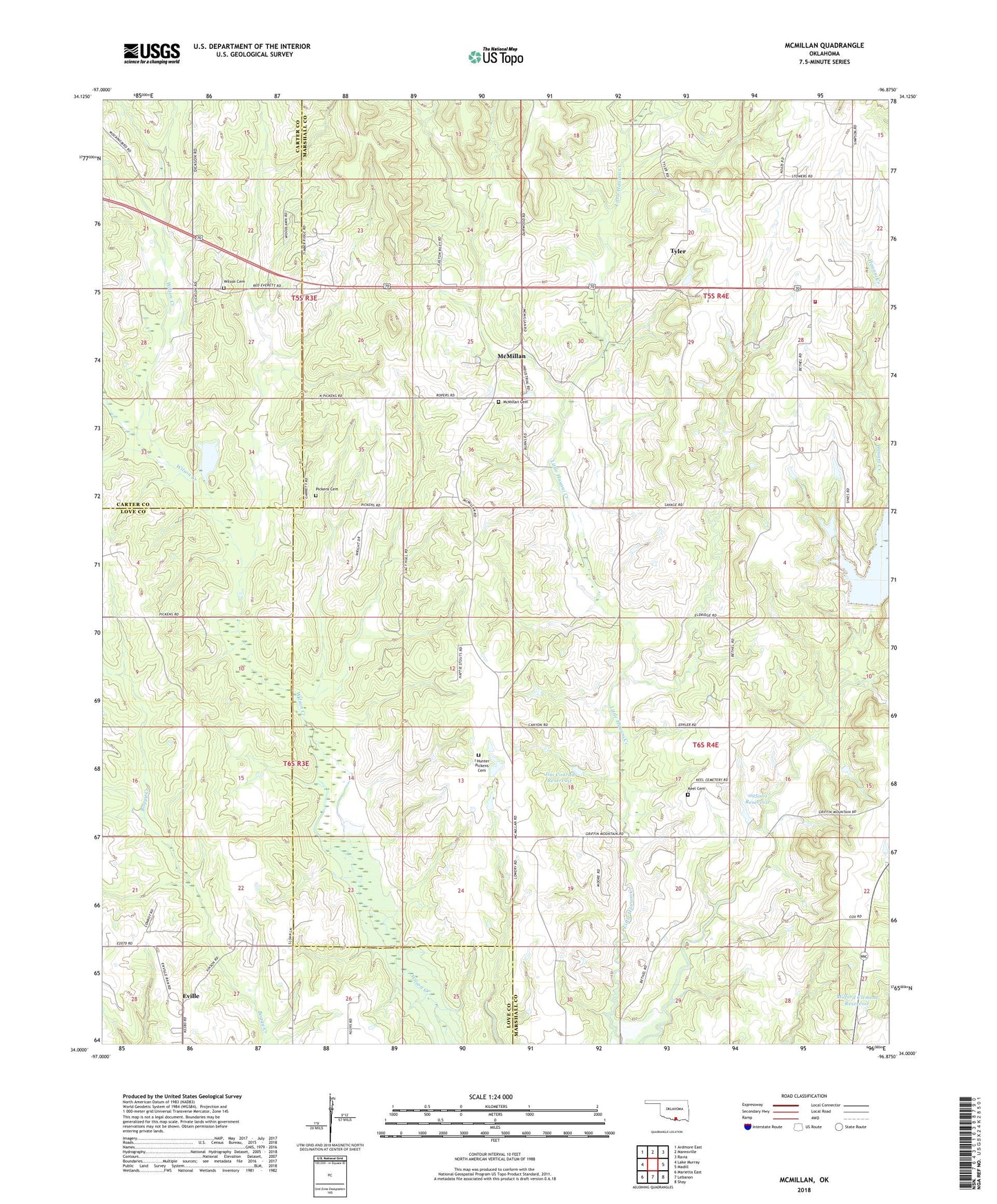
2022 topographic map quadrangle McMillan in the state of Oklahoma. Scale: 1:24000. Based on the newly updated USGS 7.5' US Topo map series, this map is in the following counties: Marshall, Love, Carter. The map contains contour data, water features, and other items you are used to seeing on USGS maps, but also has updated roads and other features. This is the next generation of topographic maps. Printed on high-quality waterproof paper with UV fade-resistant inks.
Quads adjacent to this one:
West: Lake Murray
Northwest: Ardmore East
North: Mannsville
Northeast: Ravia
East: Madill
Southeast: Shay
South: Lebanon
Southwest: Marietta East
This map covers the same area as the classic USGS quad with code o34096a8.
Contains the following named places: Eville, Hauana Creek Fire Department, Hauani Creek, I Hunter Pickens Cemetery, Jack McDearman 8 Dam, Jack McDearman Reservoir, Jim Conrad Dam, Jim Conrad Reservoir, Keel Cemetery, McMillan, McMillan Cemetery, Milford Clement Dam, Milford Clement Reservoir, Oknoname 095001 Dam, Oknoname 095001 Reservoir, Pickens Cemetery, Pickens Church, Township of Halford, Tyler, Wilson Cemetery