MyTopo
Mannsville Oklahoma US Topo Map
Couldn't load pickup availability
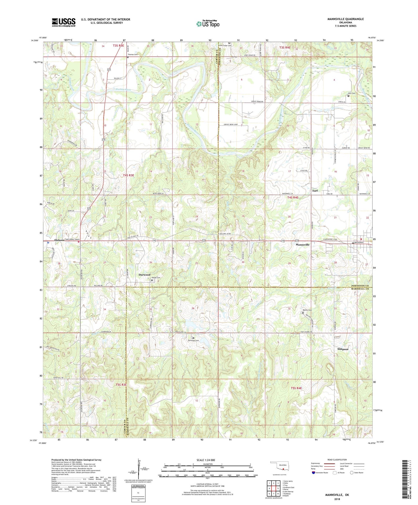
2022 topographic map quadrangle Mannsville in the state of Oklahoma. Scale: 1:24000. Based on the newly updated USGS 7.5' US Topo map series, this map is in the following counties: Carter, Johnston, Marshall. The map contains contour data, water features, and other items you are used to seeing on USGS maps, but also has updated roads and other features. This is the next generation of topographic maps. Printed on high-quality waterproof paper with UV fade-resistant inks.
Quads adjacent to this one:
West: Ardmore East
Northwest: Gene Autry
North: Nebo
Northeast: Troy
East: Ravia
Southeast: Madill
South: McMillan
Southwest: Lake Murray
This map covers the same area as the classic USGS quad with code o34096b8.
Contains the following named places: Baum Church, Caddo Creek, Dickson, Dickson Elementary School, Dickson High School, Dickson Lower Elementary School, Dickson Police Department, Dickson Upper Elementary School, Dickson Volunteer Fire Department Station 1, Durwood, Durwood Cemetery, Durwood Church, Durwood School, Earl, Earl Cemetery, Earl Census Designated Place, Lone Cedar Cemetery, Mannsville, Mannsville Post Office, Mannsville Volunteer Fire Department Station 2, Marvin Poppe 5 Dam, Marvin Poppe 5 Reservoir, Nelda Cemetery, Oil Creek, Rollins Cemetery, Simpson, Thomas Cemetery, Town of Dickson, Town of Mannsville, Wolf Creek