MyTopo
Bellvue Oklahoma US Topo Map
Couldn't load pickup availability
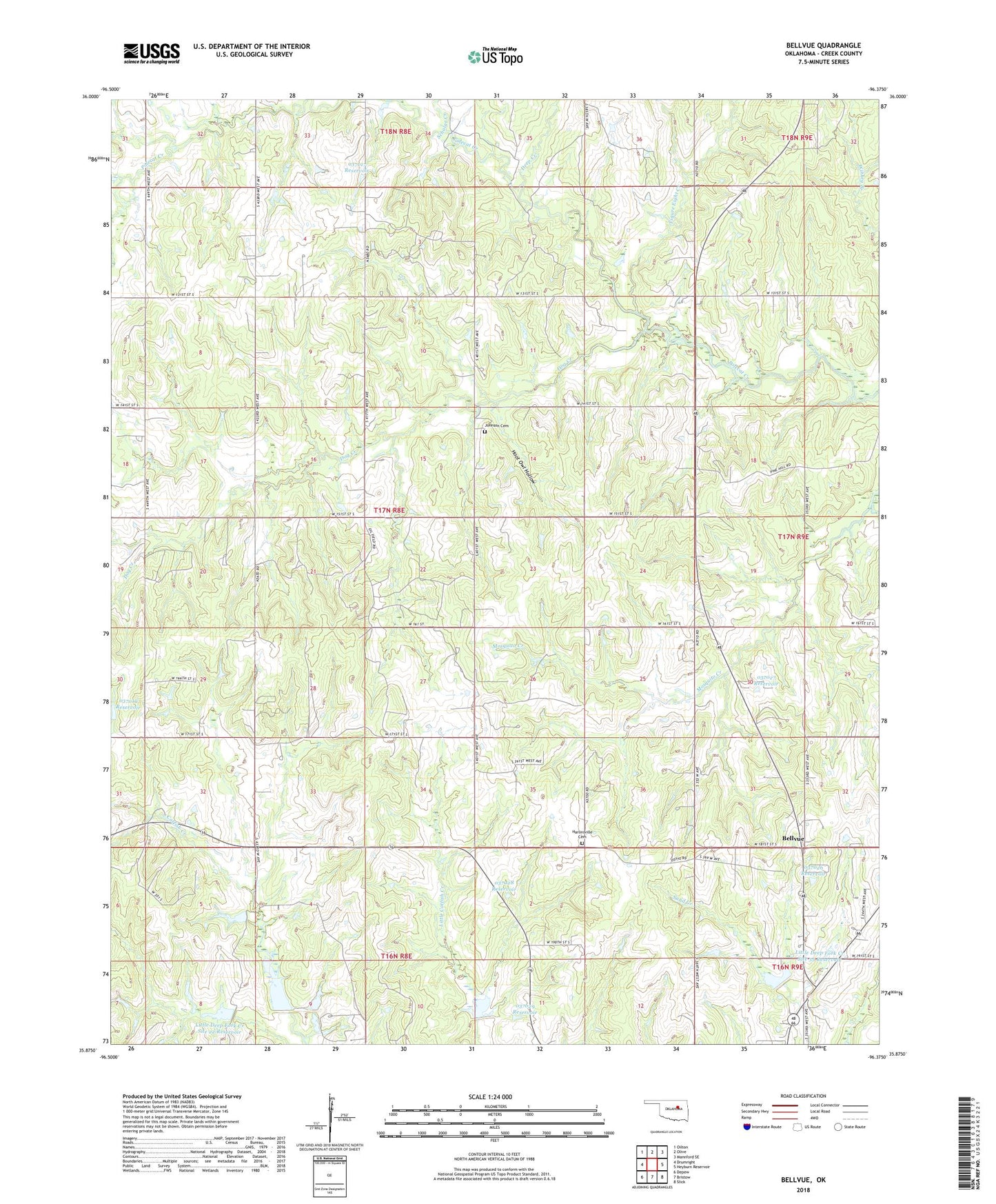
2022 topographic map quadrangle Bellvue in the state of Oklahoma. Scale: 1:24000. Based on the newly updated USGS 7.5' US Topo map series, this map is in the following counties: Creek. The map contains contour data, water features, and other items you are used to seeing on USGS maps, but also has updated roads and other features. This is the next generation of topographic maps. Printed on high-quality waterproof paper with UV fade-resistant inks.
Quads adjacent to this one:
West: Drumright
Northwest: Oilton
North: Olive
Northeast: Mannford SE
East: Heyburn Reservoir
Southeast: Slick
South: Bristow
Southwest: Depew
This map covers the same area as the classic USGS quad with code o35096h4.
Contains the following named places: Bellvue, Deep Creek, Dog Creek, Figure Eight Creek, Harlinsville Cemetery, Hoot Owl Hollow, Johnson Cemetery, Little Deep Fork Creek Site 21r Dam, Little Deep Fork Creek Site 21r Reservoir, Little Deep Fork Creek Site 22 Dam, Little Deep Fork Creek Site 22 Reservoir, Little Deep Fork Creek Site 29 Dam, Little Deep Fork Creek Site 29 Reservoir, Little Deep Fork Creek Site 33 Dam, Little Deep Fork Creek Site 33 Reservoir, Little Deep Fork Creek Site 35 Dam, Little Deep Fork Creek Site 35 Reservoir, Oknoname 037017 Dam, Oknoname 037017 Reservoir, Oknoname 037019 Reservoir, Oknoname 037026 Dam, Oknoname 037026 Reservoir, Oknoname 037027 Dam, Oknoname 037027 Reservoir, Oknoname 037028 Dam, Oknoname 037028 Reservoir, Oknoname 037029 Dam, Oknoname 037029 Reservoir, Scholar Creek, Shamrock-Heyburn Lake Division