MyTopo
Olive Oklahoma US Topo Map
Couldn't load pickup availability
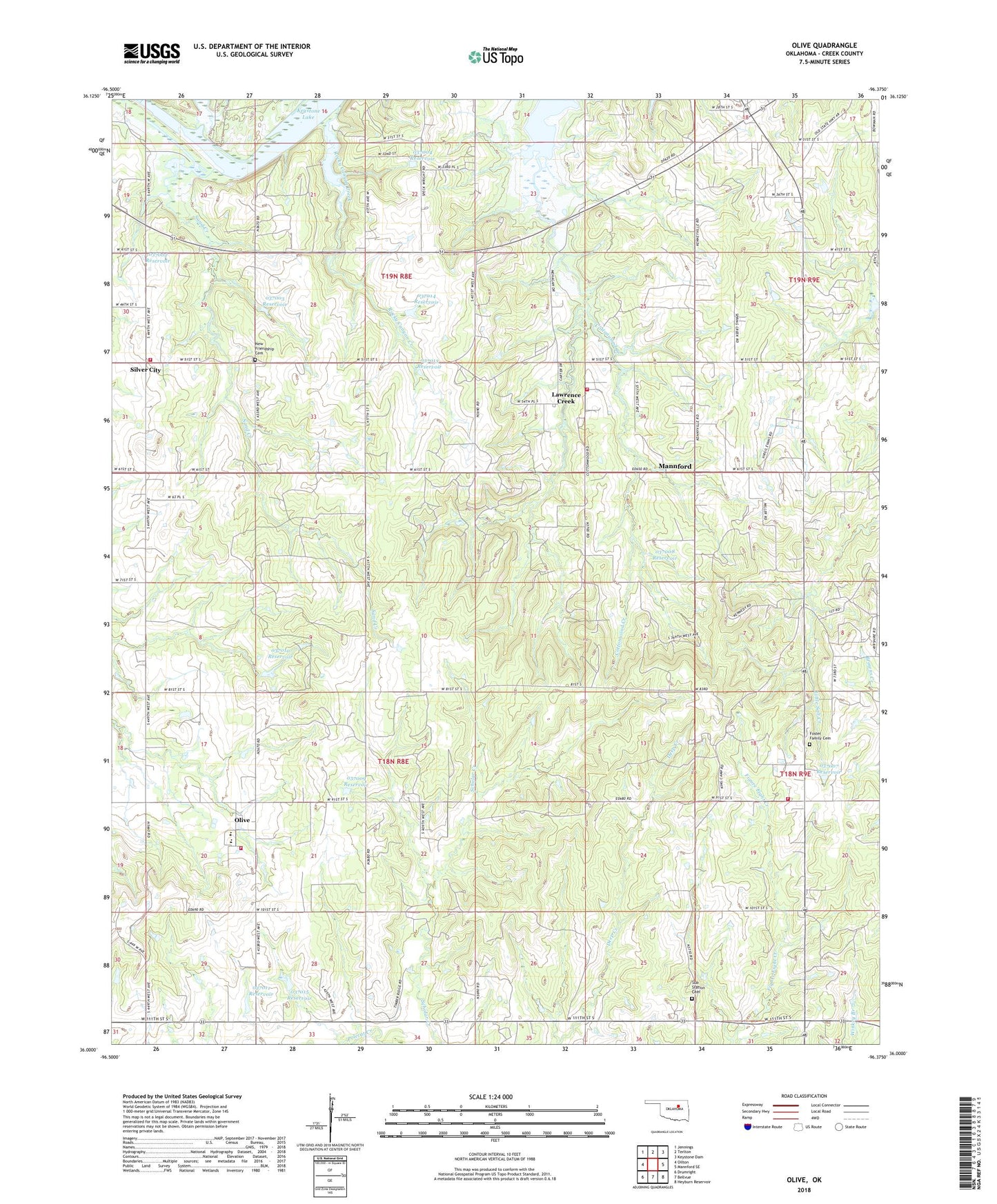
2022 topographic map quadrangle Olive in the state of Oklahoma. Scale: 1:24000. Based on the newly updated USGS 7.5' US Topo map series, this map is in the following counties: Creek. The map contains contour data, water features, and other items you are used to seeing on USGS maps, but also has updated roads and other features. This is the next generation of topographic maps. Printed on high-quality waterproof paper with UV fade-resistant inks.
Quads adjacent to this one:
West: Oilton
Northwest: Jennings
North: Terlton
Northeast: Keystone Dam
East: Mannford SE
Southeast: Heyburn Reservoir
South: Bellvue
Southwest: Drumright
This map covers the same area as the classic USGS quad with code o36096a4.
Contains the following named places: Church Camp, Cottonwood Creek, Foster Family Cemetery, Freedom Hill Fire Department, Friendship Church, Keystone Lake Division, Lawrence Creek, Lawrence Creek Volunteer Fire Department, Liberty Church, New Friendship Cemetery, Oknoname 0370003 Dam, Oknoname 037002 Dam, Oknoname 037002 Reservoir, Oknoname 037003 Reservoir, Oknoname 037004 Dam, Oknoname 037004 Reservoir, Oknoname 037007 Dam, Oknoname 037007 Reservoir, Oknoname 037008 Dam, Oknoname 037008 Reservoir, Oknoname 037009 Dam, Oknoname 037009 Reservoir, Oknoname 037010 Dam, Oknoname 037010 Reservoir, Oknoname 037011 Dam, Oknoname 037011 Reservoir, Oknoname 037012 Dam, Oknoname 037012 Reservoir, Oknoname 037013 Dam, Oknoname 037013 Reservoir, Oknoname 037014 Dam, Oknoname 037014 Reservoir, Oknoname 037015 Dam, Oknoname 037015 Reservoir, Olive, Olive Census Designated Place, Olive Elementary School, Olive High School, Olive Volunteer Fire Department, Rocky Canyon Creek, Sand Creek, Silver City, Silver City Volunteer Fire Department, Sub - Station Cemetery, Town of Lawrence Creek, Township of Hazlie, Township of Mannford, Township of Olive, ZIP Code: 74044