MyTopo
Oilton Oklahoma US Topo Map
Couldn't load pickup availability
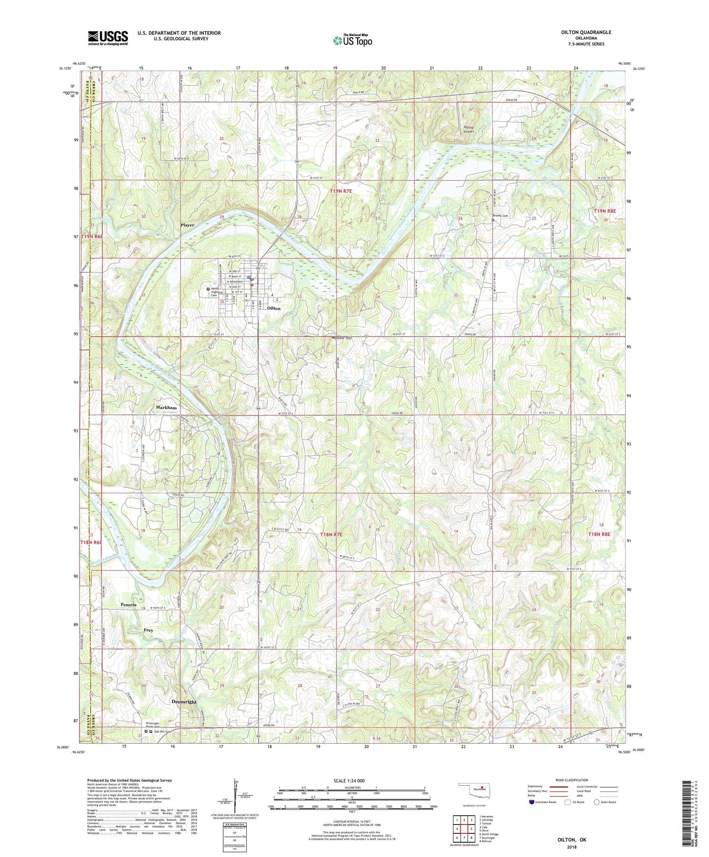
2022 topographic map quadrangle Oilton in the state of Oklahoma. Scale: 1:24000. Based on the newly updated USGS 7.5' US Topo map series, this map is in the following counties: Creek, Payne. The map contains contour data, water features, and other items you are used to seeing on USGS maps, but also has updated roads and other features. This is the next generation of topographic maps. Printed on high-quality waterproof paper with UV fade-resistant inks.
Quads adjacent to this one:
West: Yale
Northwest: Maramec
North: Jennings
Northeast: Terlton
East: Olive
Southeast: Bellvue
South: Drumright
Southwest: North Village
This map covers the same area as the classic USGS quad with code o36096a5.
Contains the following named places: Brooks Cemetery, Buckeye Creek, Cimarron Valley Church, City of Oilton, Deer Creek, Drumright North Cemetery, Dry Creek, Euchee Creek, Frey, Highland Cemetery, Hilltop Airport, J F Kennedy Elementary School, Markham, Monitor Hill, Oak Hill Cemetery, Oilton, Oilton High School, Oilton Police Department, Oilton Post Office, Oilton Volunteer Fire Department, Pemeta, Player, Tiger Creek, Township of Tiger, ZIP Code: 74052