MyTopo
Maramec Oklahoma US Topo Map
Couldn't load pickup availability
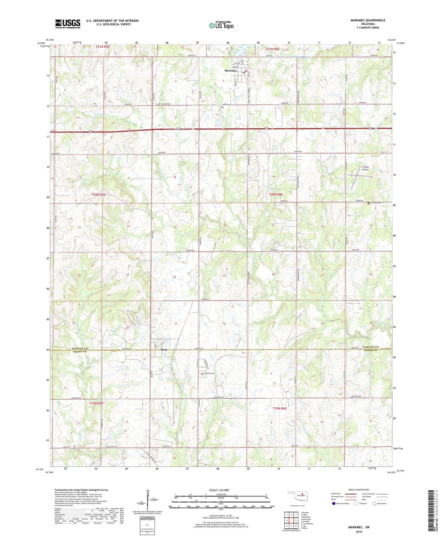
2022 topographic map quadrangle Maramec in the state of Oklahoma. Scale: 1:24000. Based on the newly updated USGS 7.5' US Topo map series, this map is in the following counties: Pawnee, Payne. The map contains contour data, water features, and other items you are used to seeing on USGS maps, but also has updated roads and other features. This is the next generation of topographic maps. Printed on high-quality waterproof paper with UV fade-resistant inks.
Quads adjacent to this one:
West: West Point
Northwest: Pawnee
North: Casey
Northeast: Blackburn
East: Jennings
Southeast: Oilton
South: Yale
Southwest: Twin Mounds
This map covers the same area as the classic USGS quad with code o36096b6.
Contains the following named places: Crystal Airport, IOOF Cemetery, Lawson Cemetery, Maramec, Maramec Dam, Maramec Fire Department, Maramec Lake, Maramec Post Office, Quay, Sunrise Cemetery, Town of Maramec, Town of Quay, Township of Lagoon, ZIP Code: 74045